Case study

Agricultural crop monitoring and assessment for CAP compliance and precision farming

Project duration
2015 - 2022
Project area
Czechia
Customer
European Space Agency (ESA), State Agricultural Intervention Fund (SZIF), farmers

SITUATION

CAP controls are difficult to execute on the ground and carry a heavy administrative burden. 

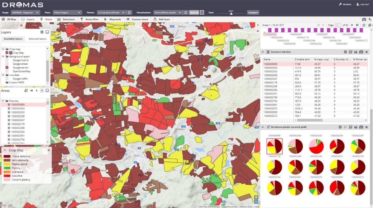
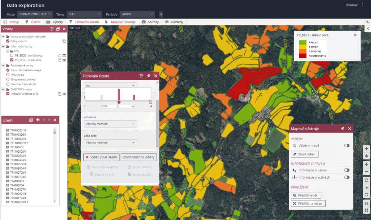
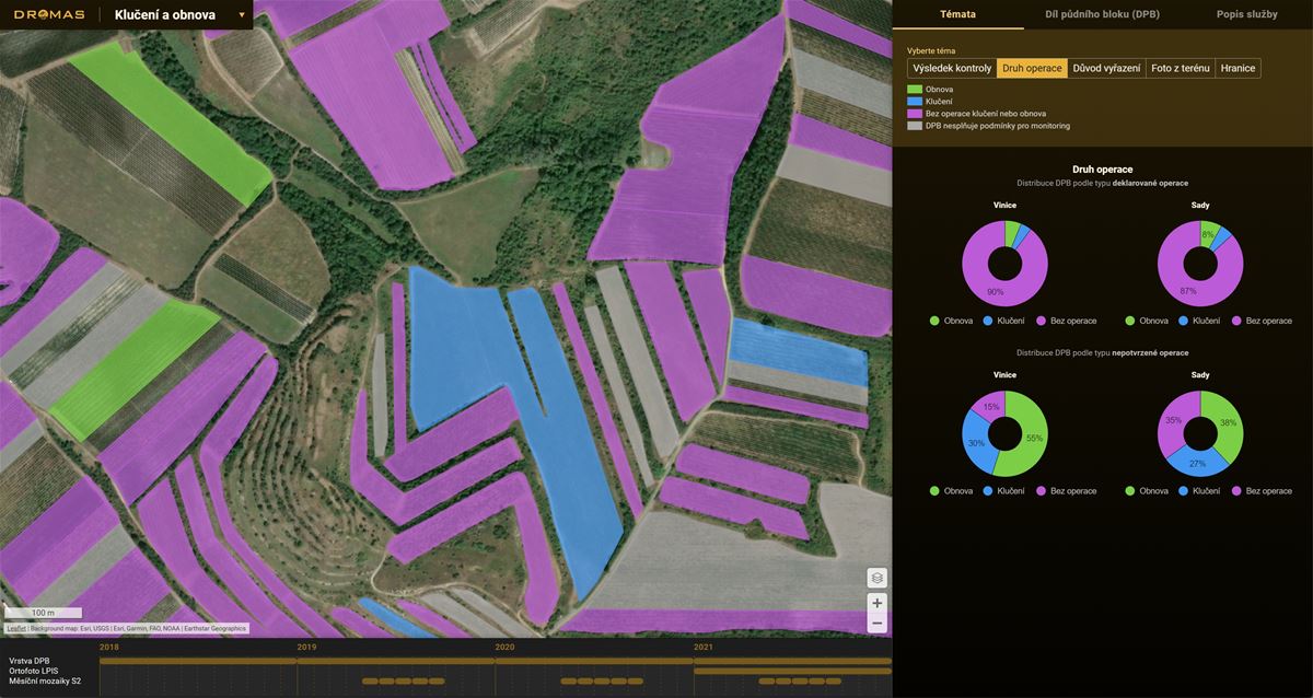
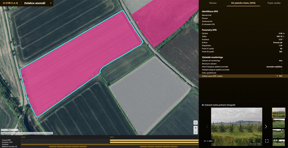
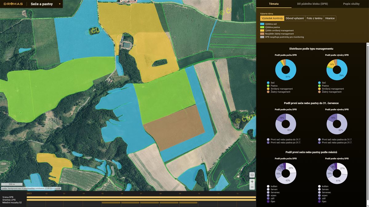
Compliance with the European Union's Common Agricultural Policy (CAP) traditionally involved considerable administrative effort for national agencies, often relying on sample-based field checks covering a small fraction of agricultural land. This approach presented limitations in terms of efficiency and comprehensive oversight. The DROMAS project was initiated to align with the CAP's evolving "Checks by Monitoring" strategy, leveraging Earth Observation (EO) data, particularly from the Copernicus Sentinel missions, to enable systematic and widespread monitoring. This strategic shift aimed to reduce administrative burdens, optimize field inspection resources, and facilitate proactive communication with farmers regarding compliance. Concurrently, the agricultural sector is increasingly adopting precision agriculture methodologies. These advanced practices require consistent access to detailed, parcel-level data on crop health and spatial variability to inform decision-making, optimize resource allocation, and promote sustainable farming. DROMAS was conceived to address these critical informational needs.

SOLUTION

Gisat's DROMAS project, supported by the European Space Agency, delivered a robust portfolio of services founded on advanced satellite data analysis.

For agricultural authorities, such as the Czech Republic's State Agricultural Intervention Fund (SAIF), our Agricultural Crop Monitoring (ACM) Services provided a transformative solution for CAP controls. These services enabled comprehensive monitoring of cultivated crop types, verification of grassland maintenance practices, and surveillance of permanent crops like orchards and vineyards for significant changes or potential issues. Furthermore, we enhanced the efficiency and accuracy of their Land Parcel Identification System (LPIS) by identifying discrepancies and streamlining update procedures, all facilitated through a dedicated online portal. This provided SAIF with a comprehensive, accurate, and efficient overview of agricultural activities. For farmers and agricultural advisors transitioning to precision agriculture, our Farming Management Services (FMS) offered detailed, actionable insights. Through analysis of multi-year satellite data archives, we identified historical patterns of crop growth variability within fields, enabling the delineation of management zones. During the growing season, we provided near real-time maps of key crop biophysical parameters, including chlorophyll and water content. This information, accessible via a user-friendly web portal, empowered farmers to make informed, targeted decisions regarding fertilization, irrigation, and pest management, thereby fostering more efficient and productive agricultural practices.

RESULTS

EO-based agricultural monitoring helped the Paying Agency minimize administration and increase accuracy. 

The DROMAS project delivered not only sophisticated data products but also tangible, real-world outcomes, demonstrating a clear pathway towards more efficient and sustainable agricultural management. Our Agricultural Crop Monitoring services were positively received and validated by the Czech State Agricultural Intervention Fund (SZIF). SZIF acknowledged the readiness of these tools for integration into their national monitoring system, highlighting the potential for significant reductions in costly field inspections and a decreased administrative load for farmers – a considerable benefit for all stakeholders. The continuous monitoring capabilities also enabled SZIF to transition towards a more proactive engagement model with farmers, issuing alerts rather than solely relying on punitive measures, thereby fostering a more collaborative relationship. The LPIS support tools also proved effective in enhancing the accuracy of land parcel data. The project's success culminated in commercial agreements for the operational provision of these services. Farmers and agricultural enterprises also realized direct advantages from our Farming Management Services. Through close collaboration with over ten farms, we demonstrated the practical application of satellite-derived insights for enhanced field-level decision-making. A detailed understanding of intra-field variability and real-time crop health allowed for the optimization of inputs such as fertilizers and water. Our strategic partnership with CleverFarm, a provider of comprehensive farm management solutions, is further extending the reach of these services by integrating our EO expertise with IoT and other agricultural technologies to offer holistic smart farming support.