Case study

Support to resilient road investments in South-East Asia

Project duration
2020
Project area
Myanmar, Bhutan
Customer
World Bank, GoM: FLERP-DOH

Situation

The World Bank invests in landslide-prone infrastructure

The World Bank, an international financial institution, supports development aid and reconstruction in low-income countries. In a recent project, the bank focused on infrastructure reconstruction in Myanmar following frequent natural disasters.

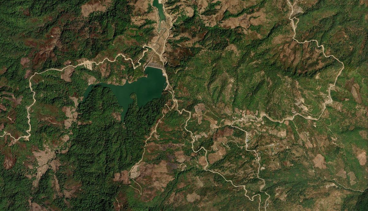
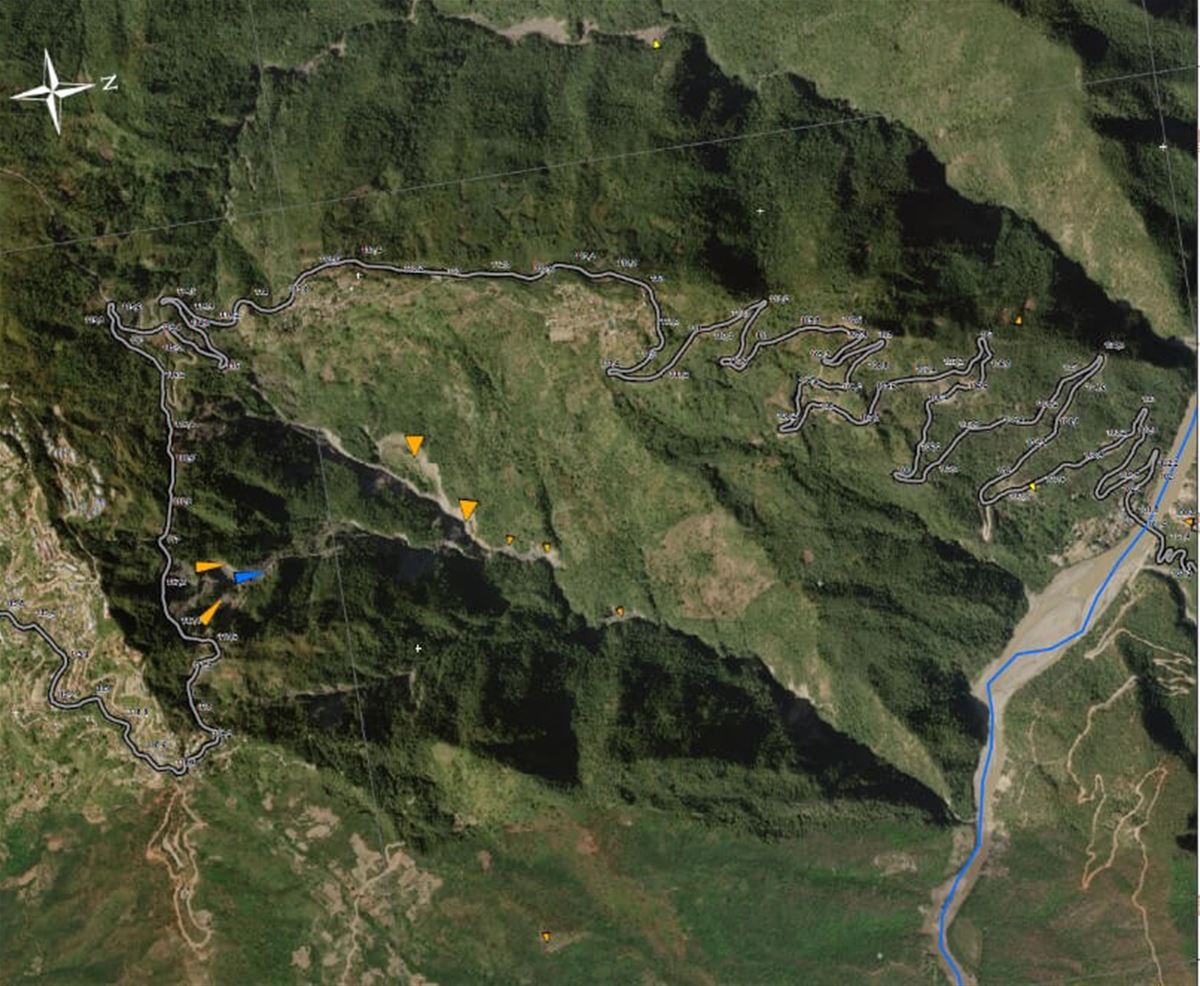
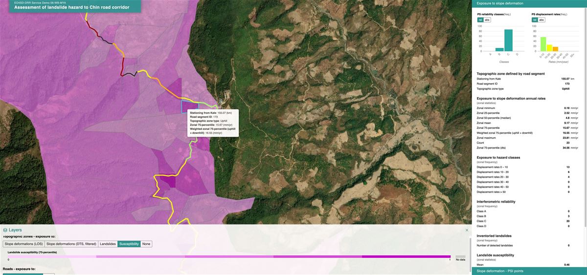
Myanmar, particularly Chin State, faces recurrent floods and landslides that routinely damage critical infrastructure. The most significant threat is landslides, which disrupt the crucial road link between Kalay and Hakha during the rainy season. This road is vital for residents' access to basic services and economic opportunities. When damaged, local residents lose their ability to travel to work or access healthcare.

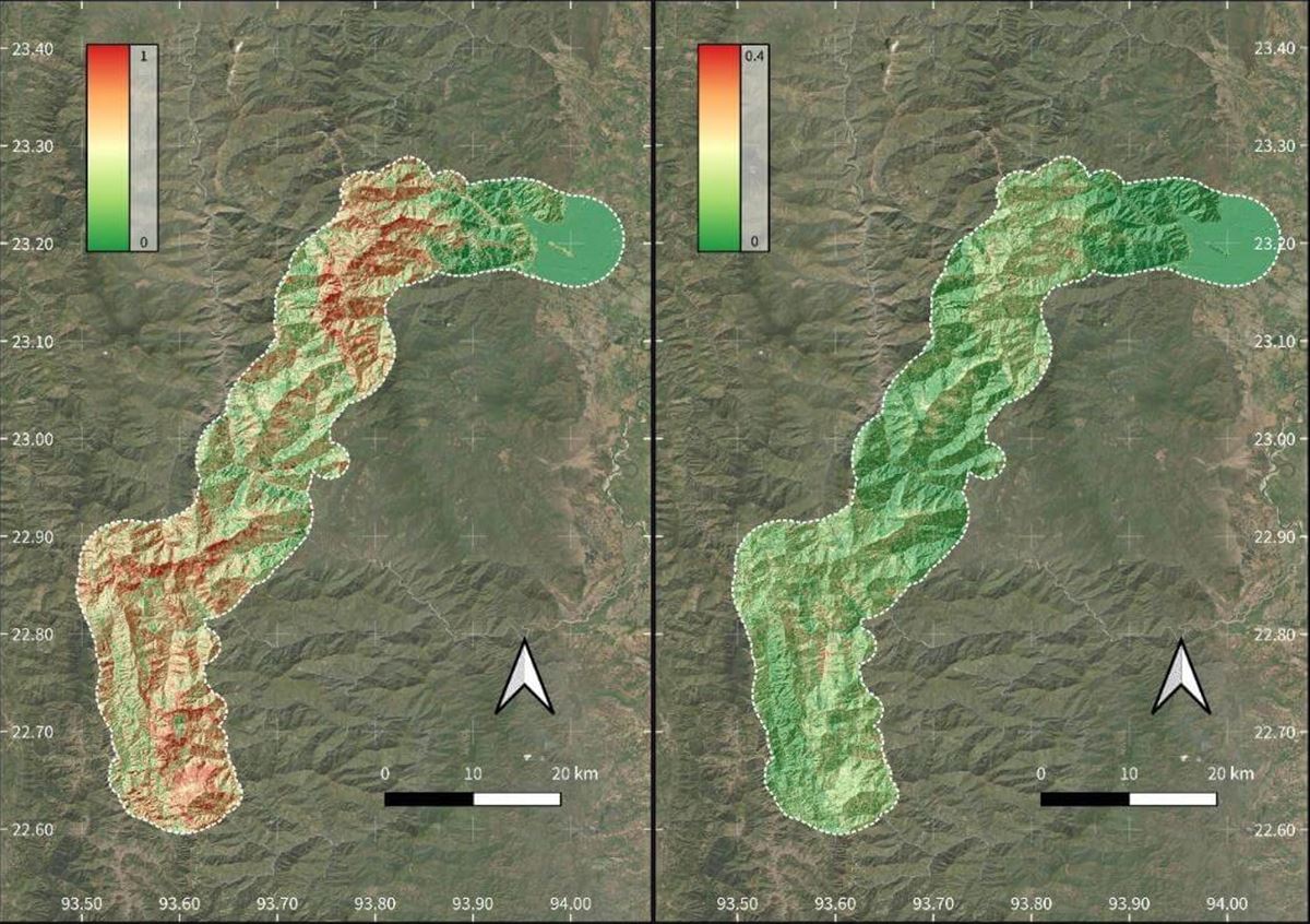
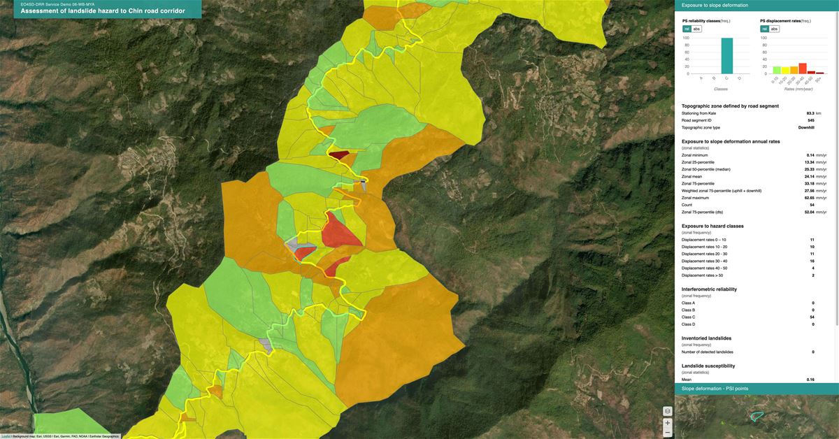
To address this issue, the World Bank commissioned a comprehensive landslide risk assessment along the road corridor. The project aimed to identify the most vulnerable sections and propose mitigation measures. It was expected to provide accurate data and analysis to facilitate reconstruction planning and improve the road's long-term resilience to natural disasters.

Solution

Comprehensive risk analysis and mapping of landslides in an inaccessible 170 km strip using earth observation

We delivered a multi-faceted solution that provides a comprehensive view of landslide risks along the road in the Chin area. Each component contributed to a better understanding of historical events, current risks, and future threats, enabling effective planning for road reconstruction and preventive measures.

Landslide Inventory Map: We created a map identifying over 700 historical landslides along a 5 km-wide corridor surrounding the road between the towns of Kalay and Hakha. This was achieved by analyzing historical remote sensing data from 2014–2019, revealing the spatial and temporal distribution of landslides. This inventory formed the foundation for further risk analyses.

Landslide Susceptibility Map: Our project partner, GeoSphere Austria, developed a predictive map identifying areas with the highest landslide risk along the road. The machine learning model was trained using the landslide inventory we created.

Slope Deformation Map: We mapped slow slope deformations along the road, indicating active and potential future landslides. This was accomplished using satellite interferometry (InSAR) with multiple datasets from three Sentinel-1 satellite orbits. The analysis detected long-term slope deformations between 2015–2019, providing a detailed picture of movements that could lead to future landslides.

Road Exposure to Landslide Hazard Map: We produced a map quantifying the landslide risk for individual road sections based on their location and geomorphological conditions. This map combined previous results (landslide susceptibility and slope deformation maps) and integrated them into geographic information systems (GIS) for effective visualization and risk analysis. This tool allows engineers and designers to better understand risk distribution along the road corridor.

Deliverables included interactive maps of landslides, landslide susceptibility, and road exposure in digital formats (GIS, PDF) for use in construction planning.

Training the customer’s technical personnel

The project included training local workers and representatives from relevant institutions to effectively use the provided tools and data. A consortium led by Gisat, supported by partners ZAMG and Indra, conducted the training. Events were organized for technical staff from Myanmar's Ministry of Construction and the consulting company JV PEC. Participants learned to use the interactive visualization platform InSARviz and other digital outputs such as GIS files and PDF maps. This training ensured their ability to manage and update data long-term, enhancing the effectiveness and sustainability of reconstruction and prevention measures.

REsults

Results target preventive measures and protect critical infrastructure

The Myanmar Ministry of Construction (DOH) and the consultancy firm JV PEC, responsible for the construction works, utilized the project deliverables effectively. They determined precise locations for installing monitoring equipment such as inclinometers and piezometers, and efficiently planned construction measures like retaining walls and drainage systems. The results proved invaluable, enabling the focus of technical and financial resources on the road's most vulnerable sections.

World Bank engineers appreciated that the landslide and deformation maps provided clear guidance on where to focus attention in the field and how to target preventive measures. The project's results were deemed beneficial for ensuring the safety and efficiency of construction works, with potential applications in similar future projects.