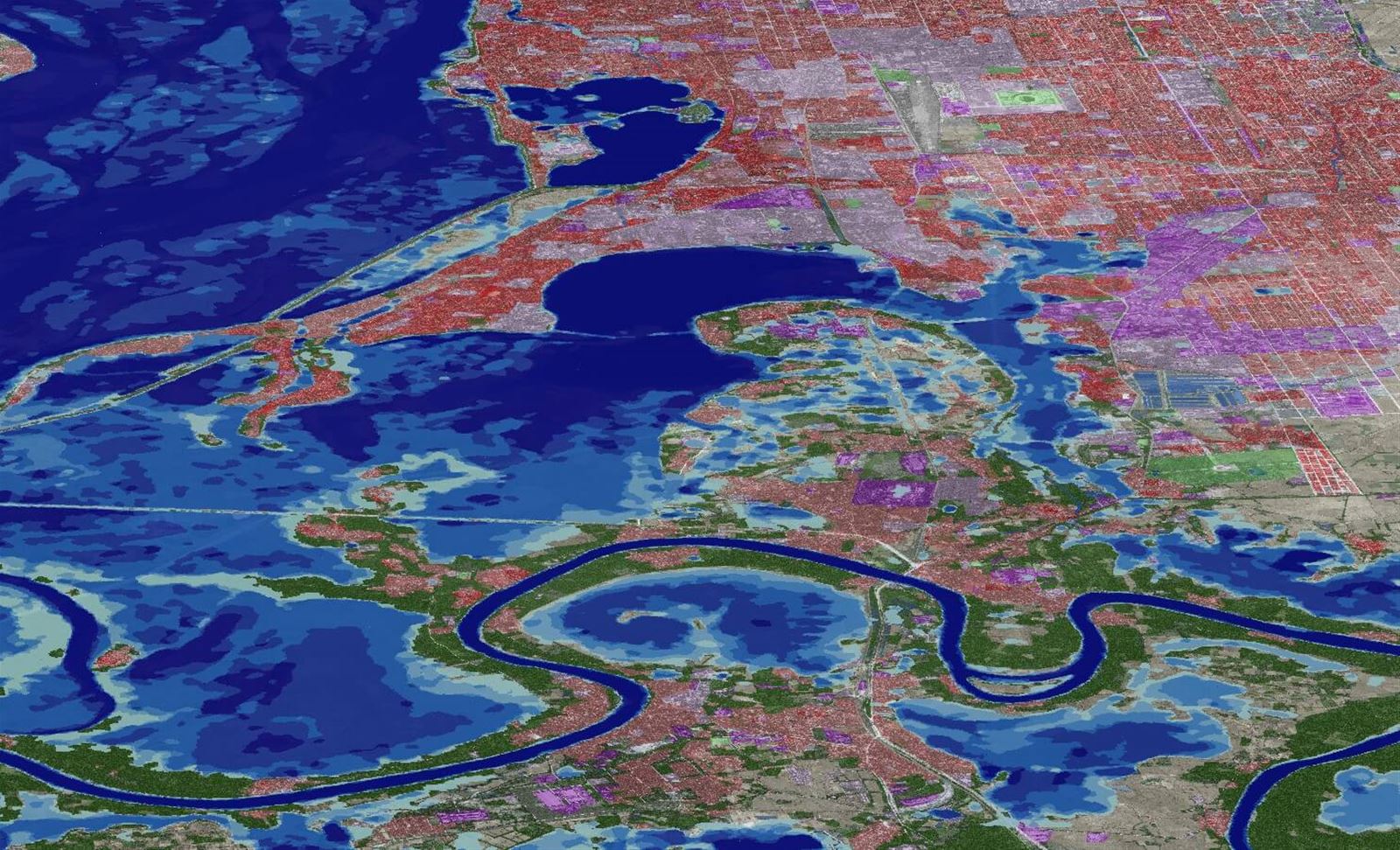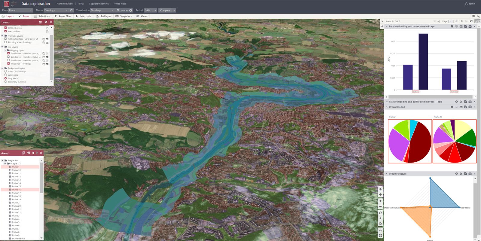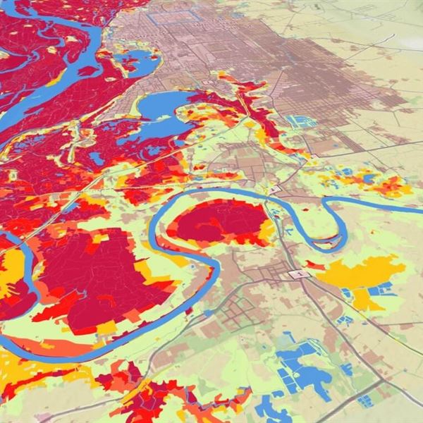

- Create or update flood maps for your area and identify impacts on flooded land
- Accurately predict the dynamics, frequency, and intensity of flood peaks based on flood risk data models
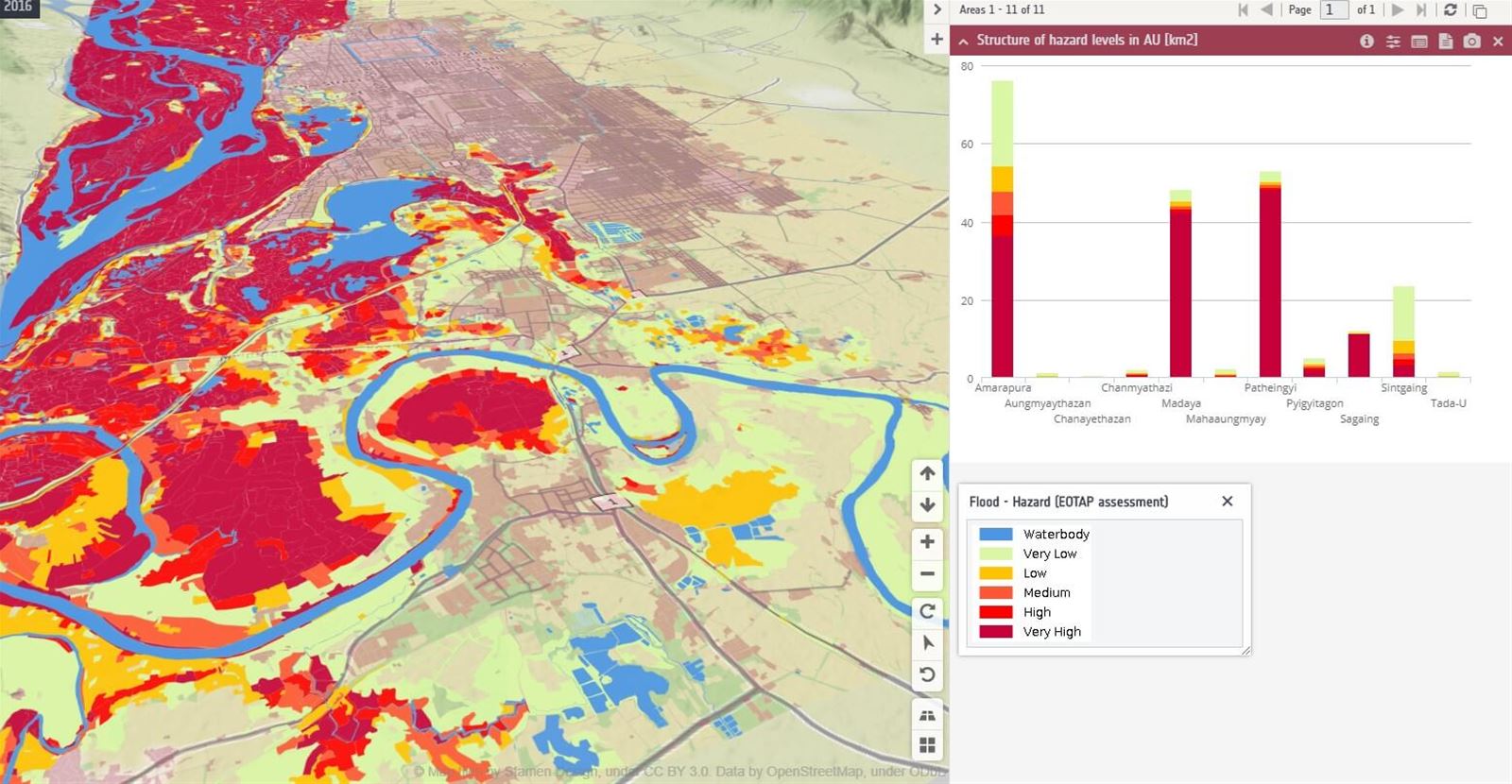
- Assess the effectiveness of flood control measures
Our clients receive actionable insights into:
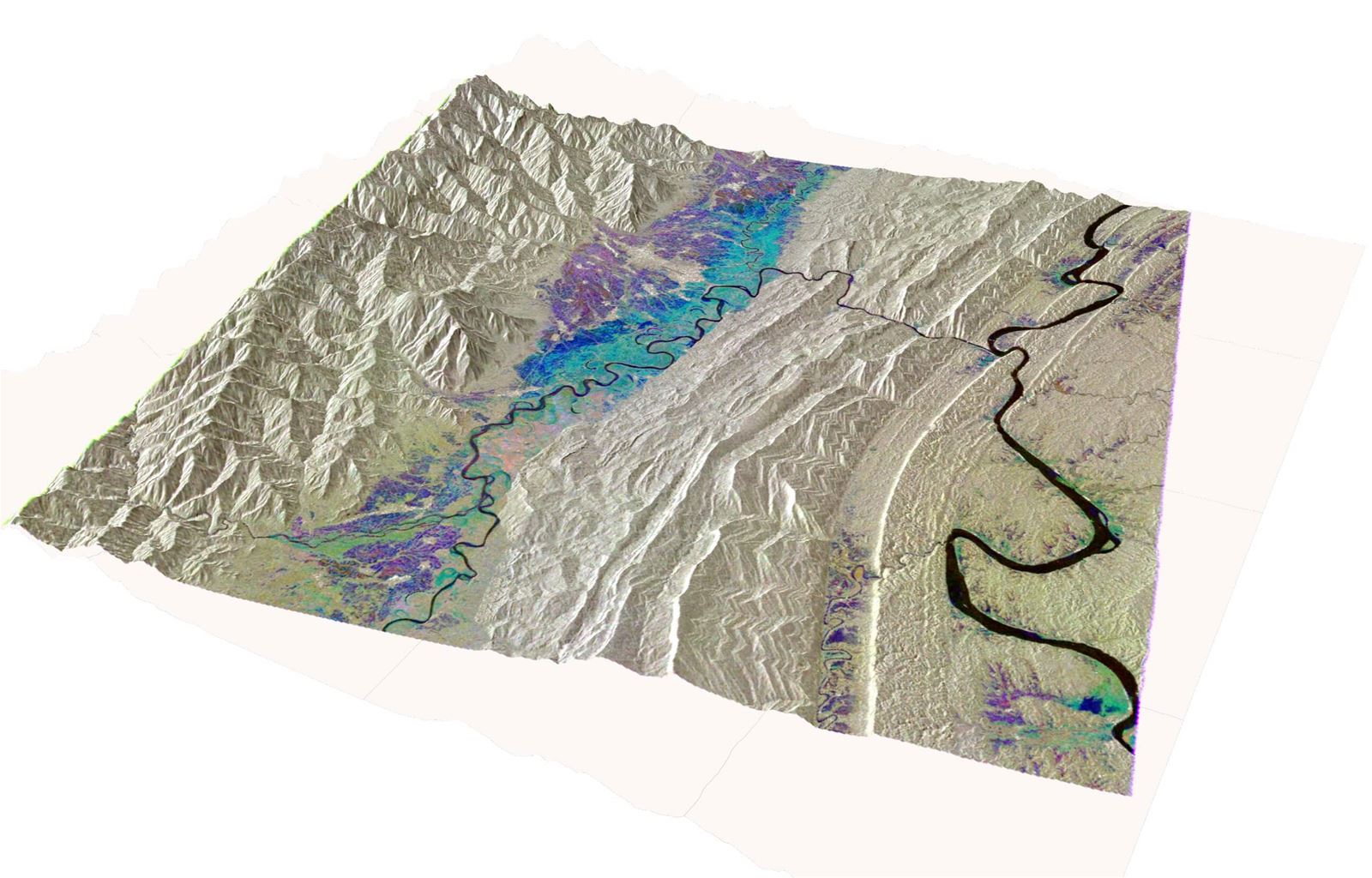
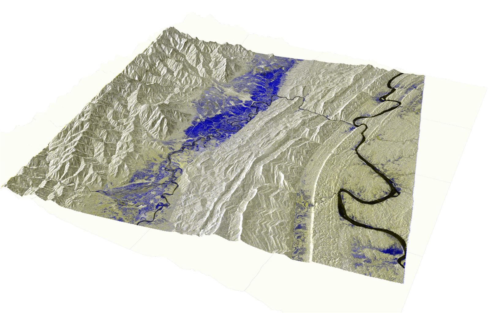
- Extent of flooding – based on data from optical and SAR images taken during the flood
- Development, dynamics, frequency, and intervals of flood peaks – based on analysis of historical satellite images
- Flood depth – derived from digital terrain models or hydraulic modeling
- Susceptibility – modeling results serve as the basis for multi-factor risk assessments including vulnerability factors and populations and infrastructure exposure to floods