Environment and Natural Resources | Use cases

Environmental Governance

Use satellite-based insights to support the implementation of environmental policies and sustainable land management. Detect non-compliance, monitor restoration progress, and deliver standardised data for ESG and SDG reporting. EO helps assess environmental risks, plan adaptation measures, and guide effective enforcement, policy evaluation, and long-term resilience strategies.

Compliance and Restoration
Monitoring regulatory compliance and supporting policies for landscape conservation and ecosystem restoration.

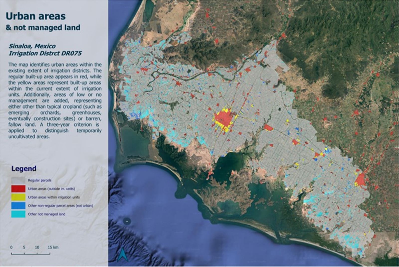
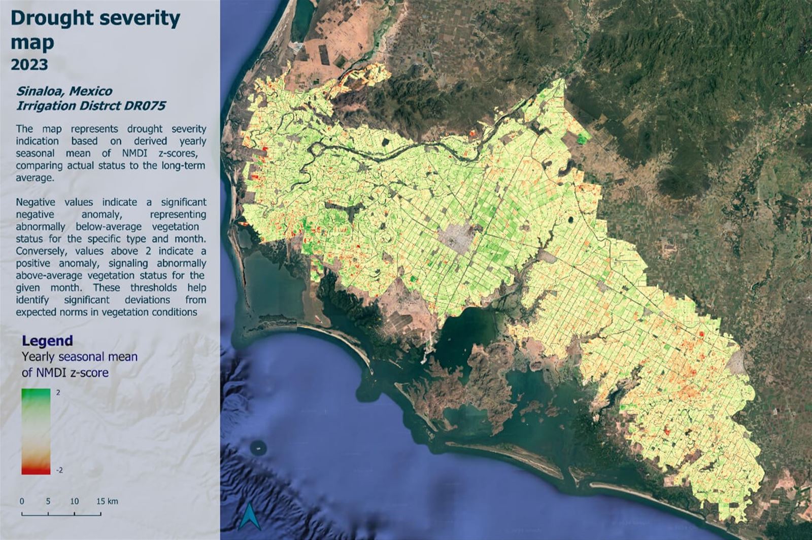
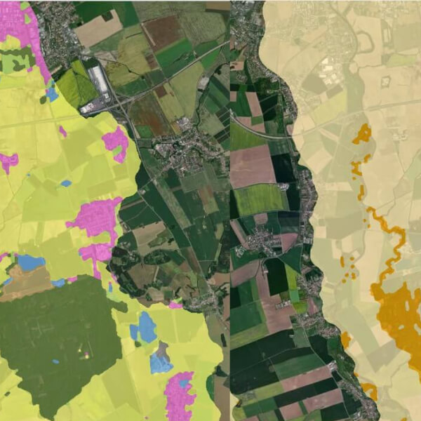
Implementation of environmental regulations and nature restoration policies supported. Use EO to monitor land-use change, detect non-compliance, and track progress of ecological restoration and land revitalization efforts.

Purpose:

  • Environmental Compliance Monitoring
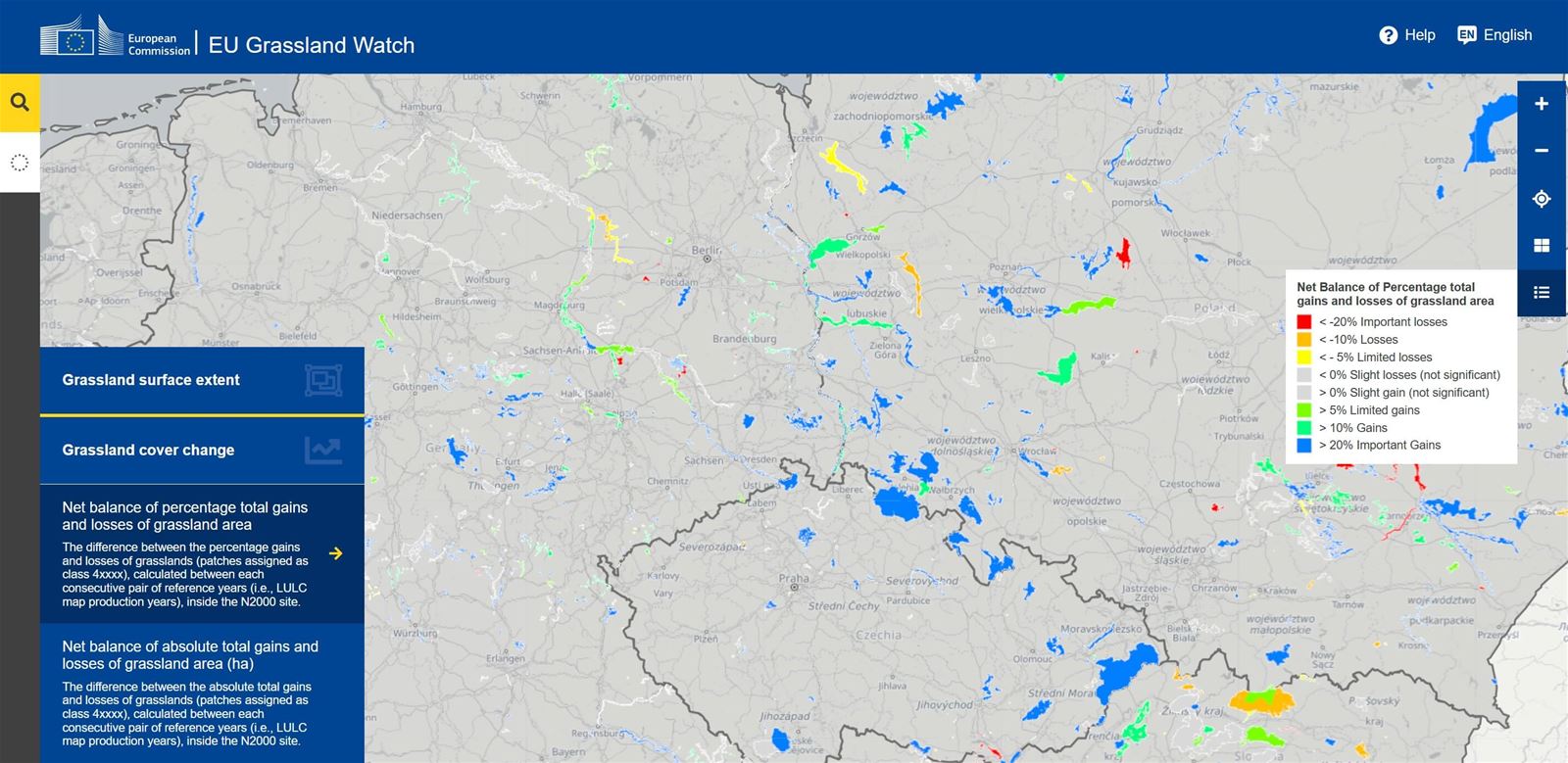
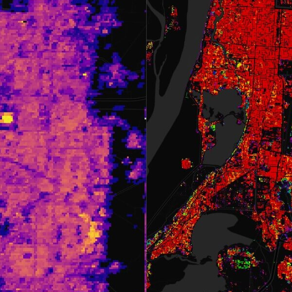
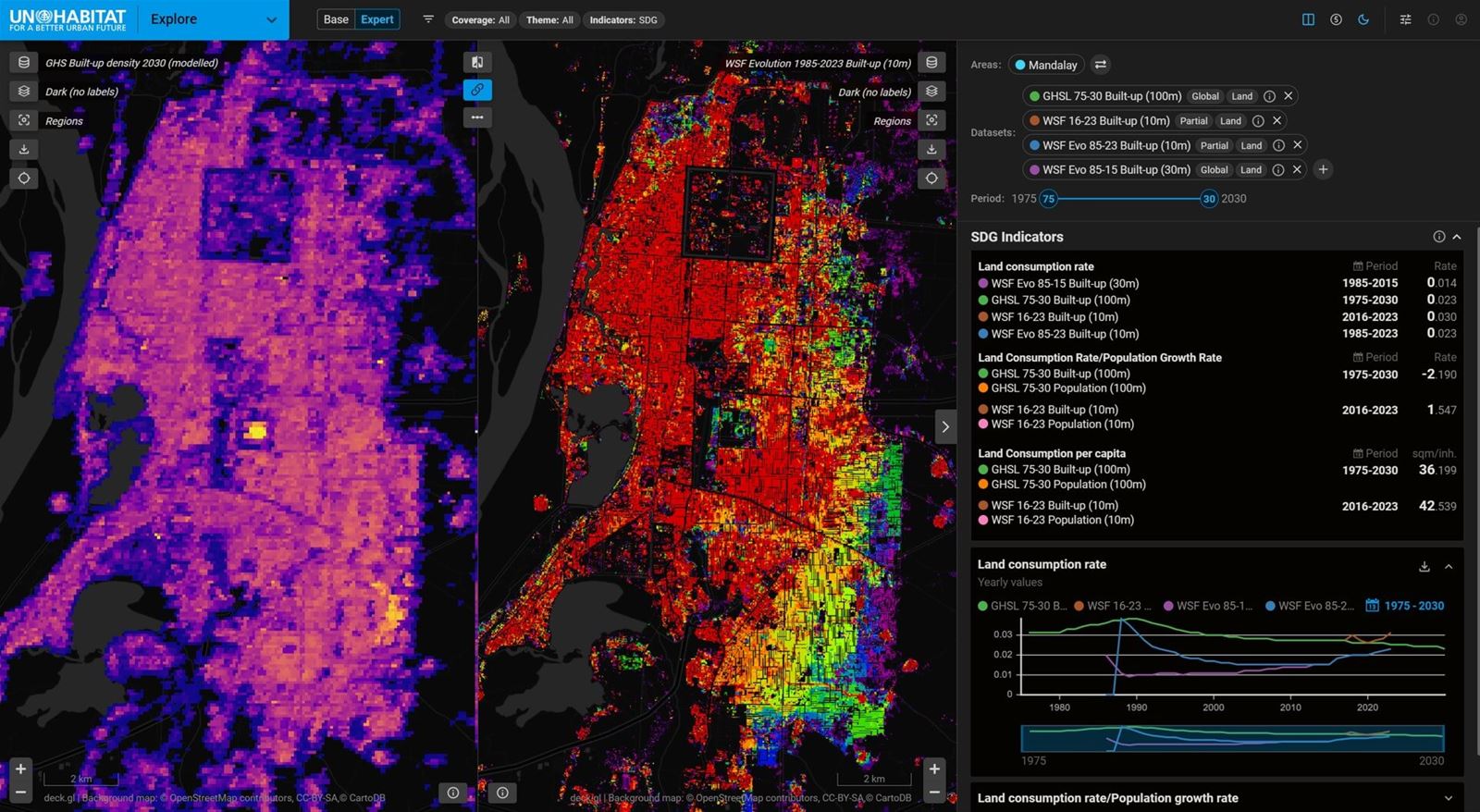
    We support enforcement of environmental regulations by detecting unauthorised land conversion, wetland drainage, or deforestation using EO-based change detection.
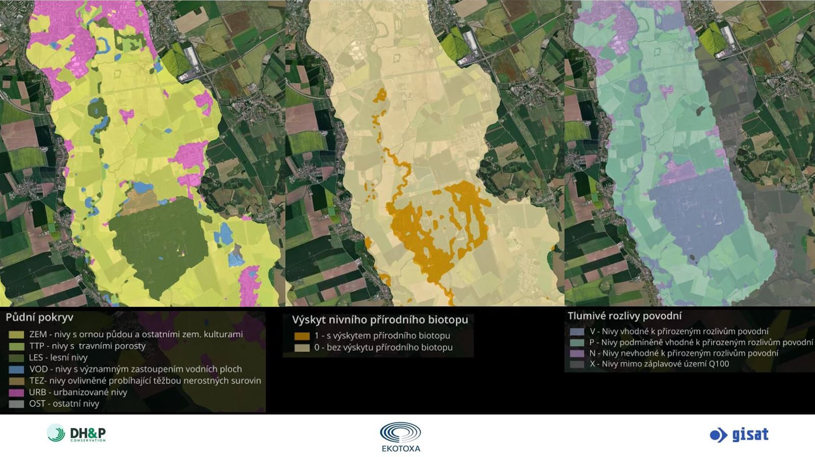
  • Land Valuation and Restoration Planning
    We identify degraded land, assess restoration potential and monitor progress of ecological restoration measures such as rewetting, reforestation or landscape restoration e.g. in the context of EU Nature Restoration Regulation or Natura 2000.
  • Support to Inspections and Enforcement
    We provide targeted geospatial alerts and evidence to support field inspections, compliance audits and enforcement of environmental rules.
Policy and Sustainability Reporting
Standardised indicators and geospatial data for policy reporting and sustainability tracking.

Our EO-based products contribute directly to SDGs, ESG frameworks and climate-related reporting under national and EU environmental legislation.

  • Sustainable Development Reporting
    We produce EO-derived indicators for SDG targets (e.g. SDG 15.1.1, 15.3.1 or 6.6.1) and support national and international environmental reporting obligations.
  • ESG Environmental Tracking
    Use satellite data to track indicators relevant to environmental performance in ESG frameworks – including deforestation, land use intensity and natural capital exposure.
  • Carbon Stock Estimation
    Estimate and monitor carbon stored in forests, grasslands and soils to support LULUCF accounting, REDD+ initiatives and carbon market mechanisms.
Climate Risks and Resilience Planning
Supporting climate adaptation and risk management through EO – NBS, vulnerability and extremes.

Informed climate adaptation and risk management using targeted EO insights. We help in assessing natural hazards, ecosystem vulnerabilities and resilience potential to support nature-based solutions and climate-smart planning.

  • Natural Hazard Assessment
    We monitor floods, droughts and landslides using multi-temporal EO data to inform preparedness, impact assessment and spatial risk planning.
  • Climate Impact and Vulnerability Analysis
    We assess long-term changes in vegetation, water availability and soil condition to understand ecosystem vulnerability to climate stressors.
  • Support to Nature-Based Solutions (NBS)
    We help to identify priority areas and monitor the effectiveness of NBS for flood control, soil retention or climate adaptation based on ecosystem condition and landscape context.

Retrospective environmental monitoring

Track long-term changes in land cover, ecosystems, and environmental conditions to understand landscape evolution and inform conservation, restoration, and planning efforts. Historical EO data provides essential context for analysing trends, pressures, and policy impact over decades.

Real-time environmental monitoring

Monitor environmental conditions in near real time to detect rapid changes, respond to emerging risks, and support adaptive management. EO-based alerts and continuous updates help guide timely decisions in areas such as ecosystem health, land use dynamics, natural hazards, and regulatory enforcement.

Ecosystem service valuation

Quantify ecosystem services to support sustainable resource management and policy decisions.

Environmental reporting tools

We provide geospatial statistics and indicators in a tailored web portal or through an API to support reporting and corporate sustainability goals.

Contact our expert

Tomáš Soukup

Product Owner

Your customer journey

Defining Your Vision

We'll start by understanding your challenges and objectives. This involves pinpointing geographic areas, desired timeframes, and crucial insights. We'll then recommend optimal data, processing, and output formats to achieve your vision.

Expert Data Acquisition

Once your needs are clear, we'll select and acquire the most suitable Earth Observation (EO) data. We'll apply advanced processing techniques like MT InSAR, NDVI, or spectral analysis, to address specific requirements like change detection or ground deformation monitoring.

Transforming Data into Intelligence

Our team will analyze data to create impactful outputs tailored to you, like maps, reports, or graphs. Every deliverable undergoes rigorous quality checks to ensure technical accuracy and meet your expectations.

Seamless Delivery & Support

We'll provide results in your preferred format – via our online portal, printed outputs, or electronic delivery. We can also include a technical report to explain analysis details and key conclusions, empowering you with deeper understanding.

Empowering Your Team

If needed, we'll provide bespoke training to equip your personnel with the skills to effectively work with data and interpret results. Our aim is to build your in-house capacity and maximize the value of our solutions.