
Get reliable, high-resolution data on what is where in the landscape. Map land cover, land use, habitats, water bodies and biomass to understand ecosystem structure and support spatial planning, conservation and restoration strategies.
- Land Cover and Land Use Mapping
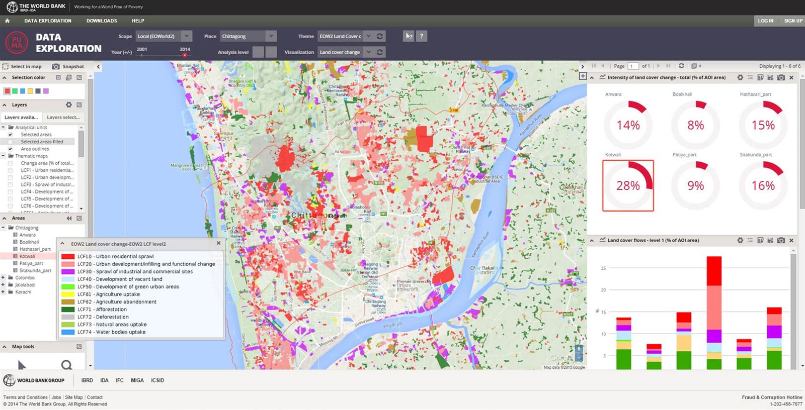
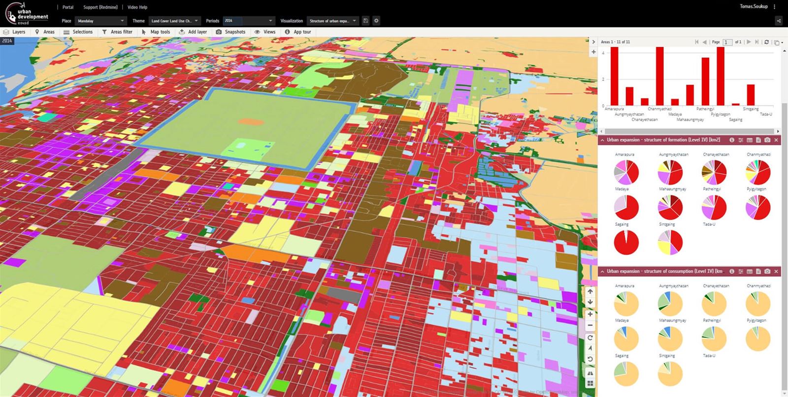
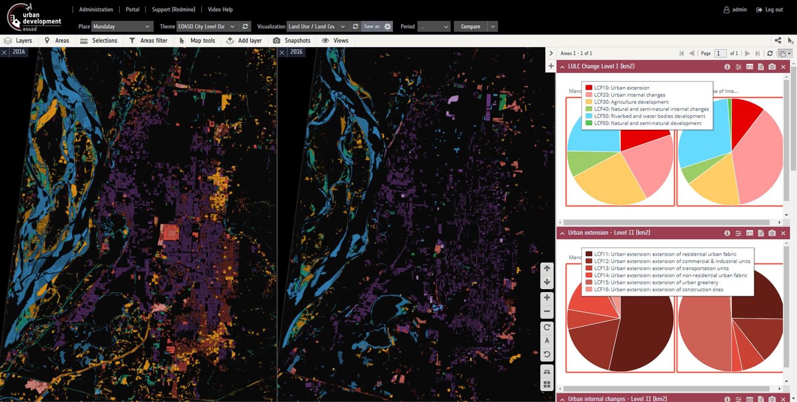
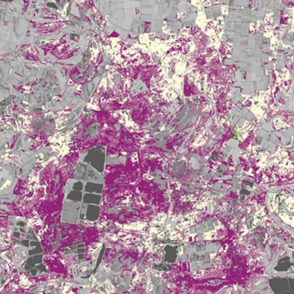
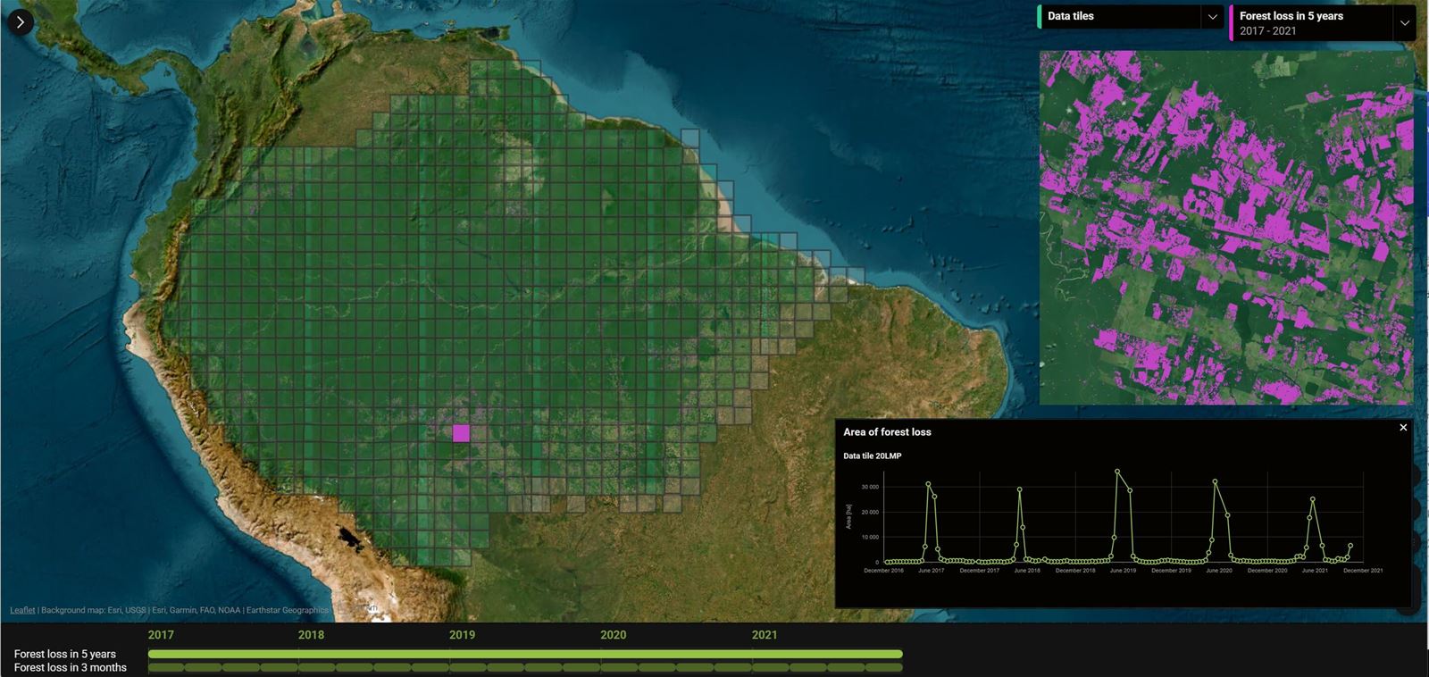
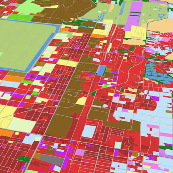
We produce consistent and up-to-date land cover and land use maps to monitor landscape structure, detect change, and support planning, conservation and resource management at multiple scales.
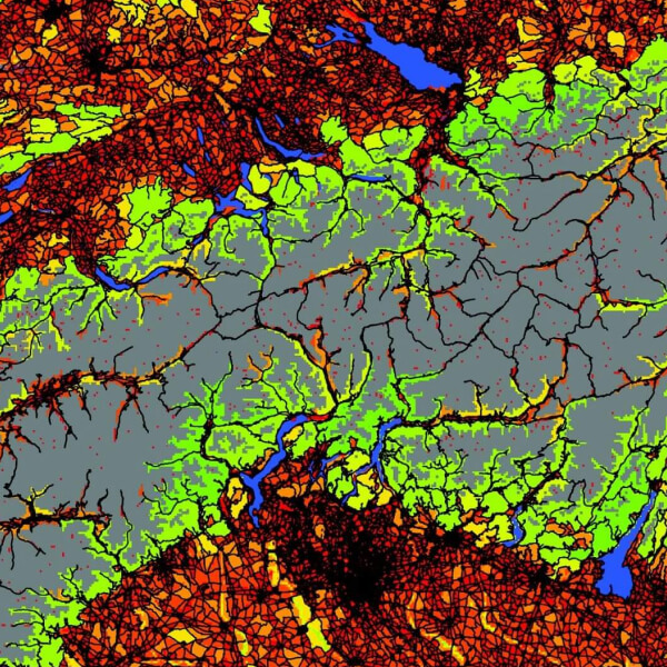
- Biodiversity and Habitat Mapping
We identify and map key habitat types and species environments using EO-based indicators to support habitat protection, ecological networks and Natura 2000 site assessments.
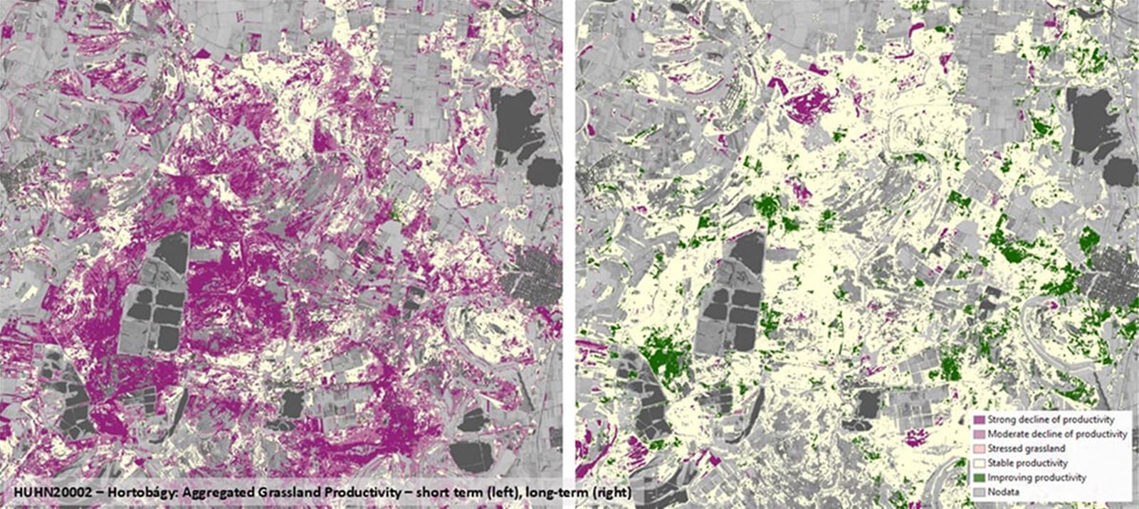
- Water Ecosystem Mapping
We monitor the extent, dynamics and seasonal variability of wetlands, lakes and floodplains to assess ecological status and support water-related ecosystem management.
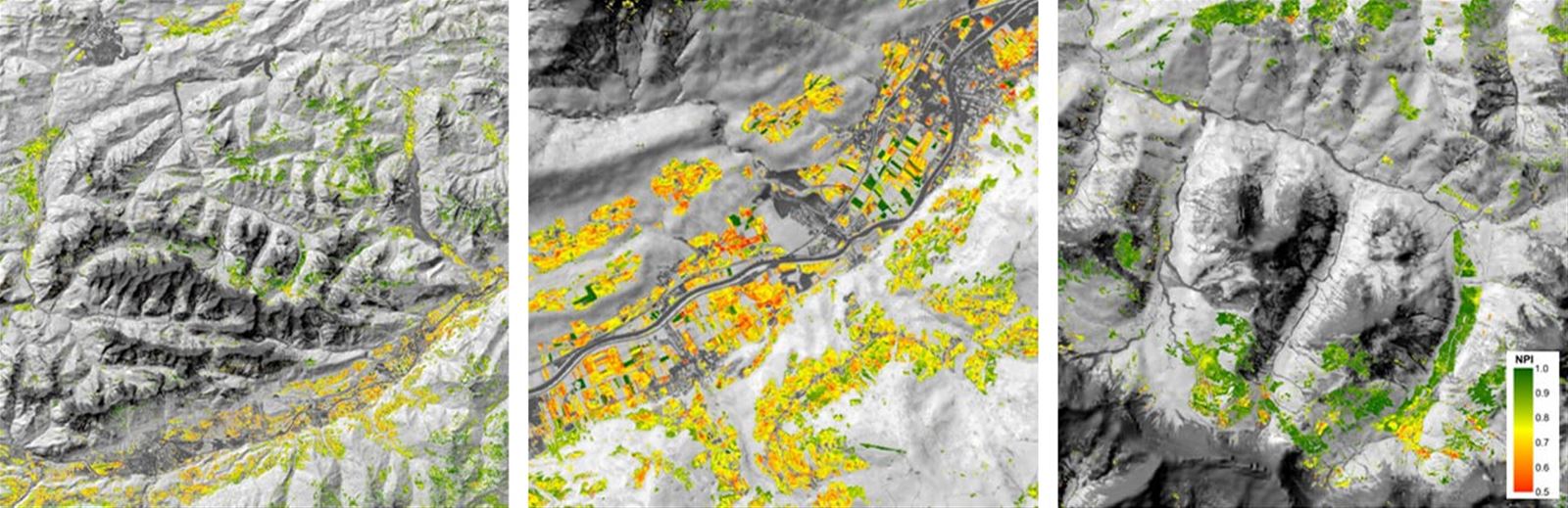
- Biomass Assessment
We estimate green biomass in agricultural and forested areas to evaluate productivity, carbon balance and the impact of land management practices.
- Ecosystem Mapping and Functional Valuation
We support national ecosystem assessments and natural capital accounting by spatially mapping ecosystems and linking them to functions and ecosystem services (e.g. under MAES or SEEA EA frameworks).