Agriculture & Forestry | Use cases

Monitoring forest stands

Map deforestation extent and development while monitoring forest stand restoration. Assess climate change impacts and support sustainable forest management with historical and real-time monitoring.

Forest condition and development
Evaluate forest ecosystems and their development using satellite data.
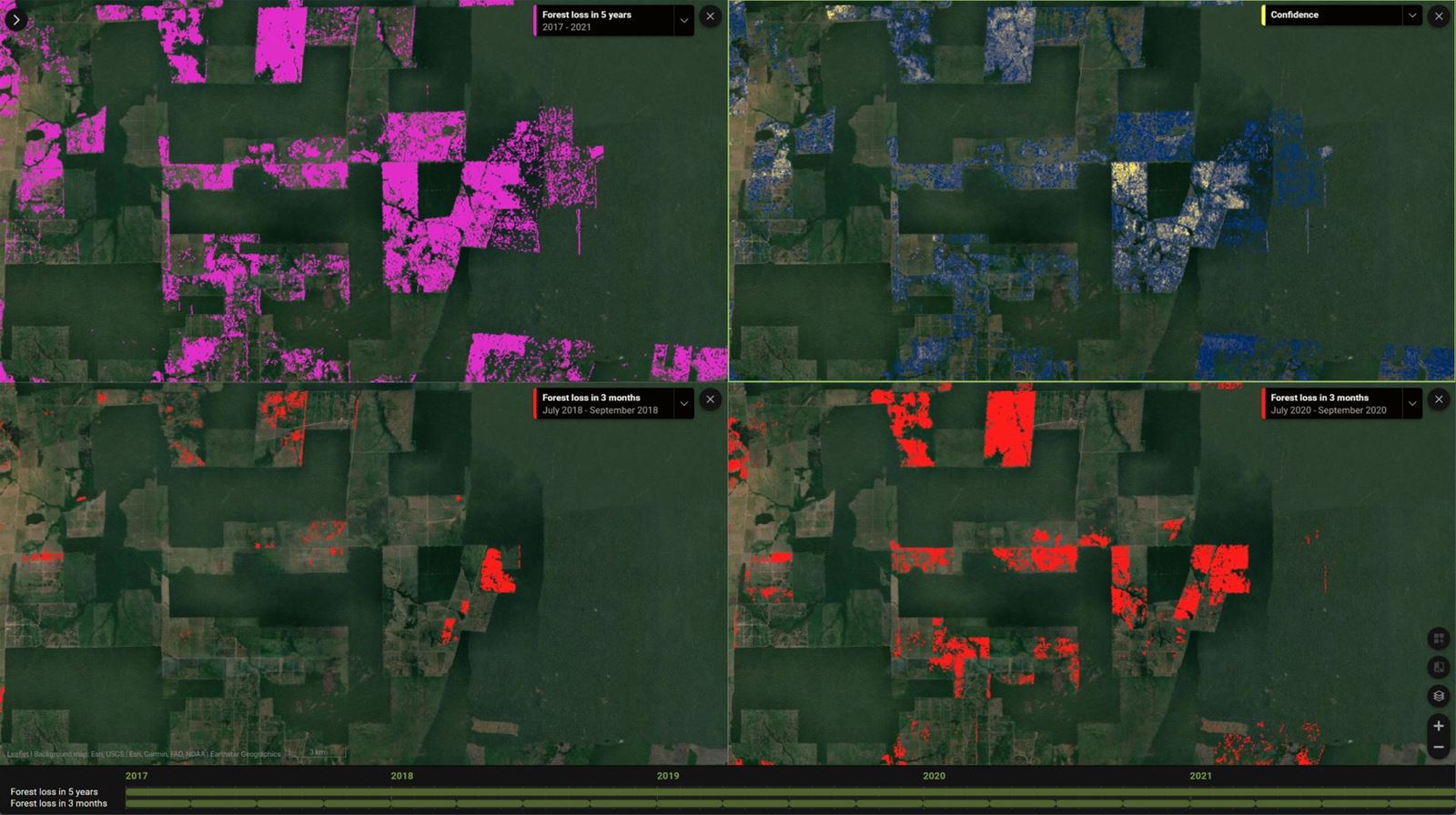
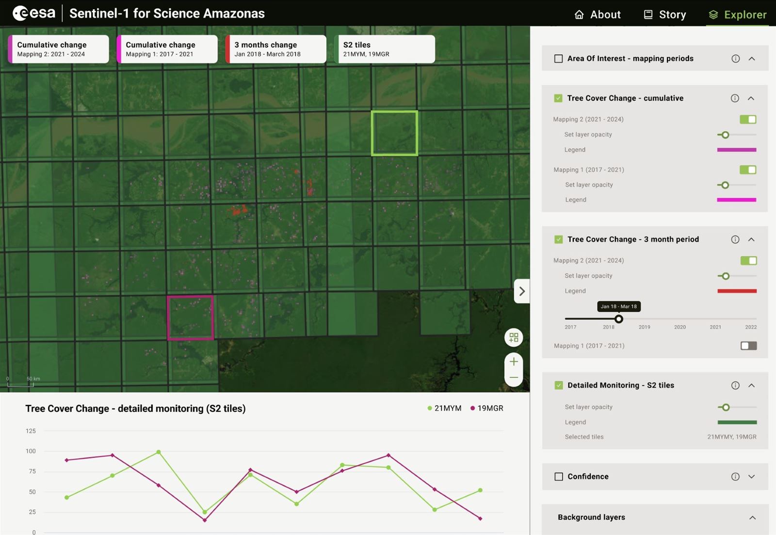
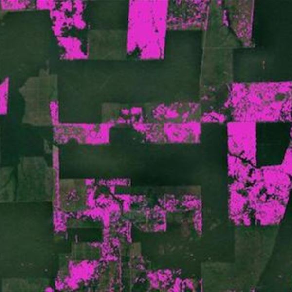
  • Detect forest loss areas and analyze deforestation trends and drivers over time
  • Monitor and control forest regeneration processes
  • Assess forest stand damage caused by natural disasters such as fires, storms, drought, and forest pests.
  • Analyze climate change impacts on long-term forest stand development
  • Encourage sustainable forest management with detailed monitoring of forest stand conditions

We employ optical and radar satellite data for regular forest monitoring at local, regional, and global levels. Long-term archive data series help us analyze and understand trends in forest canopy cover development, species composition, and health status.

Agricultural vegetation mapping

We map agricultural land, classify crops, and monitor management for targeted practices, subsidy controls, damage assessment, and statistics. Our mapping uses free optical and radar data from Sentinel and Landsat, supplemented by higher-resolution Planet or other data when necessary.

Monitoring vegetation growth and forecasting future states

We monitor crop parameters like chlorophyll, leaf area, biomass, nitrogen, carbon balance, and water. This helps us track drought, forecast yields, assess climate change, and promote smart farming. Our monitoring uses biophysical and biochemical modeling with satellite data indicators, and predictive AI/machine learning.

Choose how to get results

We deliver mapping and monitoring results in formats that suit customer needs and preferences: spatial data (GIS layer), custom web map portal, API integration, or as a technical report with maps

Contact our expert

Jan Mišurec

EO Innovation Lead

Your customer journey

Defining Your Vision

We'll start by understanding your challenges and objectives. This involves pinpointing geographic areas, desired timeframes, and crucial insights. We'll then recommend optimal data, processing, and output formats to achieve your vision.

Expert Data Acquisition

Once your needs are clear, we'll select and acquire the most suitable Earth Observation (EO) data. We'll apply advanced processing techniques like MT InSAR, NDVI, or spectral analysis, to address specific requirements like change detection or ground deformation monitoring.

Transforming Data into Intelligence

Our team will analyze data to create impactful outputs tailored to you, like maps, reports, or graphs. Every deliverable undergoes rigorous quality checks to ensure technical accuracy and meet your expectations.

Seamless Delivery & Support

We'll provide results in your preferred format – via our online portal, printed outputs, or electronic delivery. We can also include a technical report to explain analysis details and key conclusions, empowering you with deeper understanding.

Empowering Your Team

If needed, we'll provide bespoke training to equip your personnel with the skills to effectively work with data and interpret results. Our aim is to build your in-house capacity and maximize the value of our solutions.