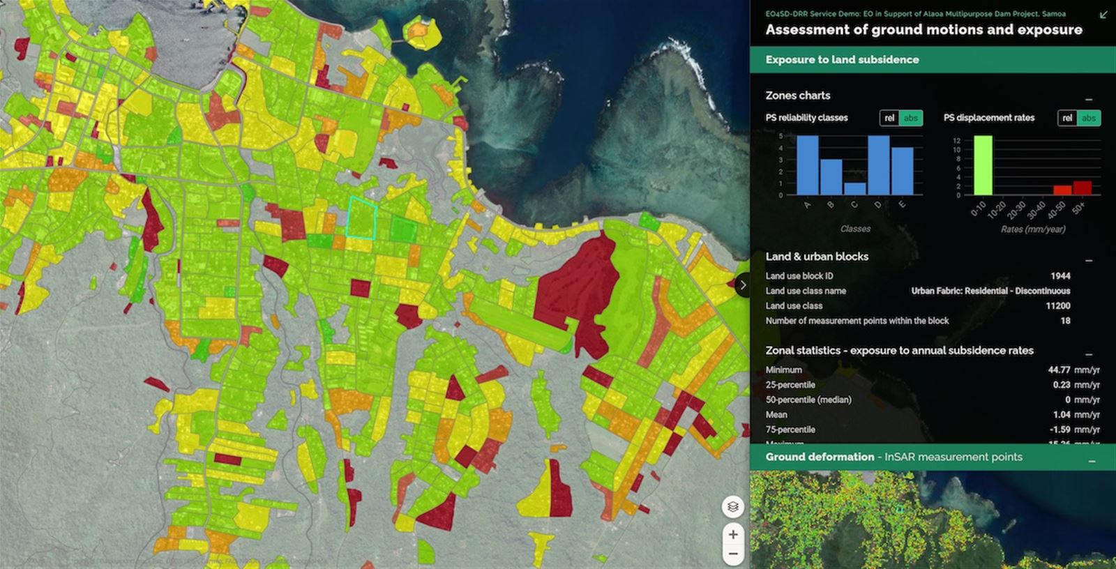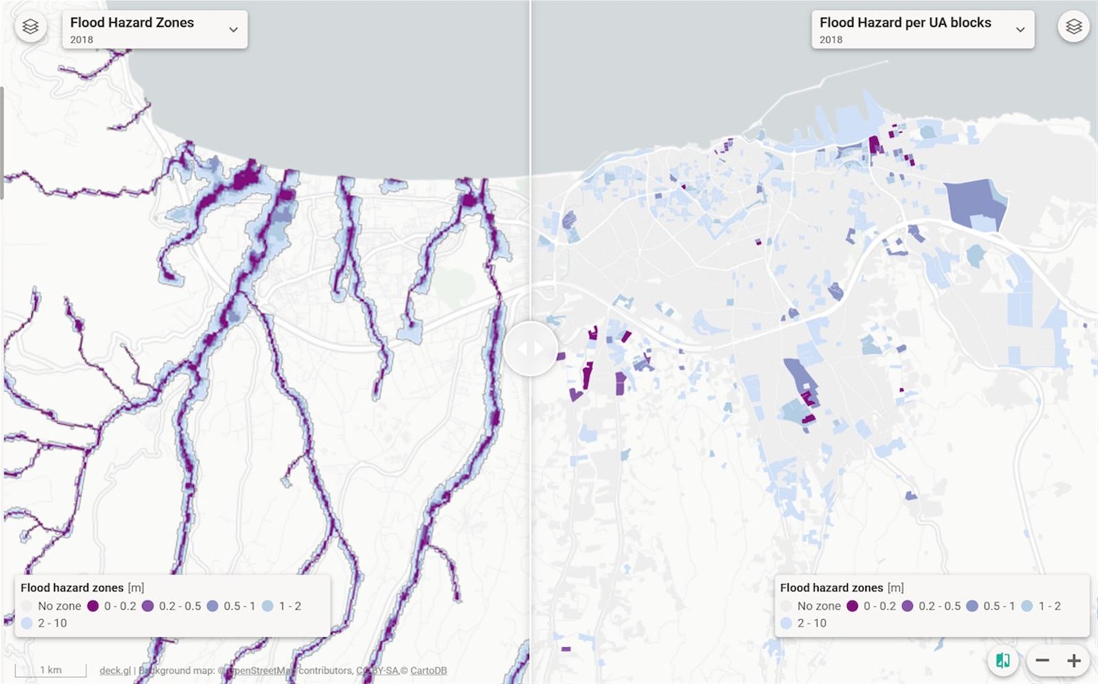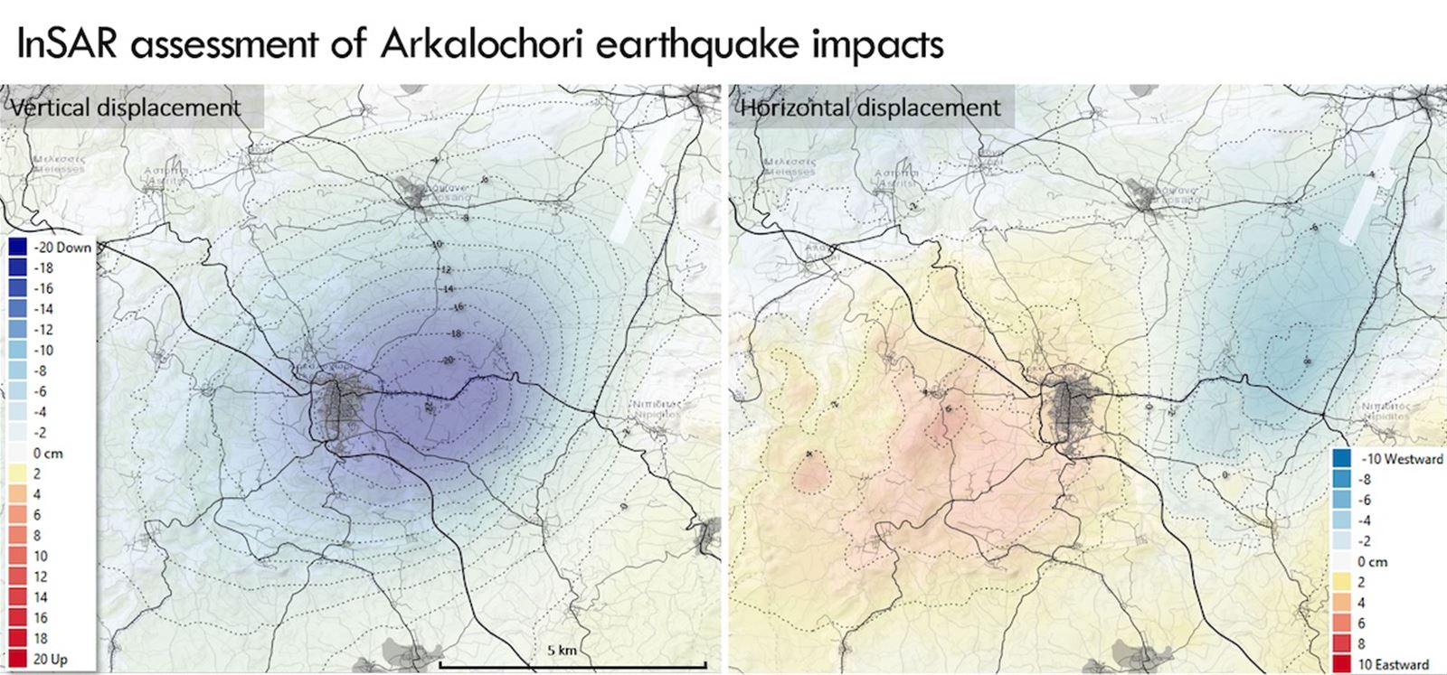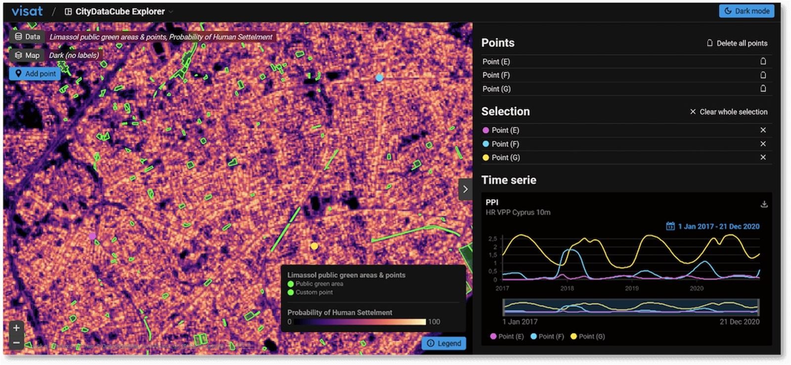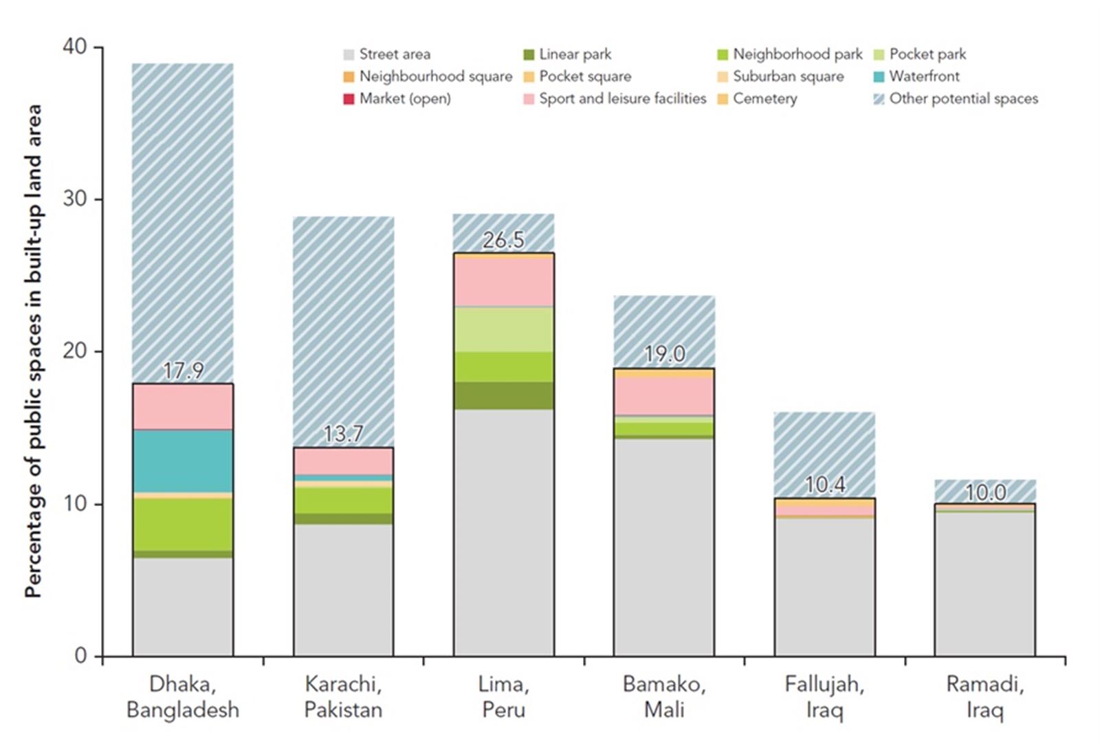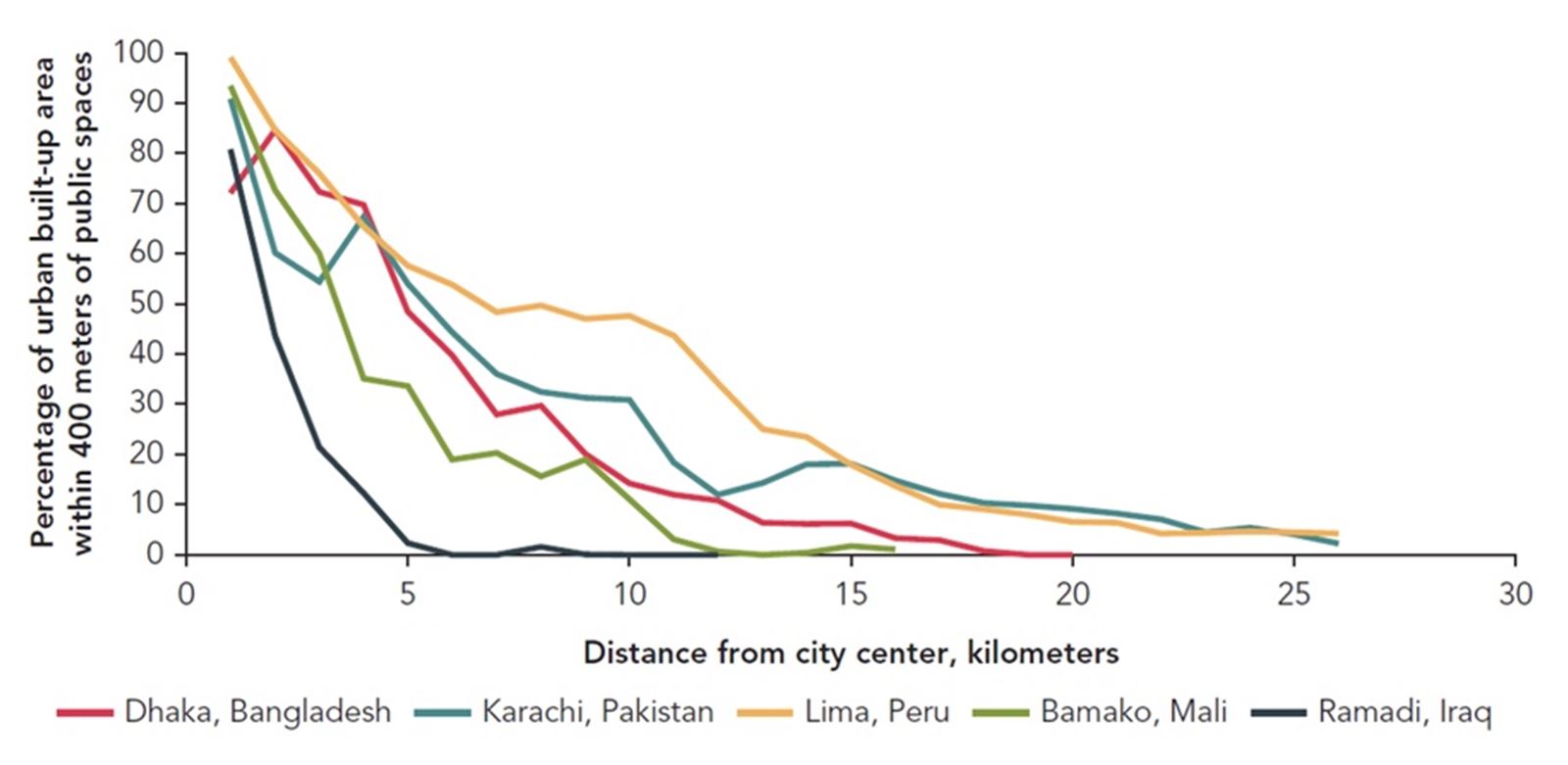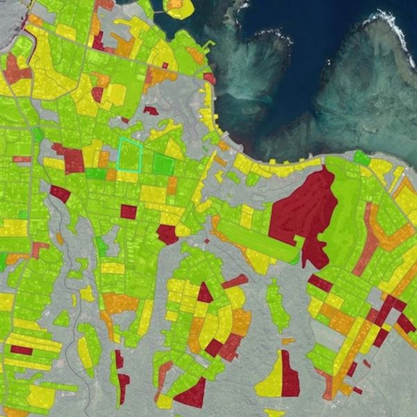

- Monitor and map areas at risk of flooding, subsidence, landslides, drought or extreme heat.
- Evaluate the impacts of climate-related risks on urban infrastructure and services.
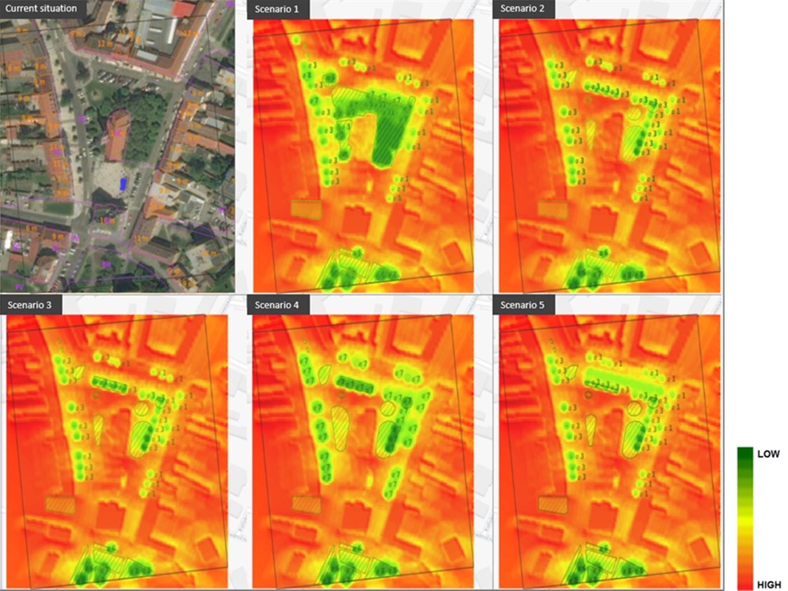
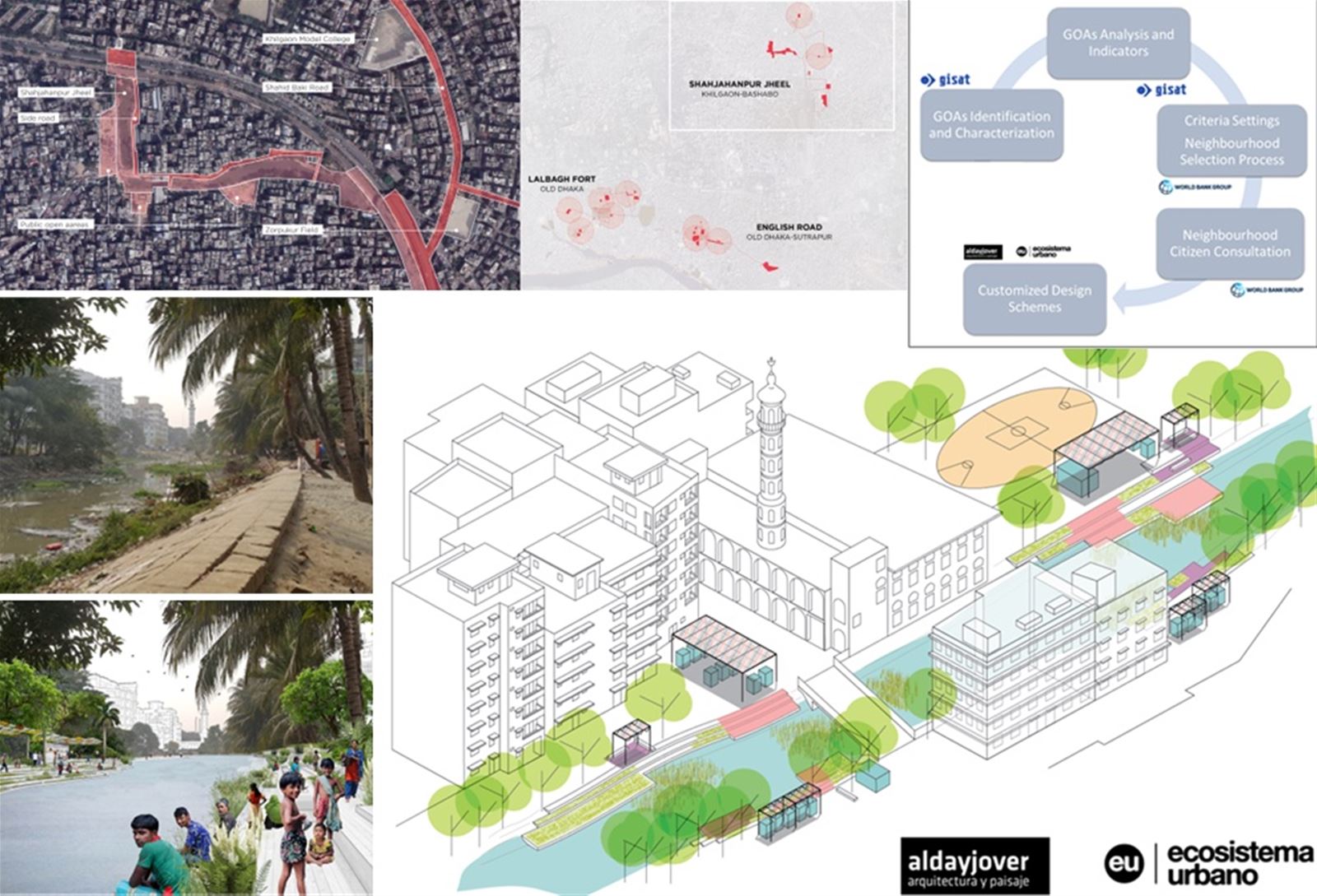
- Support urban planning to prioritize resilience-building measures.
We use satellite imagery and advanced geospatial data to identify climate risks in urban environments, enabling cities to prepare for and mitigate potential hazards effectively.