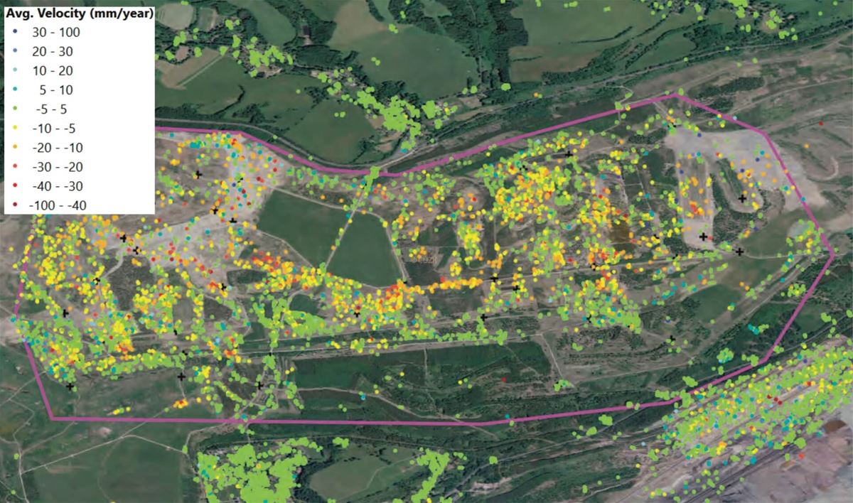
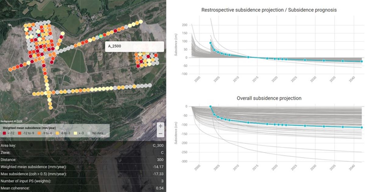
Case study

Geotechnical prognosis of long-term dump consolidation

Project duration
2019, 2014
Project area
Czechia
Customer
Undisclosed mine operators

Situation

Pre-existing conditions in post-mining areas hamper new construction

Designing new structures such as buildings or infrastructure in reclaimed post-mining areas presents a number of serious challenges. Customers considering investments on former landfill sites faced challenges due to the unstable subsoil that is a natural effect of previous human activity. The key factors for safe construction were the load-bearing capacity of the area and the long-term behavior of the subsoil. Detailed geological and geotechnical surveys are essential for designing an optimal solution and minimizing risks.

MT-InSAR based on archived Sentinel-1 measurements is often the only possible tool to assess historical and current rates of subsidence in areas not covered by traditional geotechnical methods.

Solution 

A tailor-made workflow was designed to address these challenges

Displacement velocity and additional characteristics such as trend dynamics were derived by analyzing the Sentinel-1 time series of the deformation signal using heavily tailored MT-InSAR algorithms. Gisat customized this workflow by adding several pre- and post-processing steps to deal with non-linear trends, frequent surface modifications and inherent phase unwrapping errors.

Observations from ascending and descending satellite orbits facilitated estimation of the motion vectors' vertical and horizontal components by decomposition of multiple radar geometries.

Displacement metrics derived from time series of InSAR measurements were aggregated for pre-defined cross-sections across the high-priority zones defined in the infrastructure design plan.

Results

Analyses and insights were seamlessly integrated into our customers' existing process pipeline, protecting them from risks

We understand our customers need to make informed decisions and optimize operations. The key is not only data delivery, but also specific, applicable insights which, as in this case, were then analyzed by the customer and integrated into their pre-existing processes. By investing into proactive monitoring, we help customers protect themselves from risks, effectively manage investments, and achieve long-term financial stability.

Our ability to provide accurate forecasts of material behavior and settlement development, including a detailed understanding of the distribution of heterogeneous consolidation velocities on the landfill surface, was one of the key benefits. By combining this information with geotechnical parameters and InSAR (Interferometric Synthetic Aperture Radar) technology, we allowed experts to project displacements for the next two decades with high accuracy. This data is invaluable for long-term planning, maintenance, and safety of structures and infrastructure, thereby providing our customers with key information for strategic decision-making and minimizing future risks.

Service delivered in cooperation with VUHU (Brown Coal Institute).