Case study

Earth observation for monitoring New CAP agriculture eco-schemes

Project duration
2022 - 2024
Project area
Czechia, the Netherlands, Spain (Castilla y León), Sweden
Customer
European Space Agency (ESA), Paying Agencies (CZ, NL, ES, SE), Farmers

SITUATION

The implementation of CAP eco-schemes requires checks and assessments made at an unparalleled scale. 

The New Common Agricultural Policy (CAP) introduced eco-schemes as a set of voluntary rules, offering a significant opportunity to address agri-environmental concerns more effectively and support farmers in transitioning towards more sustainable management models. These eco-schemes focus on a common list of action areas defined at the EU level, such as organic farming, agro-ecology, precision farming, and carbon farming. The effective implementation and verification of these new schemes necessitated robust and innovative monitoring techniques. 

The People4NewCAP (Pioneer Earth Observation apPLications for Environment - The New CAP Agriculture Eco-schemes) project was designed to demonstrate how Earth Observation (EO) monitoring techniques can be utilized to track the fulfillment of conditions defined for particular eco-schemes, thereby supporting Paying Agencies and farmers under the new CAP.
SOLUTION

Paying Agencies in 4 countries shared their needs and requirements for CAP controls. 

The People4NewCAP project, led by Gisat with support from partners Wageningen Environmental Research, Solenix, and Cleverfarm, focused on developing and demonstrating innovative EO-based products, indicators, methods, and tools to support the monitoring of eco-scheme implementation. The project targeted two main user groups: Paying Agencies, which defined user requirements and pilot regions, and farmers, who can benefit from the results of agricultural practice monitoring. 

Several use cases were defined, addressing both the needs of Paying Agencies (e.g. monitoring crop rotation, land lying fallow, extensive use of grassland, winter soil cover and catch crops, use of geotagged photos) and benefits for farmers (e.g. managing crop water demands, estimation of soil organic carbon and farm carbon footprint). These methods were developed and demonstrated in close collaboration with Paying Agencies in four countries (Czechia, The Netherlands, Spain, Sweden) and involved processing time series of Sentinel-1 and Sentinel-2 satellite data, analysis of vegetation indices (NDVI, BSI), SAR coherence, and the application of machine learning and artificial intelligence techniques for geotagged photo analysis.

RESULTS

The lessons learned and feedback from Paying Agencies confirmed the potential of these tools for integration into their monitoring systems.  

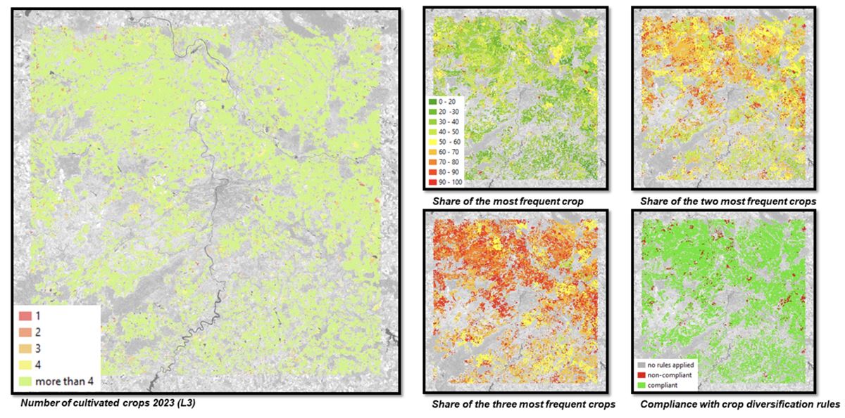
The People4NewCAP project successfully demonstrated the capability of the proposed EO-based methods to monitor a wide range of agricultural practices relevant to the New CAP eco-schemes. For instance, the crop rotation use case achieved high thematic accuracy in crop type classification (e.g., 95% for Level-1 in 2021/2022) and strong agreement with GSAA declarations (e.g., over 97% for Level-3 in 2023). Monitoring of land lying fallow showcased the flexibility of the approach by tailoring methods to local conditions and specific definitions in member states, utilizing both NDVI and SAR coherence. 

For the extensive use of grassland, a methodology based on NDVI profile analysis was developed to identify managed and unmanaged parcels. The monitoring of winter soil cover and catch crops in the Netherlands successfully detected the presence and timing of catch crop growing cycles. Farmer-oriented use cases provided valuable insights into crop water stress and the potential for estimating soil organic carbon, contributing to more sustainable management.