Cookies settings

We use cookies on our website to ensure their proper functioning and the best possible user experience. By clicking on the Accept button, you agree to the use of cookies for the purposes of: .

Case study

Monitoring construction of Metro line D in Prague

Project duration
2022-2024
Project area
Czechia
Customer
Prague Transport Commission

Situation

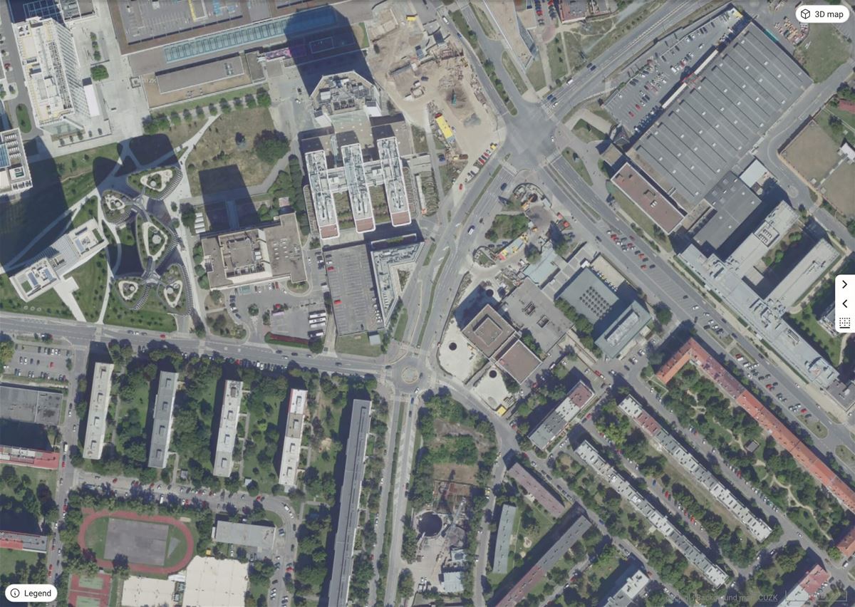
Prague is getting a long-awaited fourth metro line

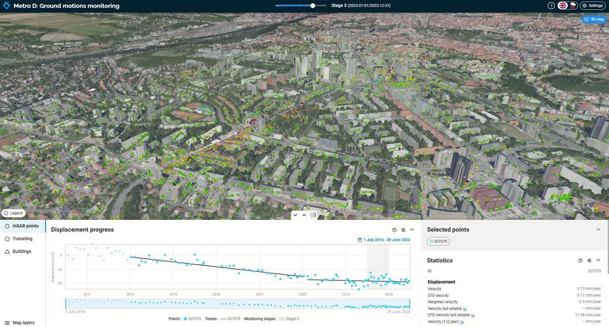
Excavating a subway in an urban area with complex geological conditions presents a technical challenge from both construction and geotechnical monitoring perspectives.

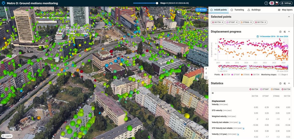
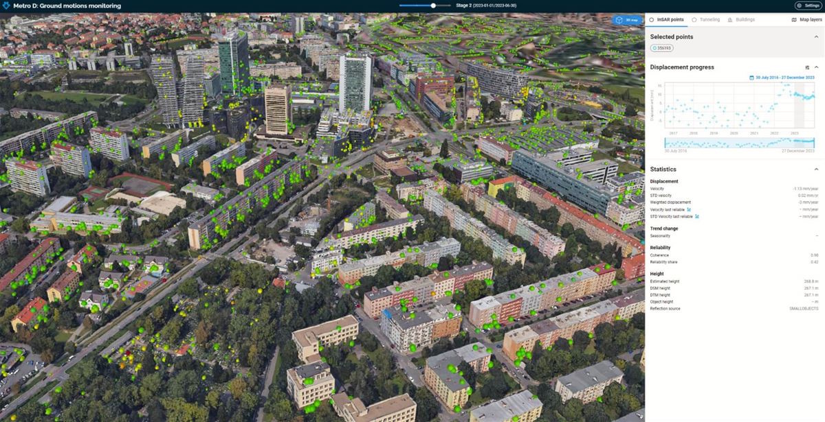
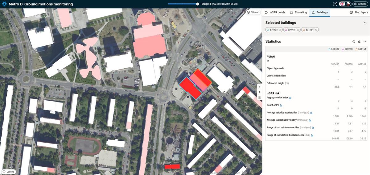
As part of the construction of metro line D in Prague, comprehensive geotechnical monitoring is provided for the Prague Public Transit Company. This is complemented by continuous monitoring of surface deformations using satellite radar interferometry (MT-InSAR) technology. The subcontract aims to detect surface movements in urban buildings with high accuracy and wide coverage without the need for point stabilization, thus supplementing measurements taken at stabilized geodetic monitoring points.

Solution

A custom multi-source monitoring solution was deployed

Our solution is based on the PS-InSAR method, enhanced with several targeted and tailor-made proprietary improvements. We analyze long time series of radar measurements from the TerraSAR-X/TanDEM-X/PAZ satellite system, which has archived radar images of the area of interest since 2016—including the period before the start of initial technical work related to route D construction. Since the construction of route D began, we've been adding current images to the archive approximately every eleven to thirty-three days. We then conduct interferometric analysis as part of the monitoring stages.

Results

Investors have access to real-time monitoring

Our solution offers crucial insights for investors, enabling immediate action and thorough damage assessment. We provide comprehensive monitoring, including areas beyond the immediate affected zone, and a significantly denser measurement network with 10x more data points.

These detailed results aid in the geotechnical interpretation of subsidence and uplift, analyzing their extent, speed, and dynamics in the area of interest, particularly in relation to ongoing construction. Furthermore, these findings can be compared against the initial InSAR mapping, which captured the stability of objects and the territory prior to the start of construction.