Monitoring vegetation growth

Track crop and grassland growth, estimate yields or damage to crops, implement variable and sustainable farming practices, and assess and respond to climate change effects promptly.

Vegetation status and vegetation growth
Map agricultural land, assess vegetation conditions, measure crop growth, and analyze climate change effects.
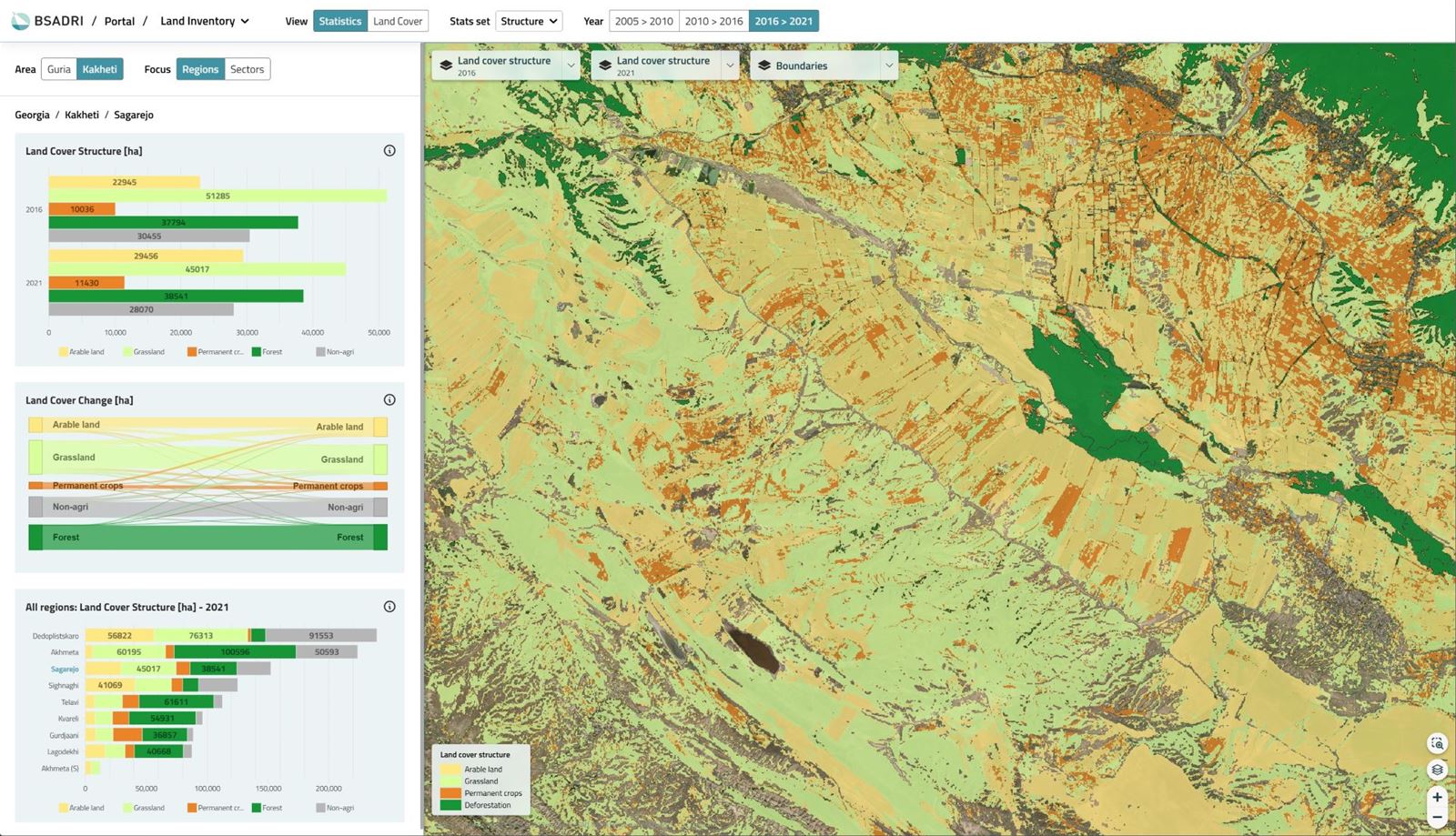
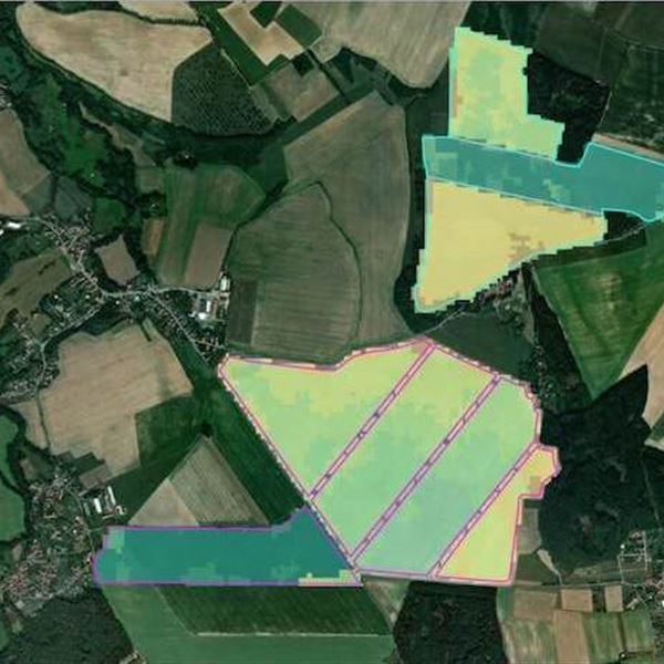
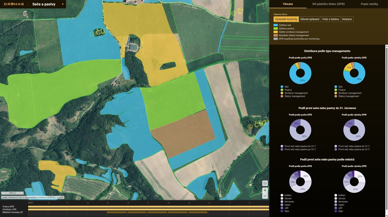
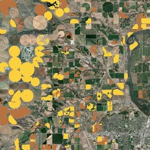
  • Create maps of agricultural areas, arable land, and grasslands
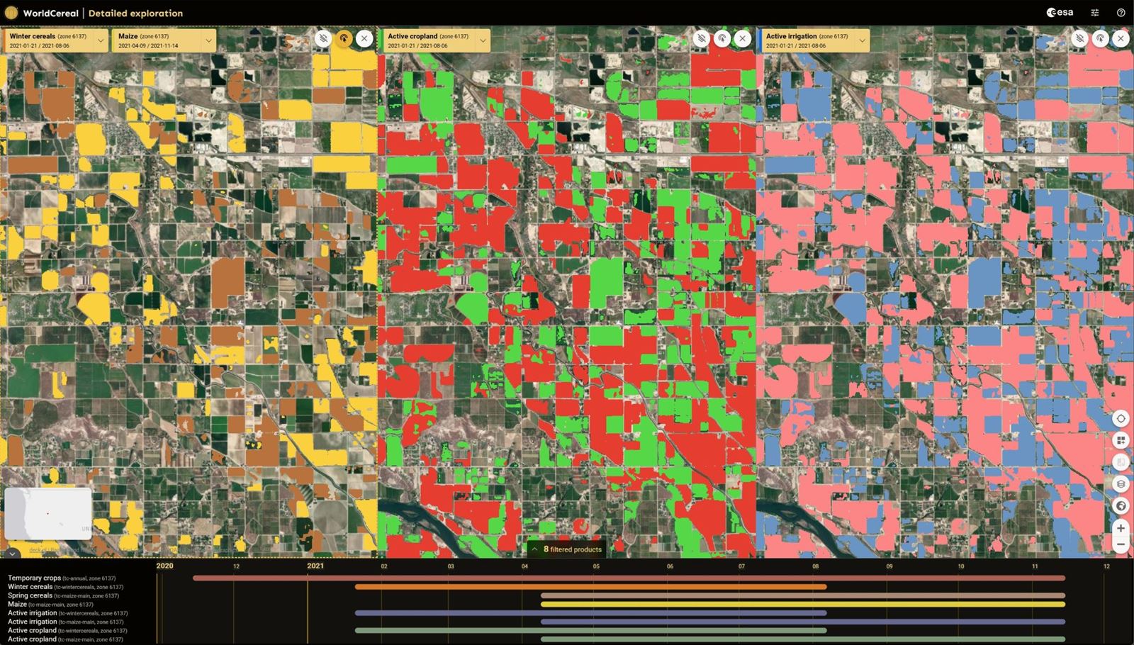
  • Classify agricultural crops and support agricultural statistics
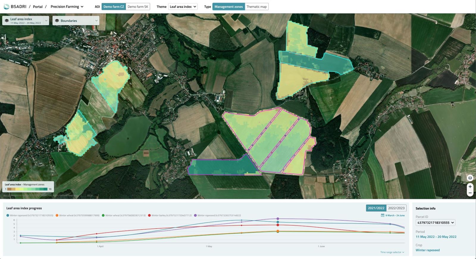
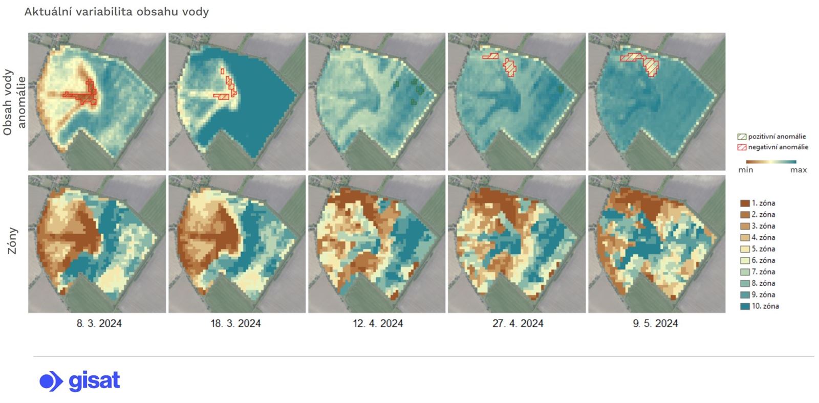
  • Monitor plant water regimes and evaluate drought effects on agricultural production
  • Assess agricultural crop damage caused by natural disasters (floods, storms, wildlife)
  • Monitor crop growth and estimate future yields
  • Analyze climate change impacts on agricultural production

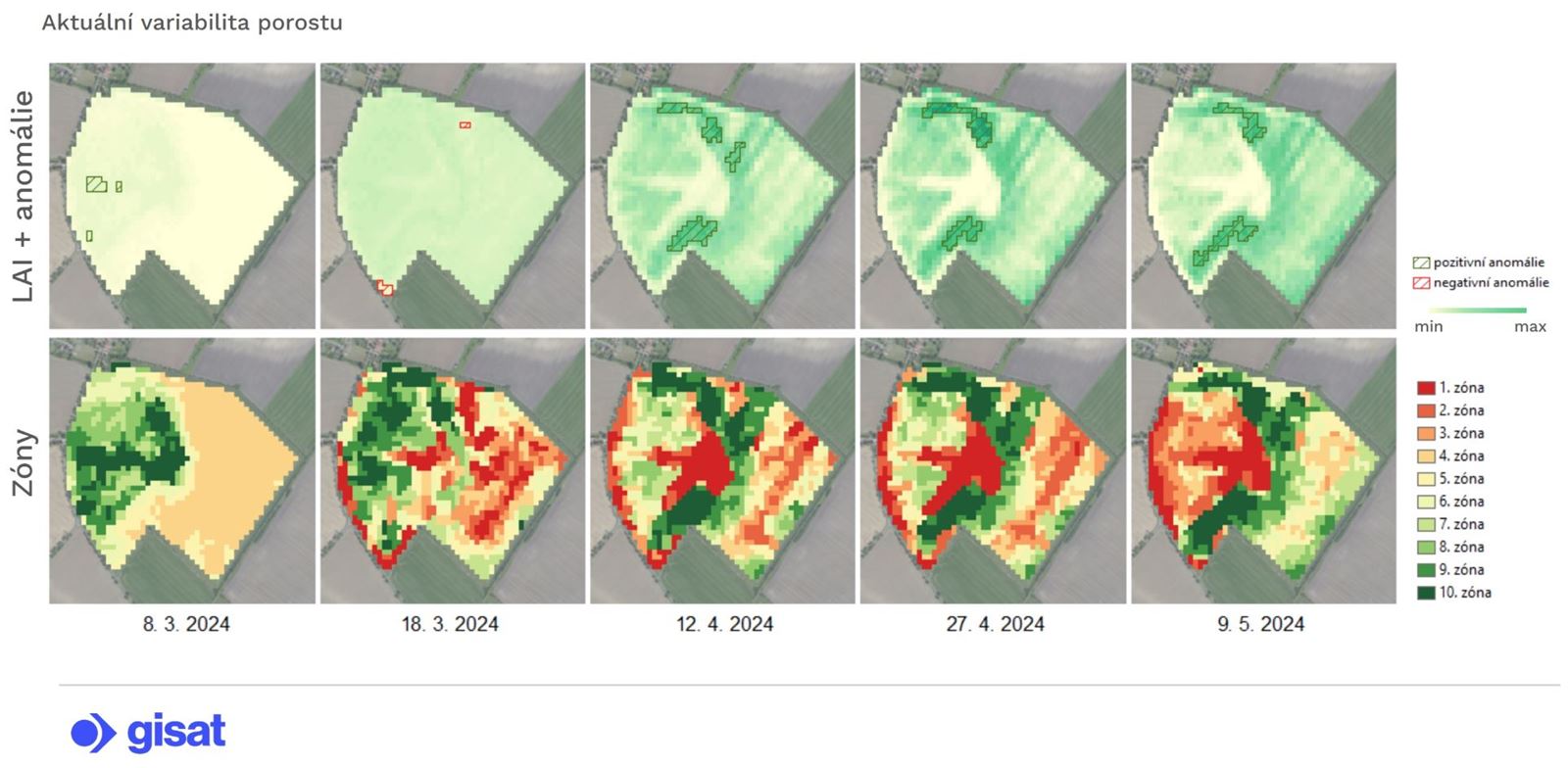
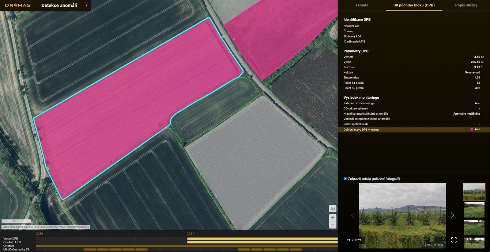
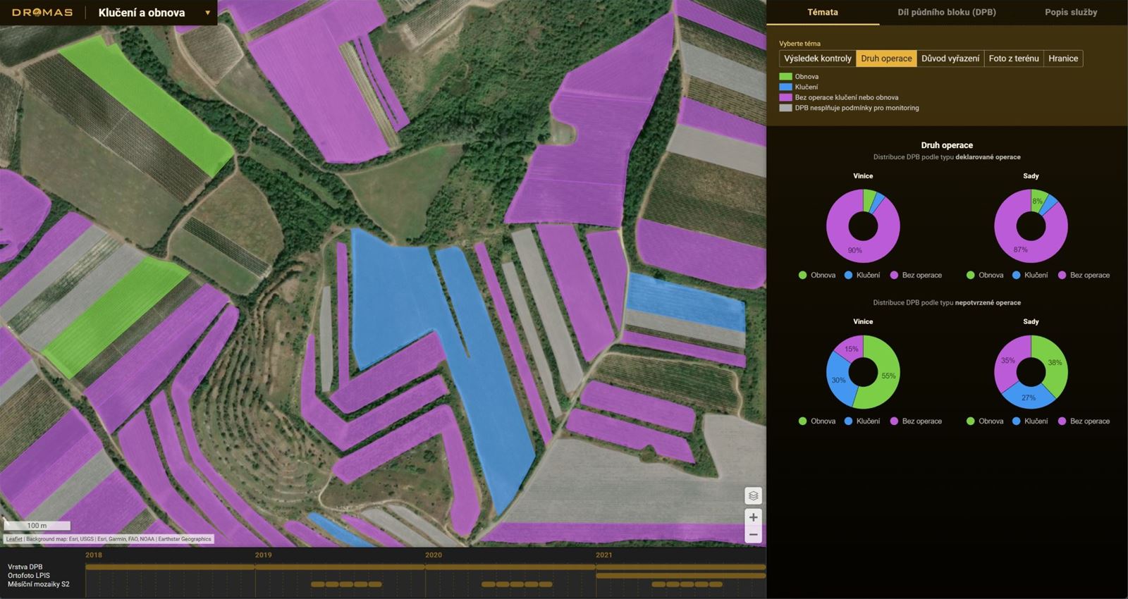
We use optical and radar satellite data to map agricultural land and analyze vegetation growth. Long-term data series reaching into the past allow us to analyze agricultural vegetation states across various periods and climatic conditions.

Smart farming
Farm efficiently, sustainably, and economically using precision farming methods.
  • Discover your land's untapped potential with precision farming practices
  • Obtain data for targeted and variable management (sowing, fertilizing, vegetation treatment)
  • Monitor plant water stress and evaluate irrigation needs
  • Plan optimal times for sowing, fertilizing, irrigating, or harvesting
  • Reduce fertilizer, seed, and irrigation costs through targeted and variable applications
  • Manage soil carefully and sustainably
  • Adapt to climate changes and choose the right crop mix

We employ satellite data to analyze vegetation heterogeneity and the resulting zoning of agricultural plots. Using time series, we assess vegetation conditions and changes in chlorophyll content, leaf area index, biomass amount, and nitrogen content. We evaluate soil carbon balance and monitor crop water regimes.

Agricultural subsidy control
Get support for countrywide, efficient and objective verification of compliance with agricultural subsidy conditions.
  • Verify the presence of declared annual and permanent agricultural crops
  • Detect mowing or grazing on grasslands, verify restoration conditions and compliance with prohibition of ploughing.
  • Confirm catch crop cultivation and compliance with fallow land provisions
  • Verify standard management of permanent crops (orchards, vineyards, hop fields, and others)
  • Detect ineligible land use
  • Support LPIS update processes

We utilize optical and radar satellite data to analyze crop conditions and crop growth, check agricultural practices, and detect ineligible farming management. We are trusted partners to EU member states’ Paying Agencies, supporting their decision-making under AMS and IACS control processes.

Agricultural vegetation mapping

We map agricultural land, classify crops, and monitor management for targeted practices, subsidy controls, damage assessment, and statistics. Our mapping uses free optical and radar data from Sentinel and Landsat, supplemented by higher-resolution Planet or other data when necessary.

Monitoring vegetation growth and forecasting future states

We monitor crop parameters like chlorophyll, leaf area, biomass, nitrogen, carbon balance, and water. This helps us track drought, forecast yields, assess climate change, and promote smart farming. Our monitoring uses biophysical and biochemical modeling with satellite data indicators, and predictive AI/machine learning.

Choose how to get results

We deliver mapping and monitoring results in formats that suit customer needs and preferences: spatial data (GIS layer), custom web map portal, API integration, or as a technical report with maps

Case studies and references

PROPOLE 2.0 – EO based crop monitoring services for precision agriculture

Customer: Farmers, agricultural enterprises, agronomic advisors, and entities involved in land management.
Country: Europe with potential for global application

Your customer journey

Defining Your Vision
Expert Data Acquisition
Transforming Data into Intelligence
Seamless Delivery & Support
Empowering Your Team