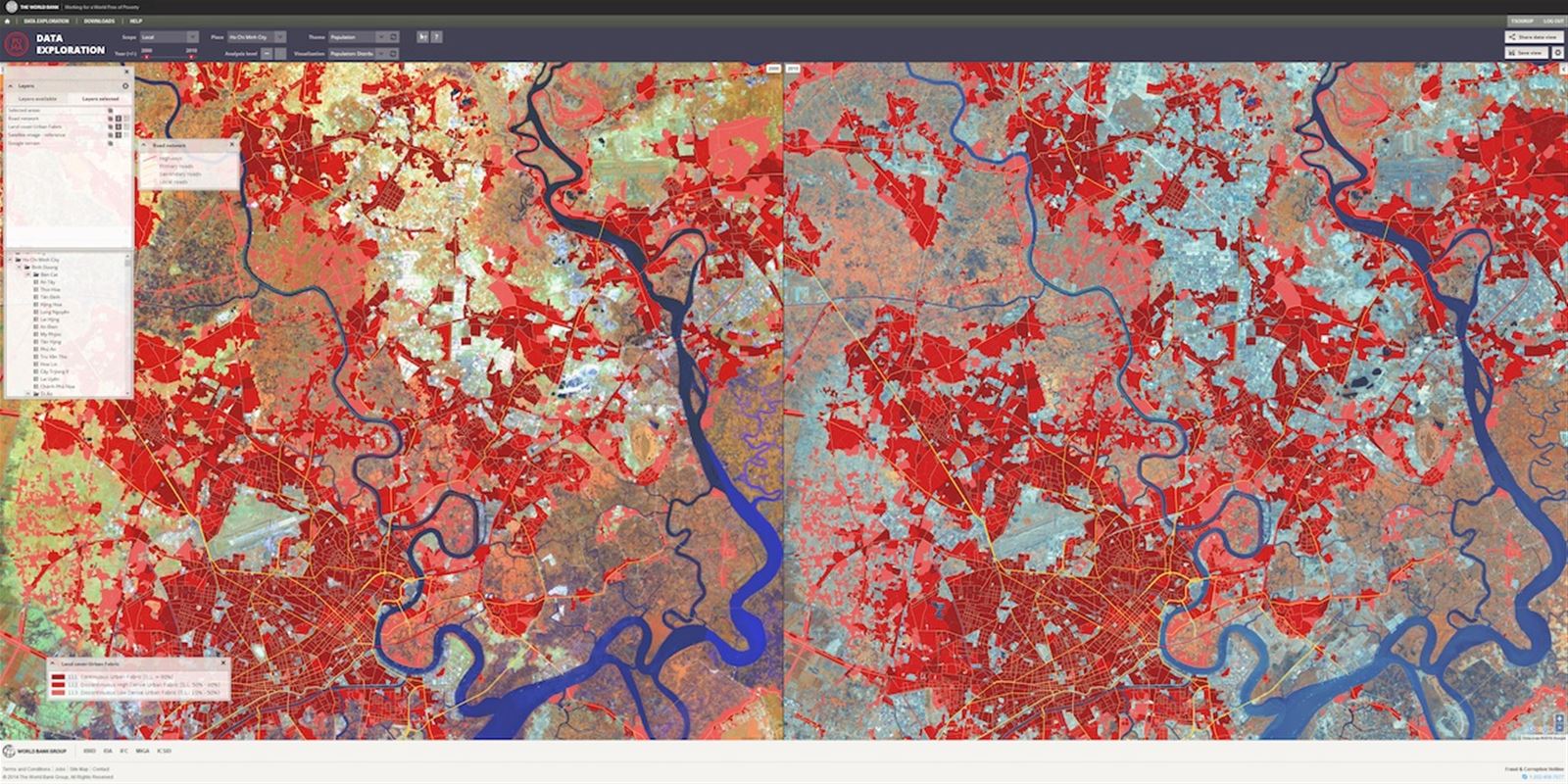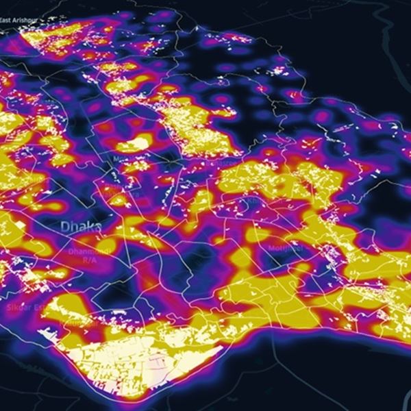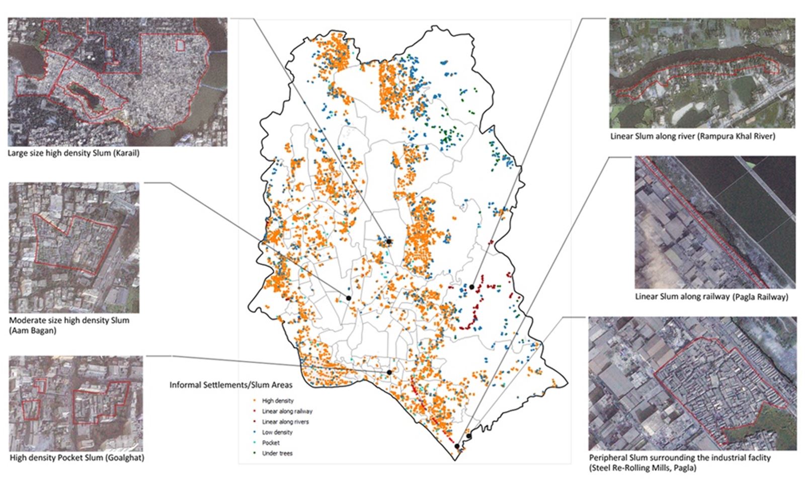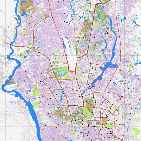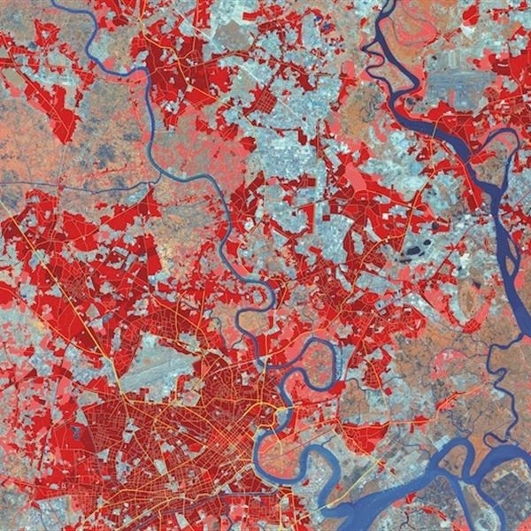

- Map and analyze historical and current urban layouts and identify expansion areas.
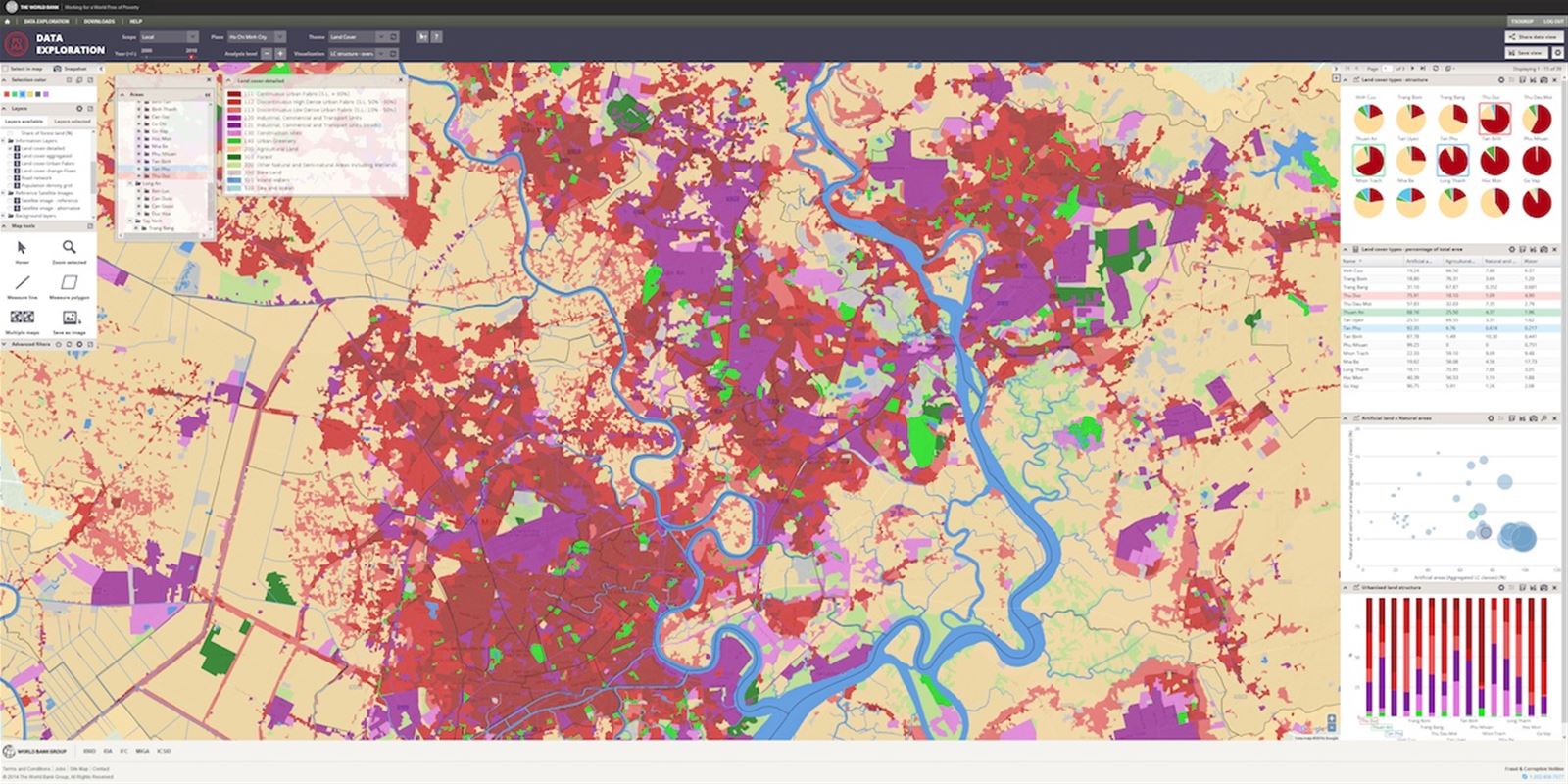
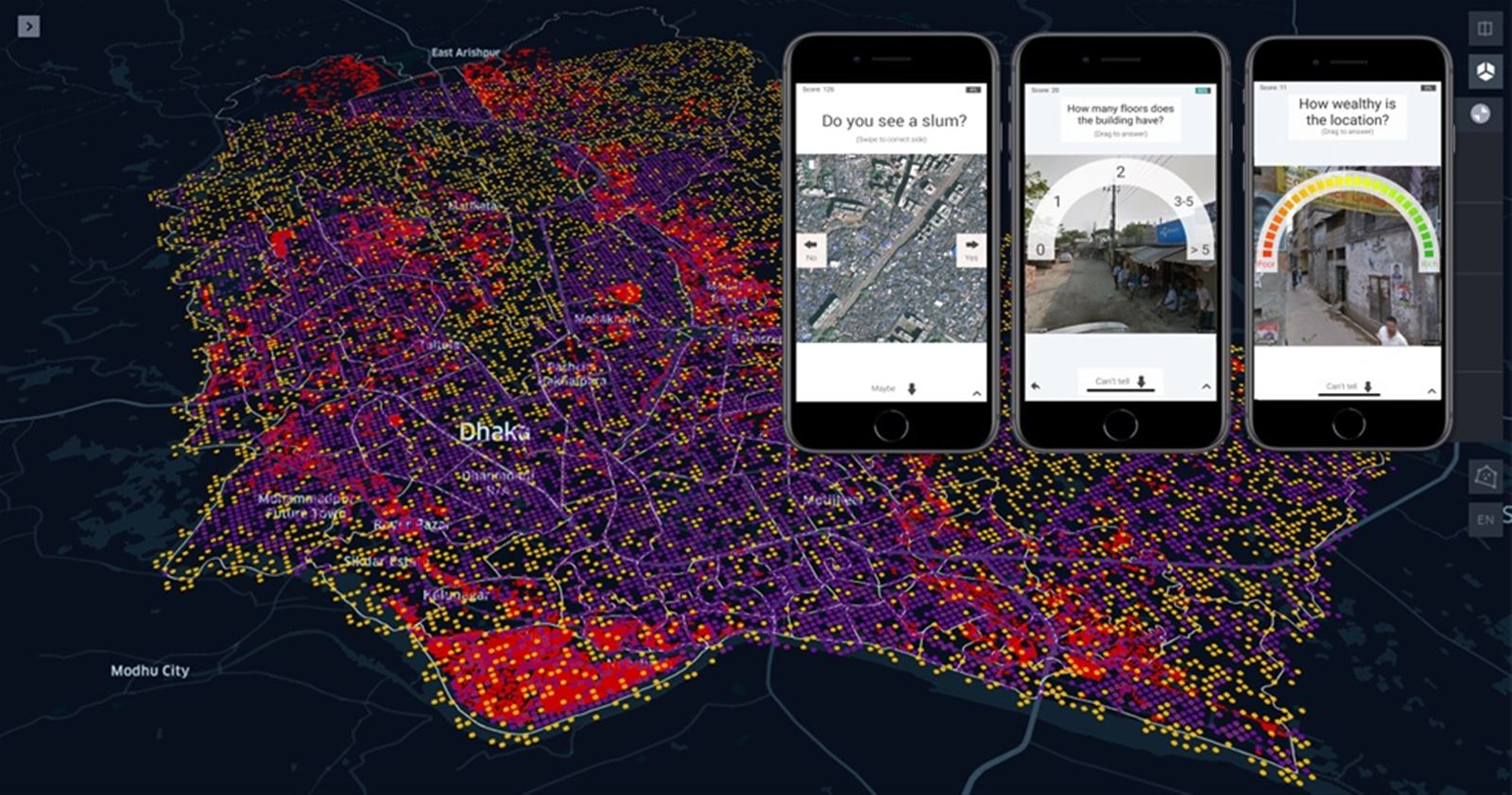
- Evaluate zoning compliance to ensure responsible development.
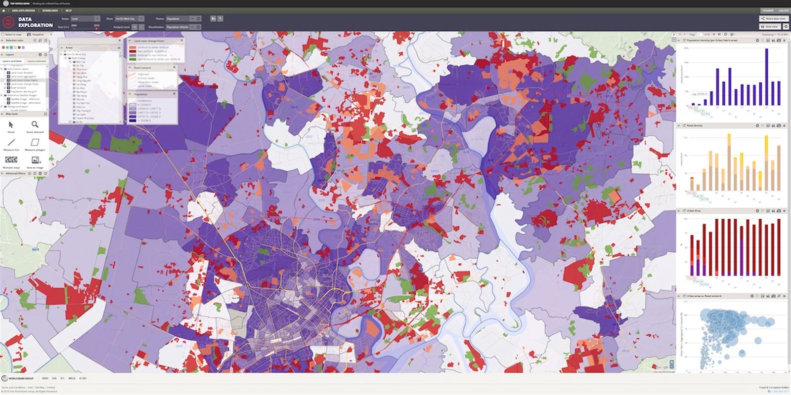
- Analyze the impacts of urban sprawl on infrastructure and services.
- Support adaptive urban governance and strategic urban planning and land-use management.
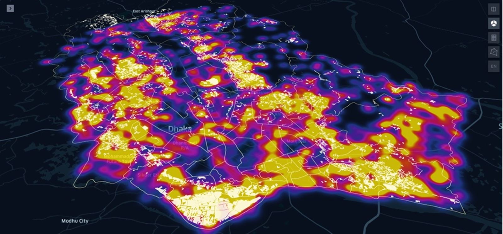
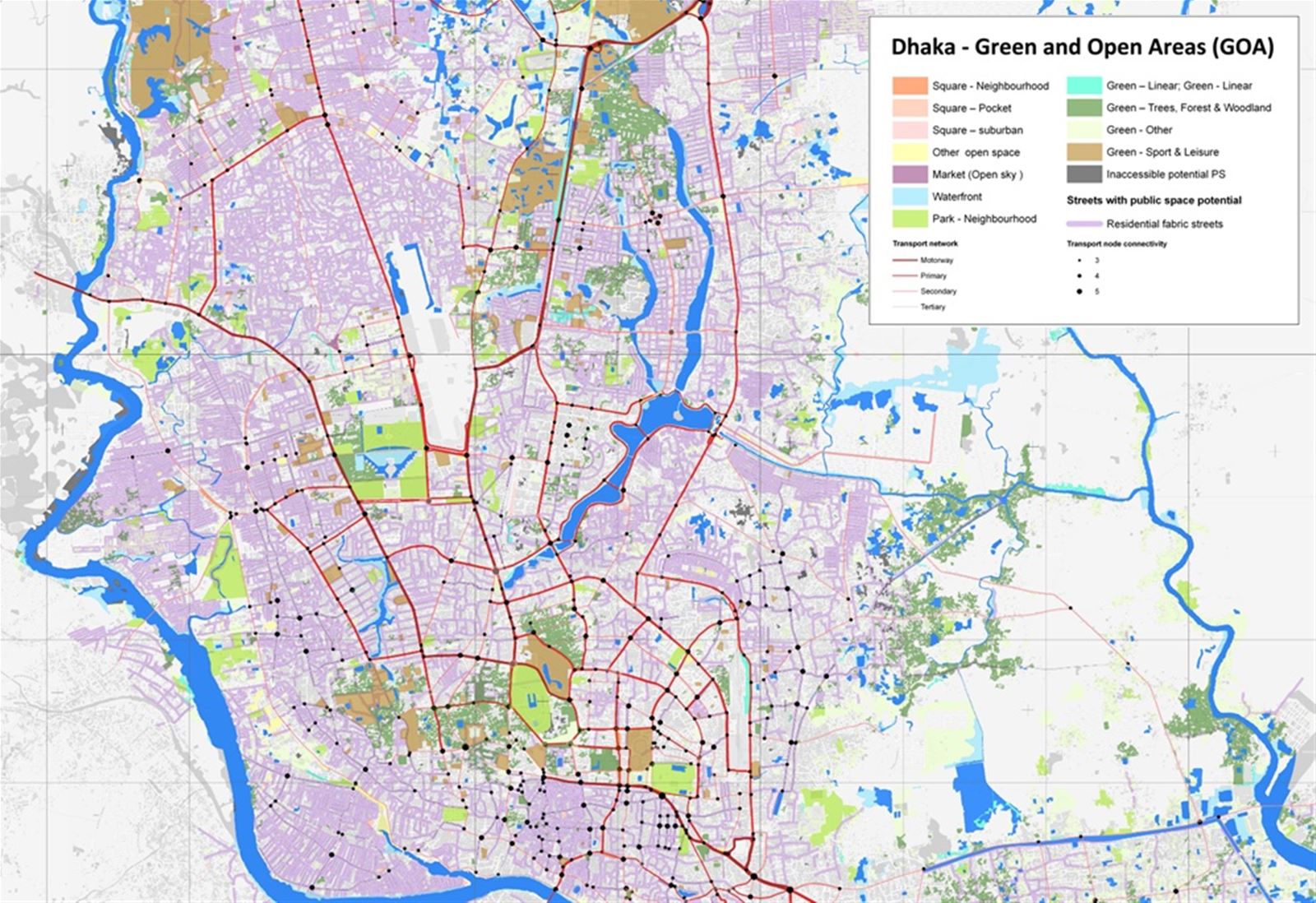
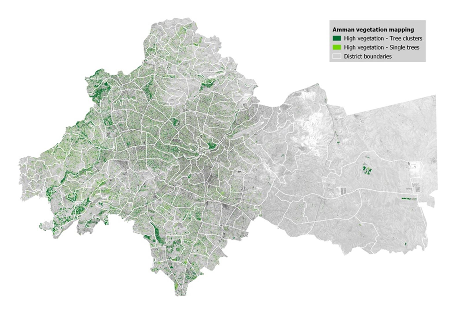
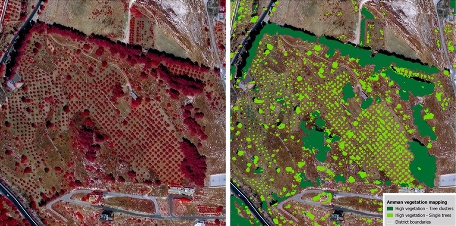
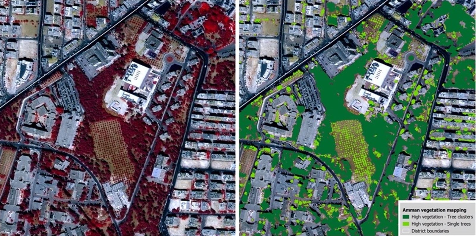
We utilize satellite data and advanced geospatial analytics to monitor urban layouts, evaluate zoning compliance, and support efficient land-use planning, ensuring sustainable and responsible urban growth.