Hazards | Use cases

InSAR for mapping geohazards

Get a detailed overview of terrain instability and landslide risks. Detect subtle deformations with millimeter precision and assess geotechnical risks at every project stage. By combining historical and current data, identify landslide-prone areas, design stabilization measures, and ensure long-term monitoring of impacts.

Ground motions
Gain insights into ground movements and assess geotechnical risks across all project stages
  • Get up-to-date information on ground subsidence or uplift with millimeter accuracy, scalable and tailored to your needs
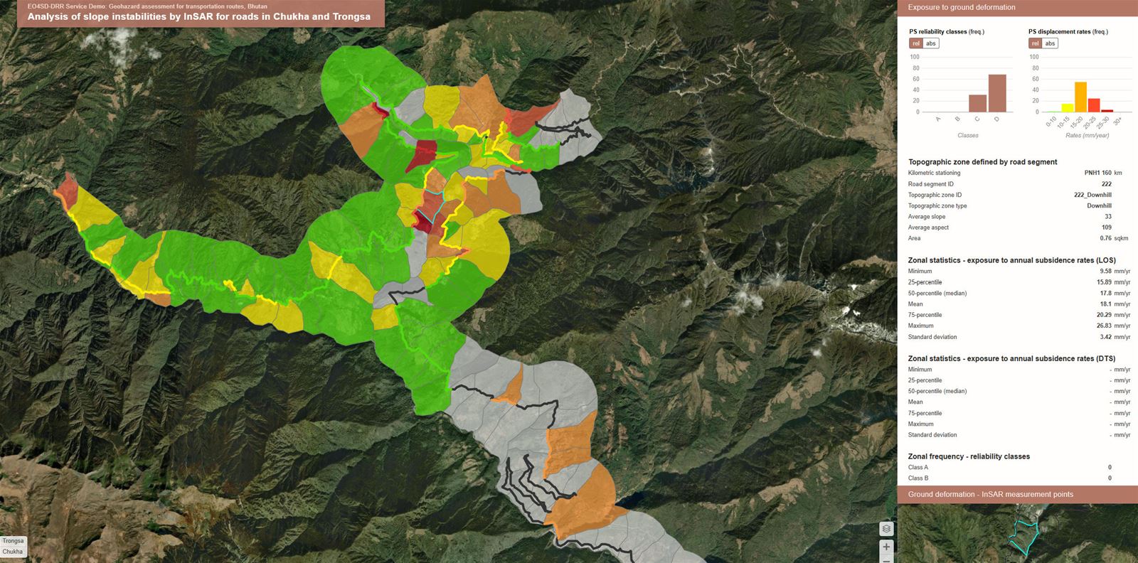
  • Assess geotechnical risks from terrain deformations and their current and potential impacts during the preparation phase of your project
  • Continuously evaluate geotechnical risks and impacts on structural stability during implementation and after project completion
  • Leverage our experience in numerous interferometry application areas

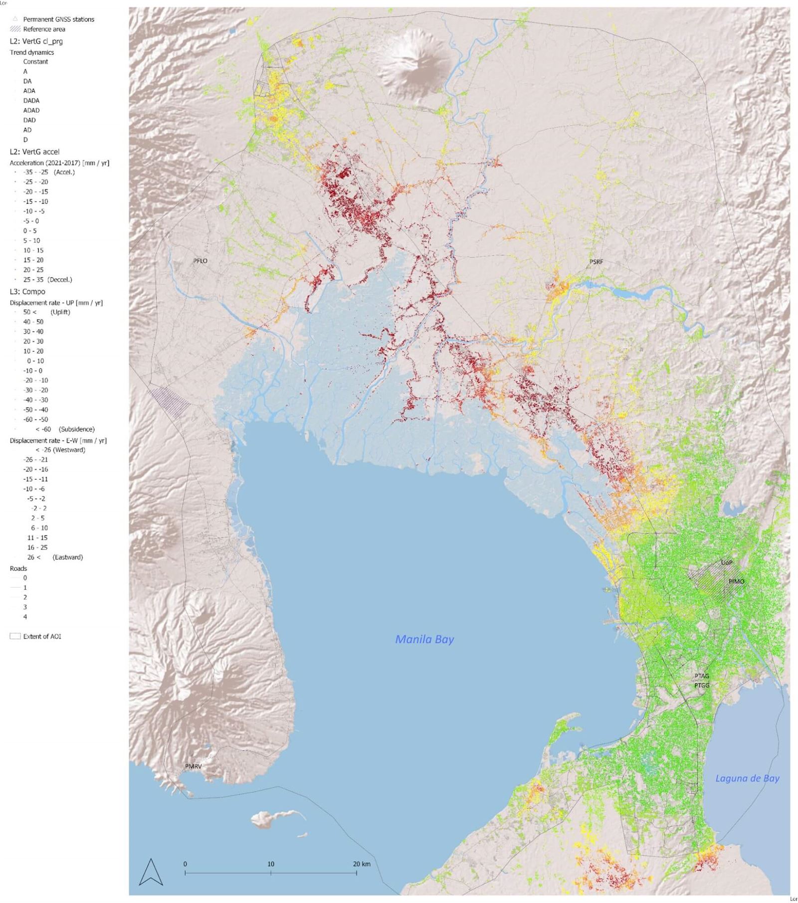
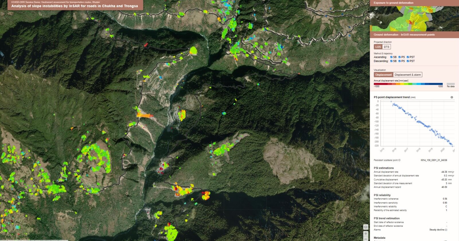
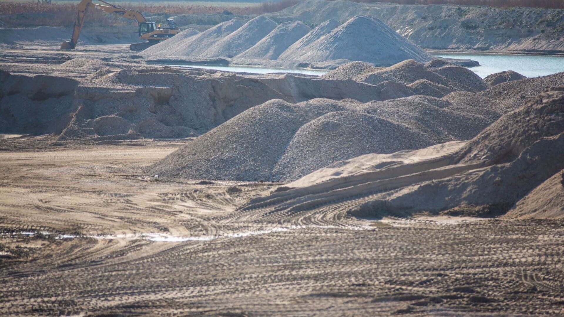
We employ multi-temporal satellite interferometry to detect subtle terrain shifts with millimeter accuracy. This technology allows us to identify changes such as tilts and stresses in the soil that can have serious consequences, including increased risk of flooding, solifluction, and structural damage to buildings, infrastructure, and utilities.

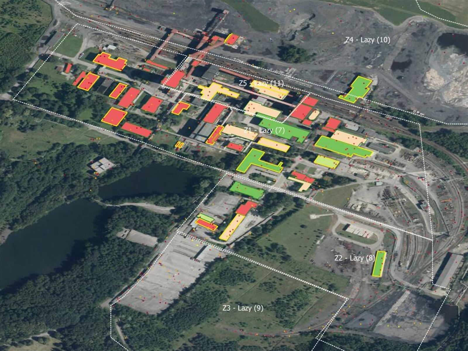
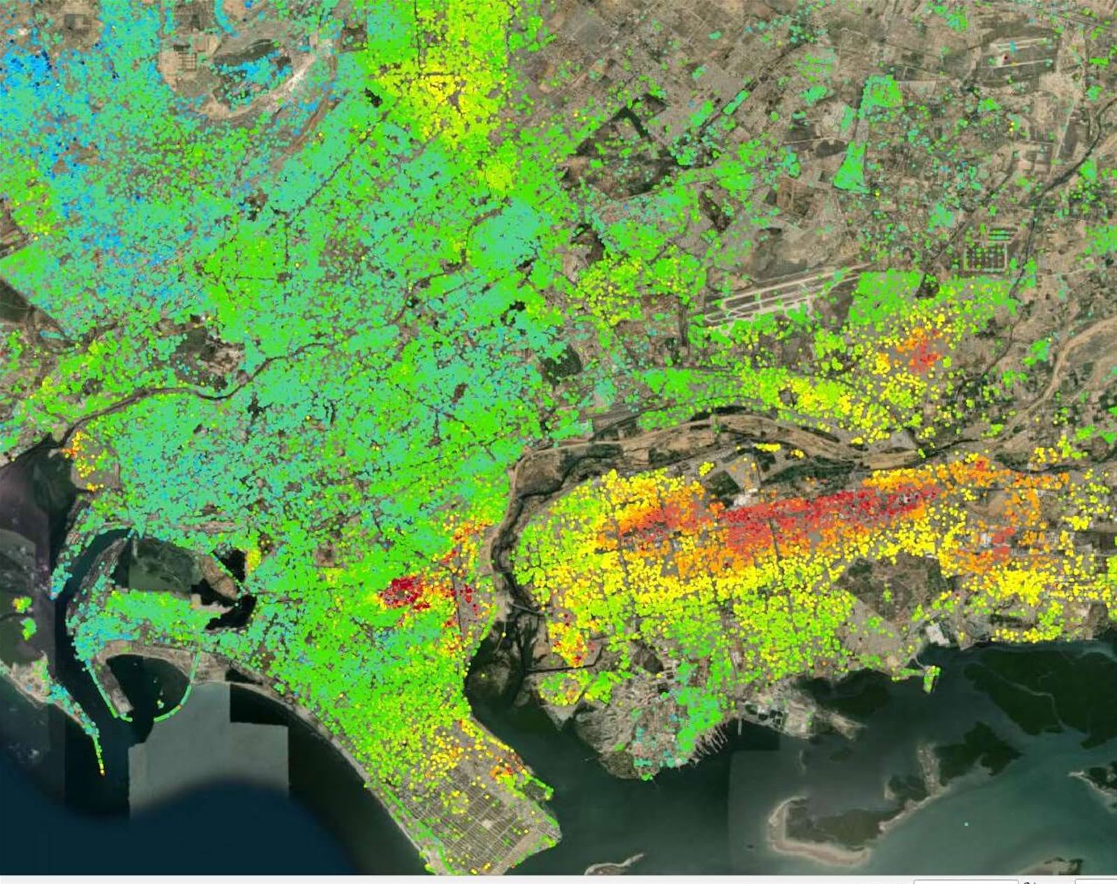
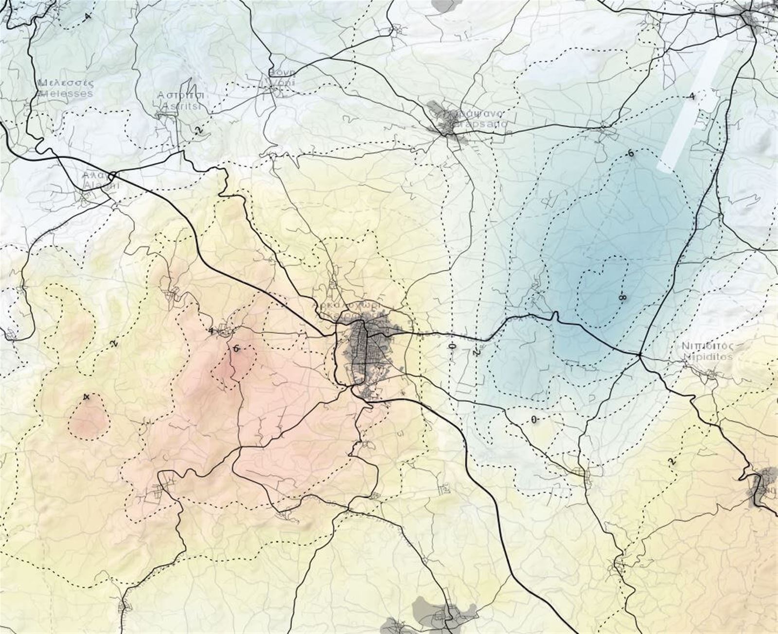
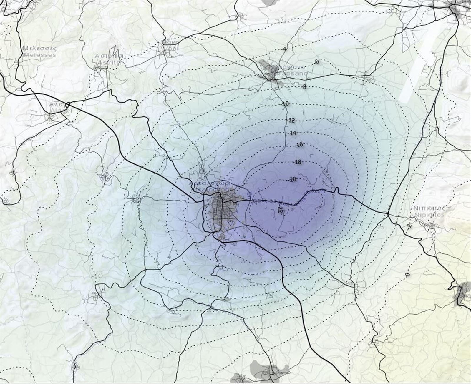
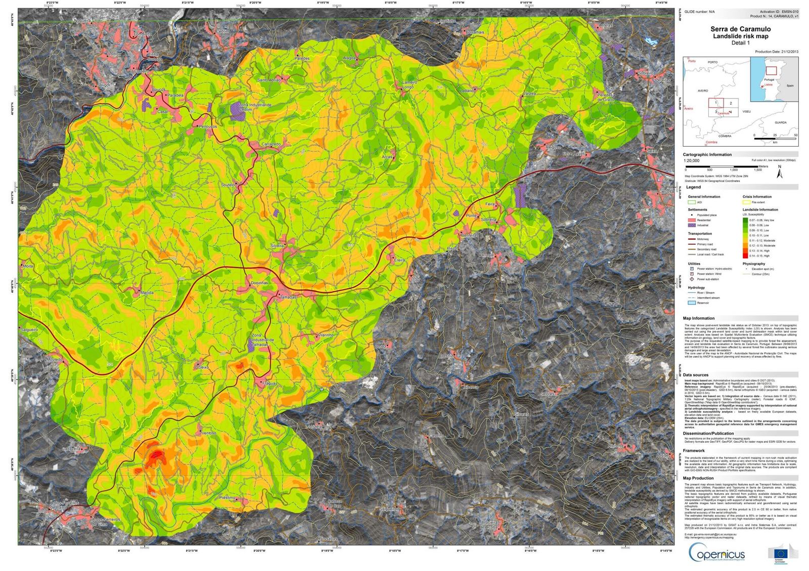
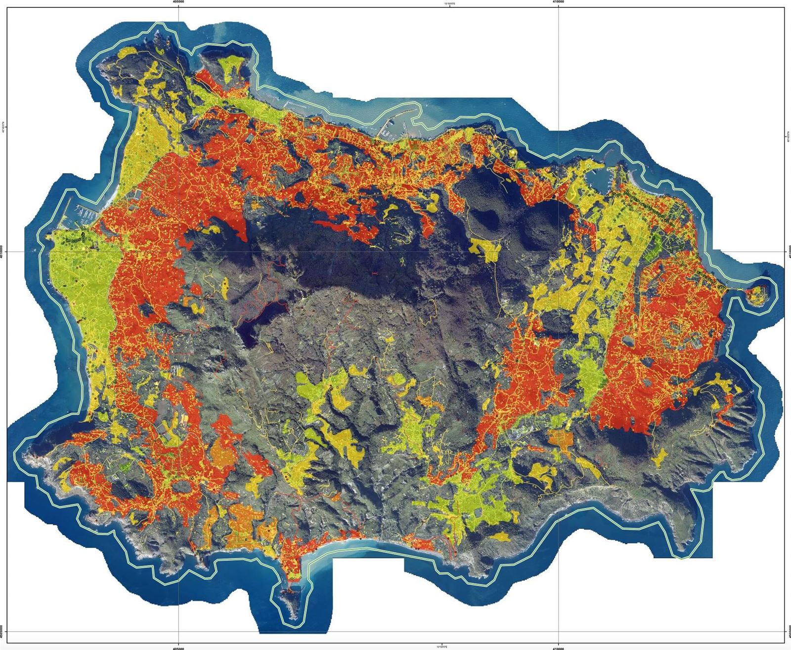
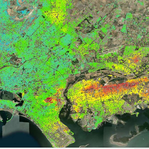
From our mapping and monitoring, we derive key spatial and temporal indicators that provide a deeper understanding of the causes, characteristics, and both ongoing and potential impacts of terrain deformations.

With a sufficient density of detected reflectors, we perform geospatial analysis to define not only the extent of subsidence basins and their rates of subsidence but also other relevant metrics such as differential subsidence, tension, and compression zones.

Landslides
Identify high-risk areas, gather critical information for stabilization decisions, and monitor the effectiveness of your interventions
  • Prevent damage by pinpointing high-risk areas and through timely remediation
  • Decide on the most suitable stabilization solution based on comprehensive analysis of archival and current data
  • Continuously evaluate the stability of slopes or entire areas using our proactive monitoring results

We map landslides and landslide susceptibility holistically, combining satellite data with other Earth observation techniques and machine learning. Using advanced change detection methods, we investigate the areal and temporal extent of landslides. Archival satellite images allow us to analyze the occurrence and impact of landslides from previous years. InSAR techniques then help us examine the rate and stages of deformation.

We deliver mapping results as a product or use them to model land susceptibility to landslides. Stability analyses based on more complex constitutional models are carried out in cooperation with external experts. The results from these models are then used for multi-factor risk assessments, which include vulnerability factors and exposure of populations or infrastructure to landslides.

Retrospective inventorization

We use advanced methods like change detection, machine learning, and InSAR to assess the extent, intensity, and progression of disasters or potential hazards. Archival satellite imagery allows for retrospective analysis of past occurrences and their impacts. Our findings are delivered as a product or used to model territorial susceptibility and contribute to multi-factor risk assessments, accounting for vulnerability and exposure to natural hazards.

Proactive monitoring

We monitor optical and radar satellite images to detect precursors to catastrophic events. These detections dynamically recalibrate susceptibility models and parameterize disaster probability scenarios. Monitoring proceeds in phases, with evaluation frequency tailored to client needs.

Choose how to get results

We deliver mapping and measurement results in formats and protocols customized to customer requirements: as spatial data with a time component, through the InSARviz online platform (interactive visualization tool for satellite SAR interferometry), through your API, or as a technical report with maps.

Artificial corner reflectors

We allow you to take or refine InSAR measurements in locations where surface characteristics, vegetation, and other influences would normally hinder standard InSAR deformation mapping.

Contact our expert

Jan Kolomazník

Product Owner

Case studies and references

Support to resilient road investments in South-East Asia

Customer: World Bank, GoM: FLERP-DOH
Country: Myanmar, Bhutan

InSAR monitoring system for landslide-prone segment of D8 highway

Customer: Czech Road and Highway Directorate
Country: Czechia

Geotechnical prognosis of long-term dump consolidation

Customer: Undisclosed mine operators
Country: Czechia

Your customer journey

Defining Your Vision

We'll start by understanding your challenges and objectives. This involves pinpointing geographic areas, desired timeframes, and crucial insights. We'll then recommend optimal data, processing, and output formats to achieve your vision.

Expert Data Acquisition

Once your needs are clear, we'll select and acquire the most suitable Earth Observation (EO) data. We'll apply advanced processing techniques like MT InSAR, NDVI, or spectral analysis, to address specific requirements like change detection or ground deformation monitoring.

Transforming Data into Intelligence

Our team will analyze data to create impactful outputs tailored to you, like maps, reports, or graphs. Every deliverable undergoes rigorous quality checks to ensure technical accuracy and meet your expectations.

Seamless Delivery & Support

We'll provide results in your preferred format – via our online portal, printed outputs, or electronic delivery. We can also include a technical report to explain analysis details and key conclusions, empowering you with deeper understanding.

Empowering Your Team

If needed, we'll provide bespoke training to equip your personnel with the skills to effectively work with data and interpret results. Our aim is to build your in-house capacity and maximize the value of our solutions.