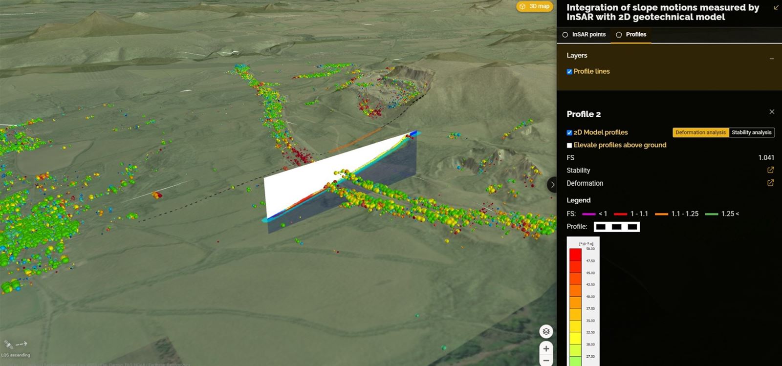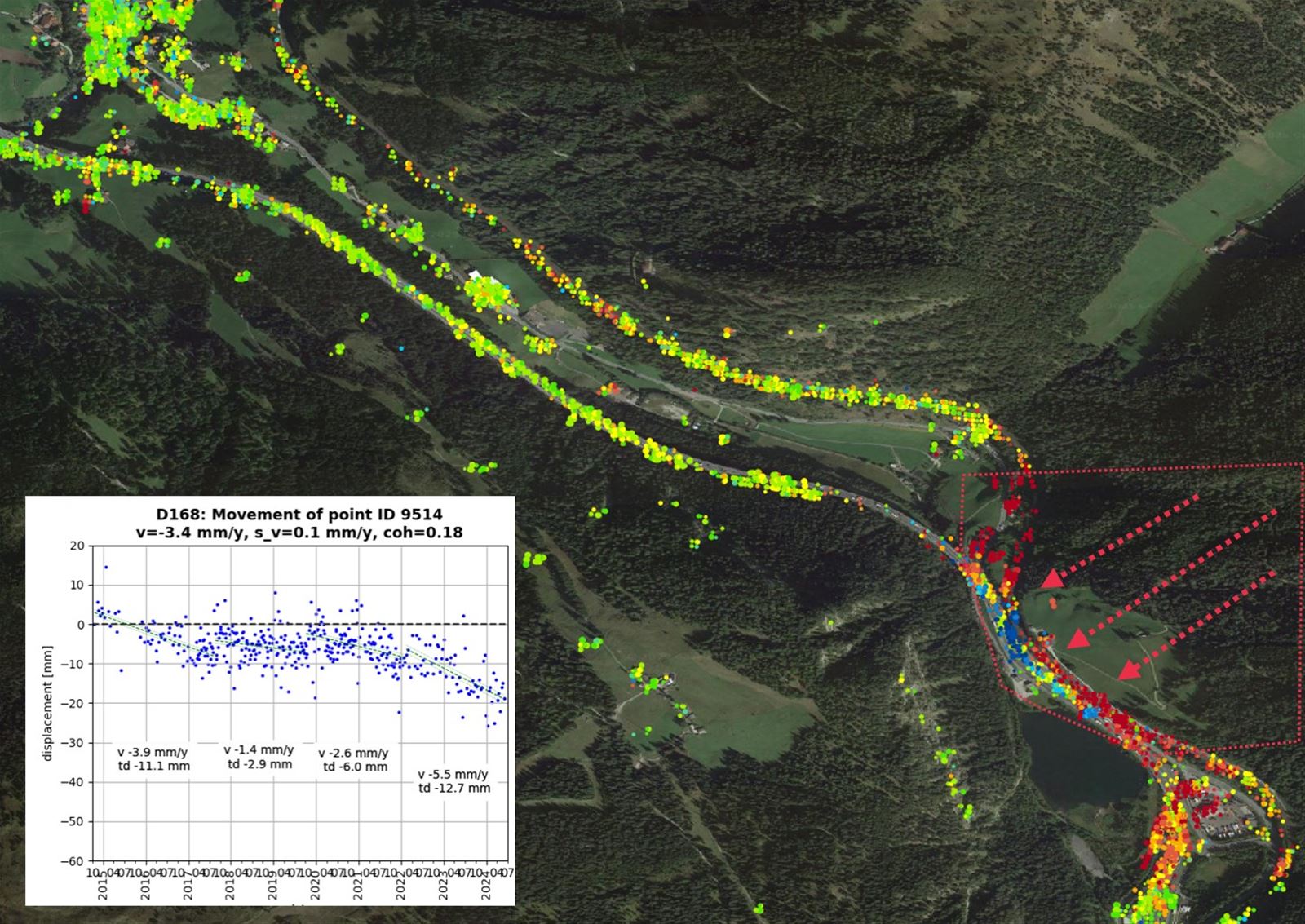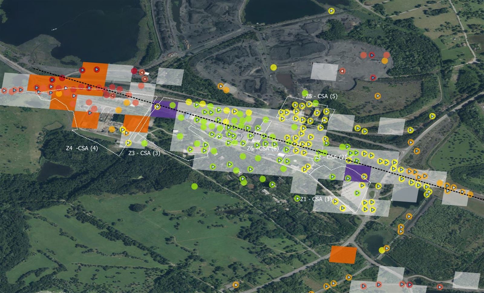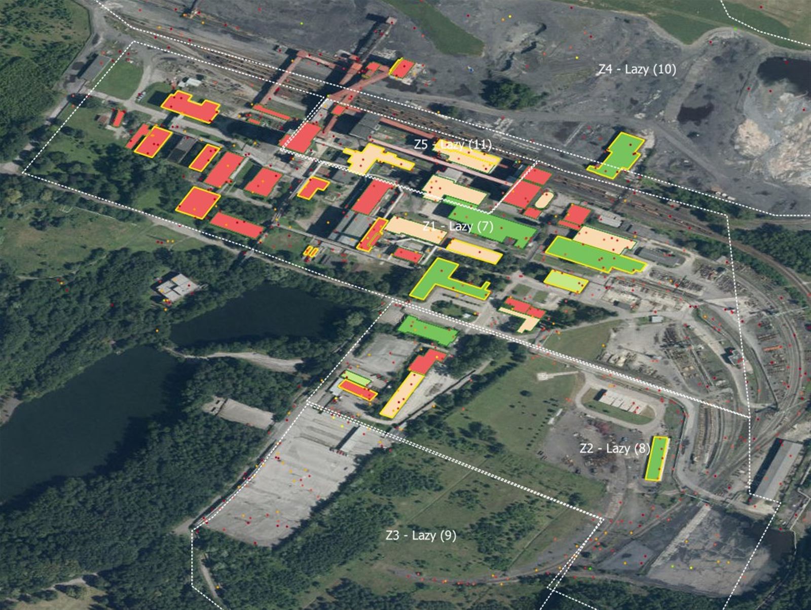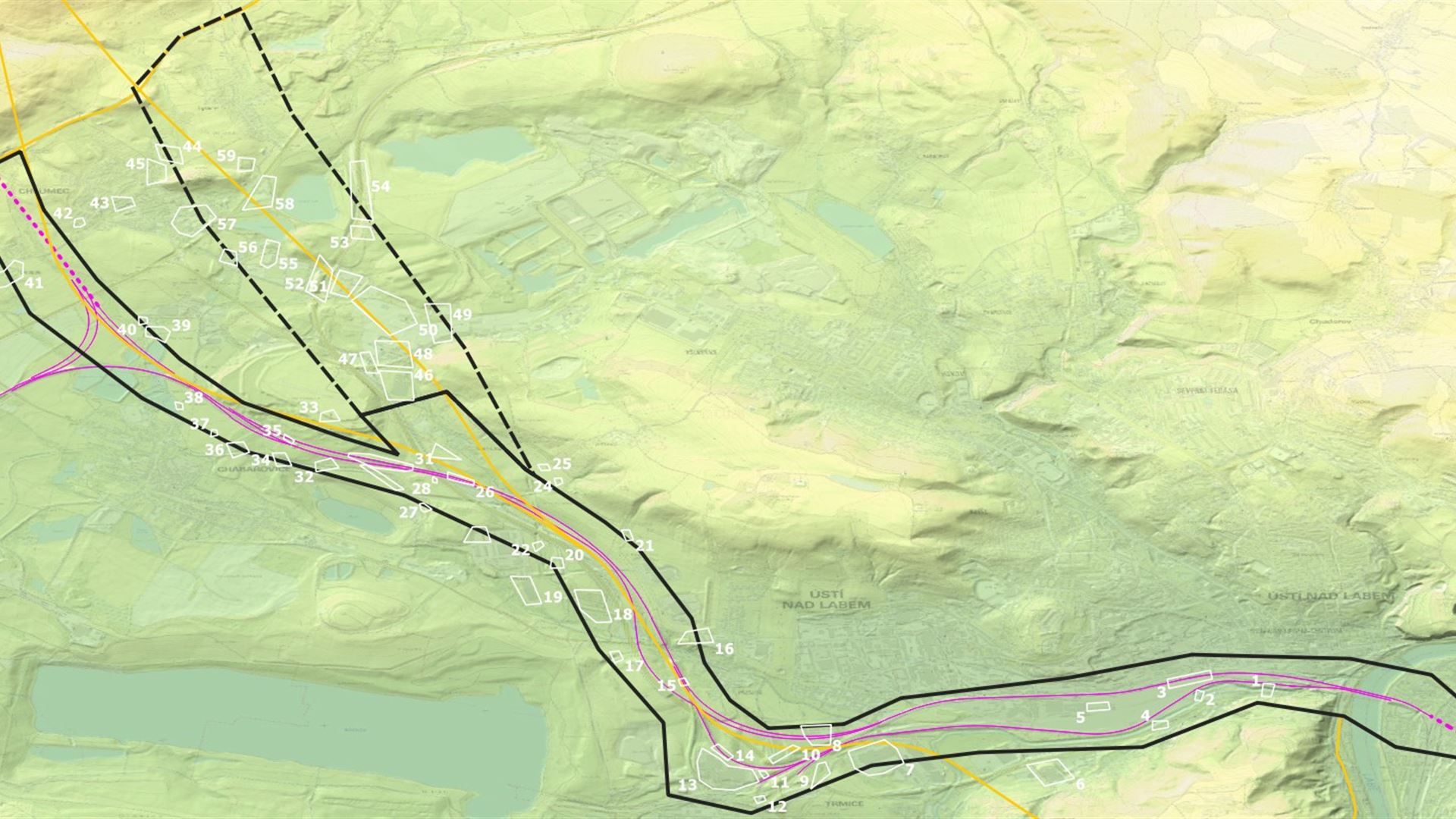

- Map terrain deformations and slope instabilities on sites in early phases of construction – indicative and preliminary geotechnical survey.
- Increase the effectiveness of engineering and geological assessments
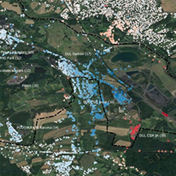
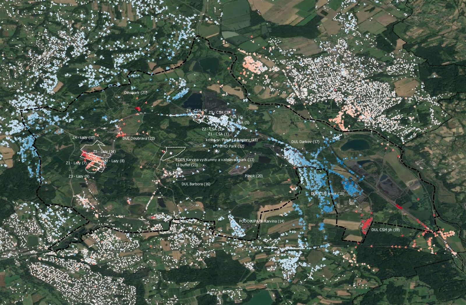
- Optimize the placement of probes, geophysical profiles and other geotechnical measuring elements in follow-up survey phases
- Compare risks across variants with respect to existing instabilities
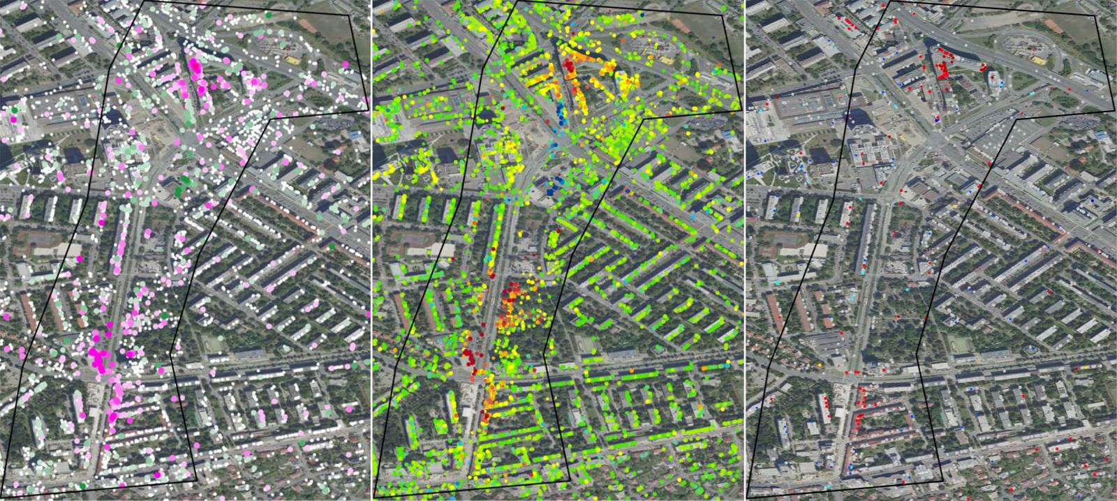
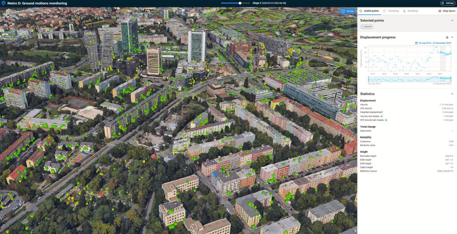
- Add temporal context to your existing monitoring network with InSAR measurements.
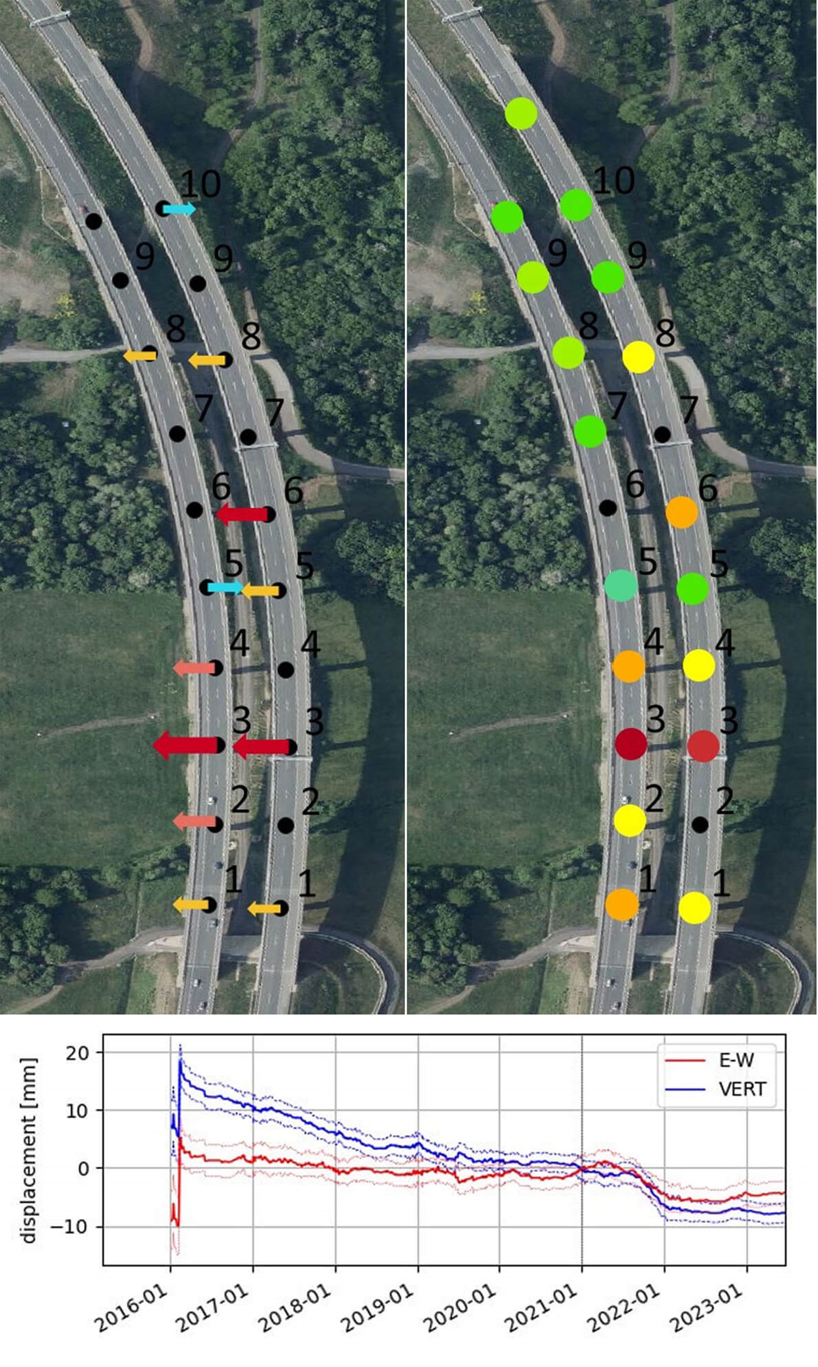
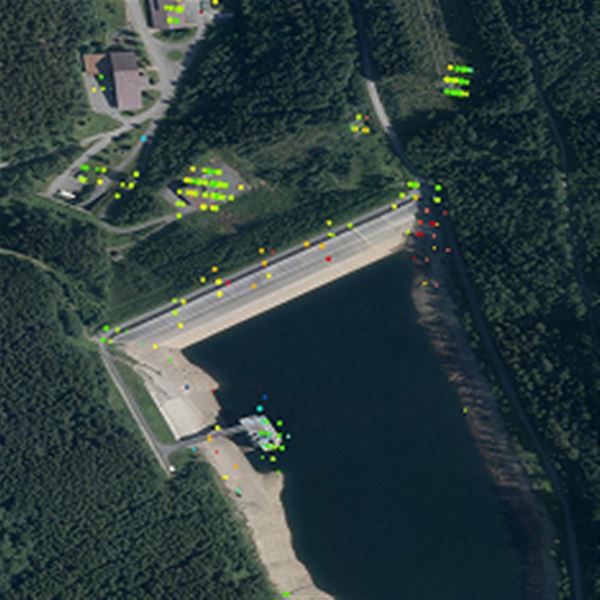
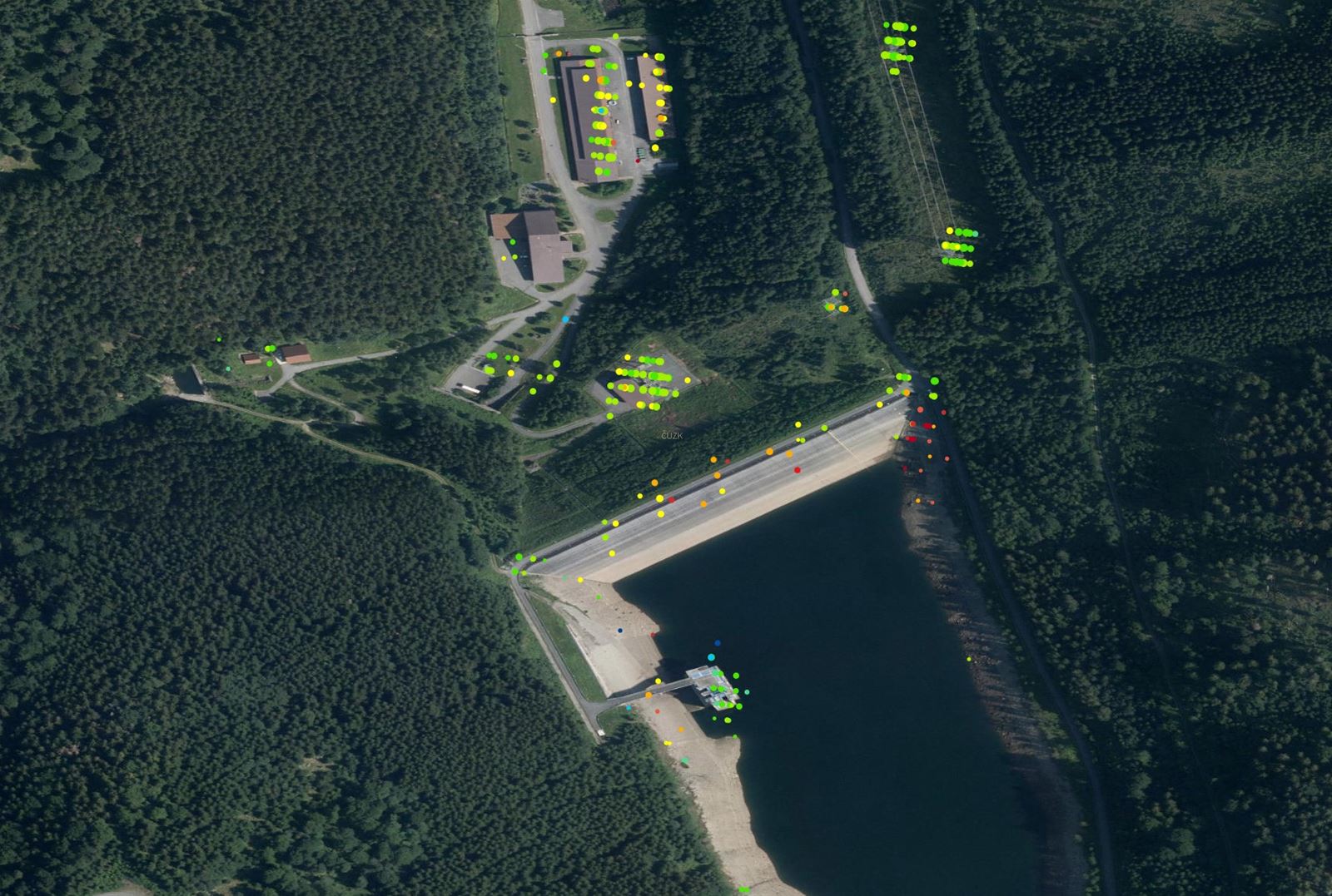
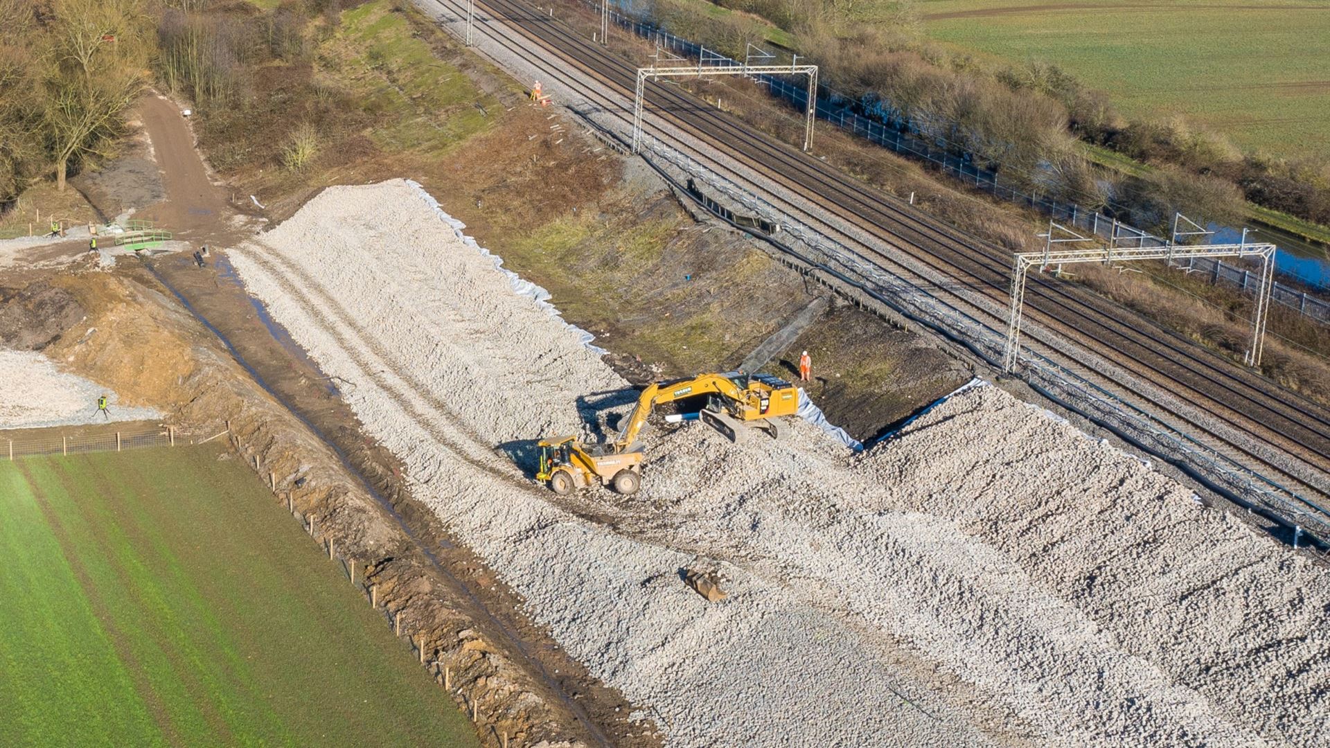
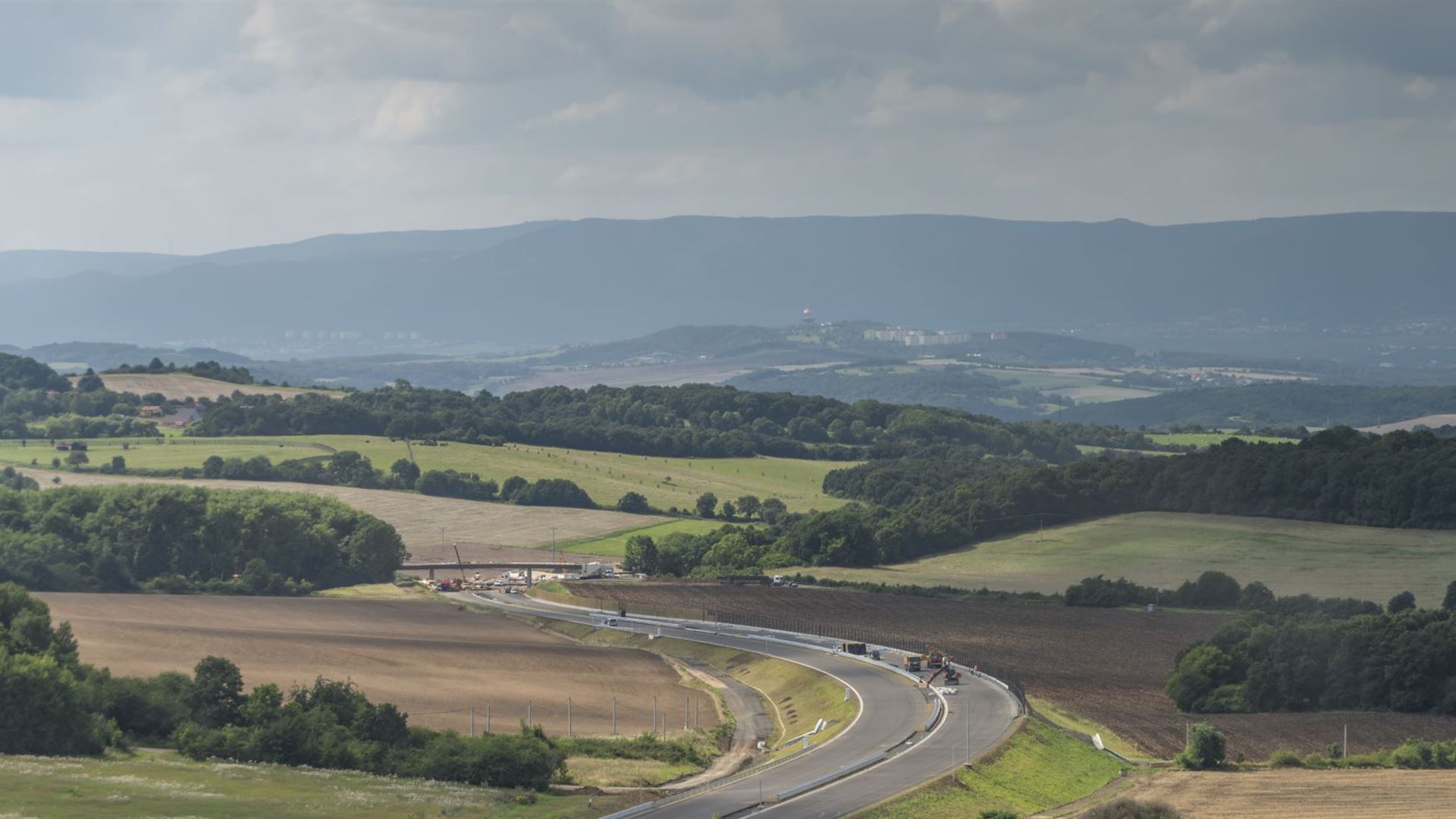
- Observe the stability of surrounding slopes, substrates and objects during construction and under operation
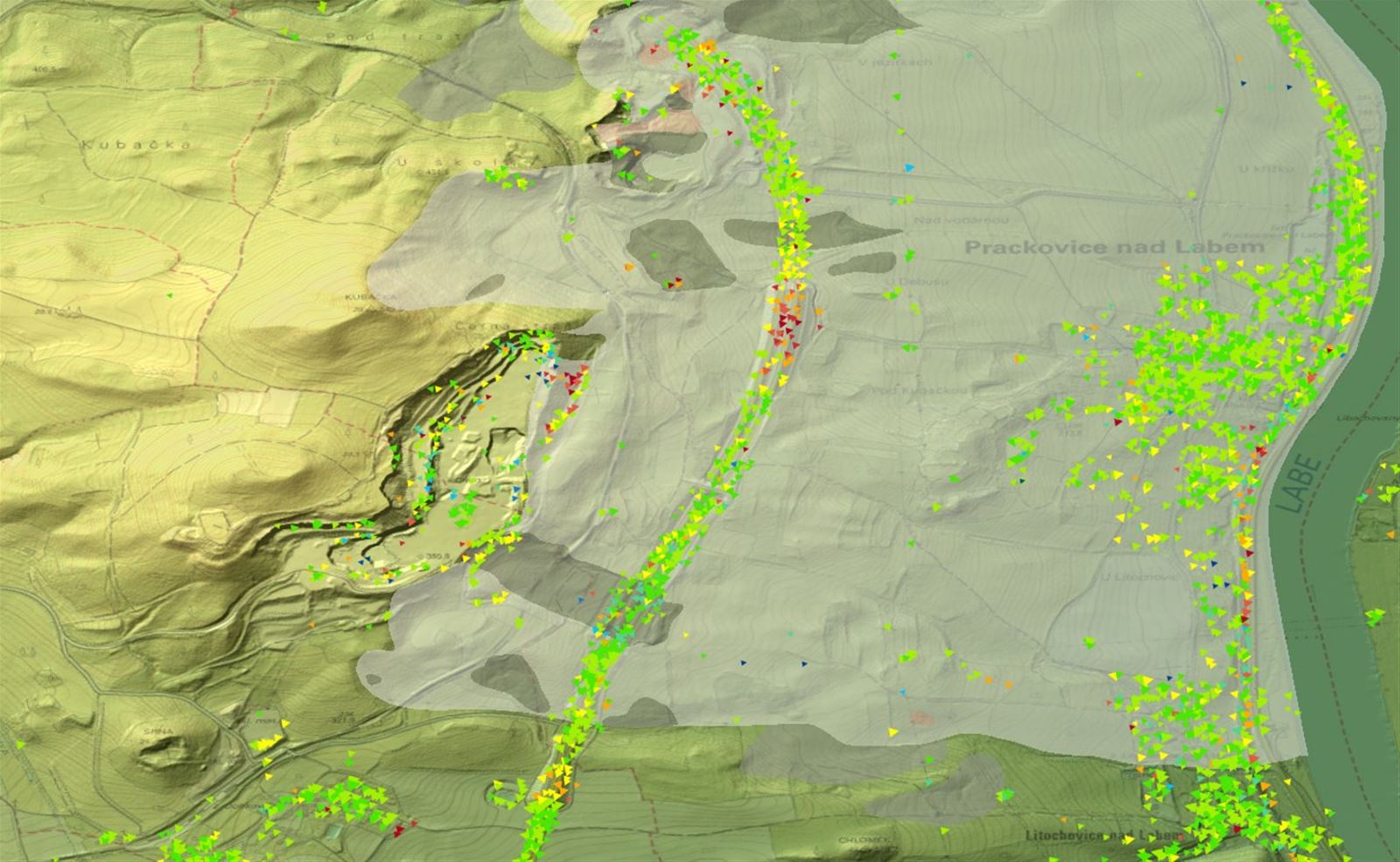
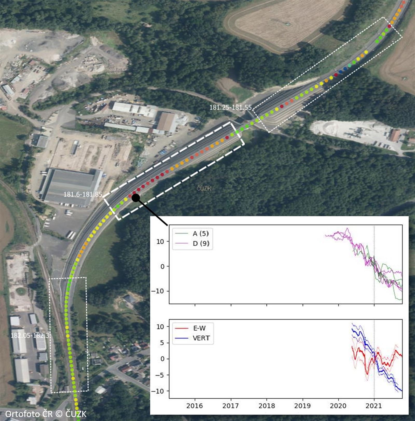
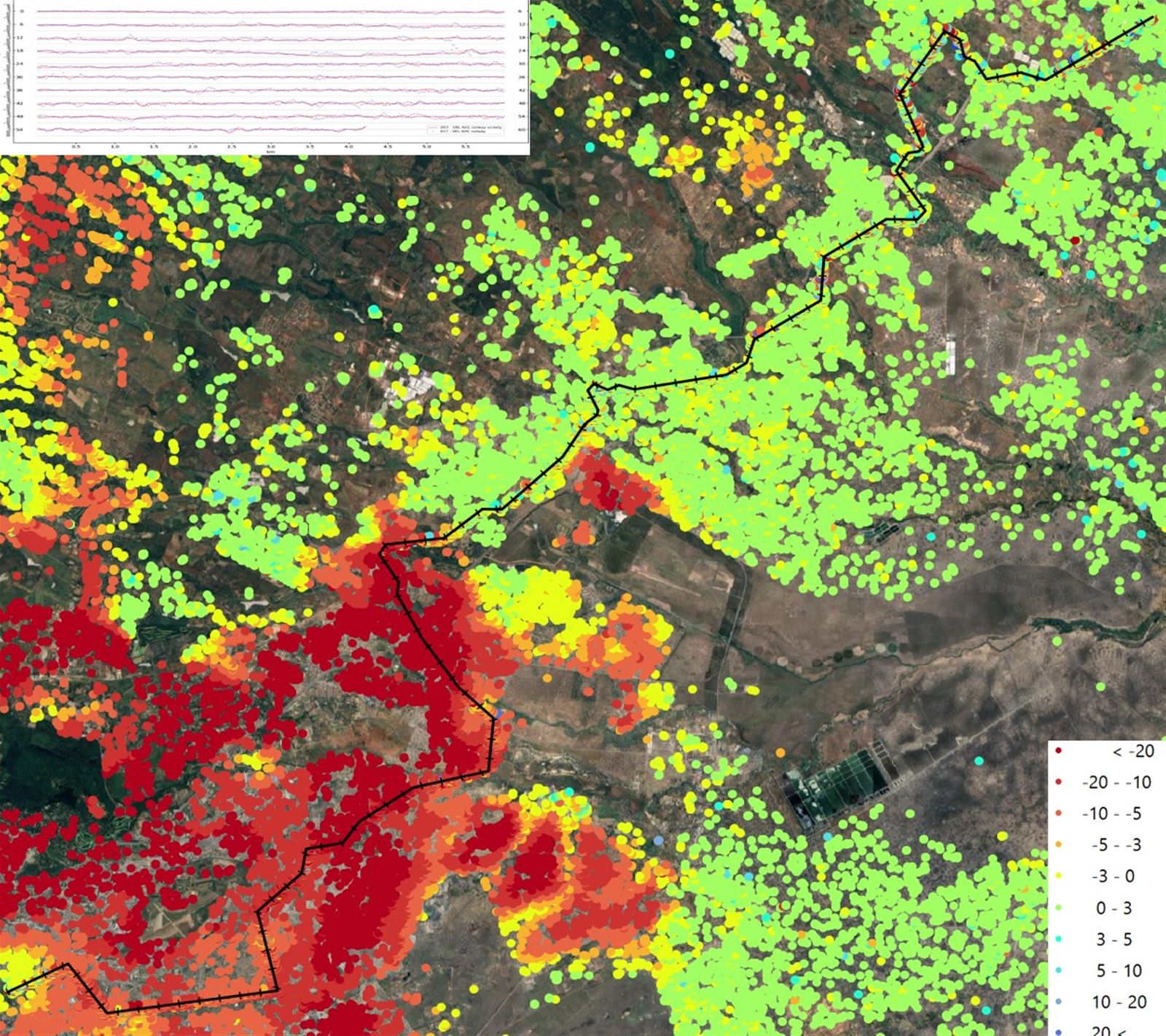
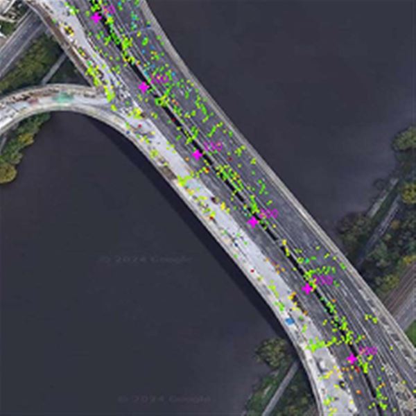
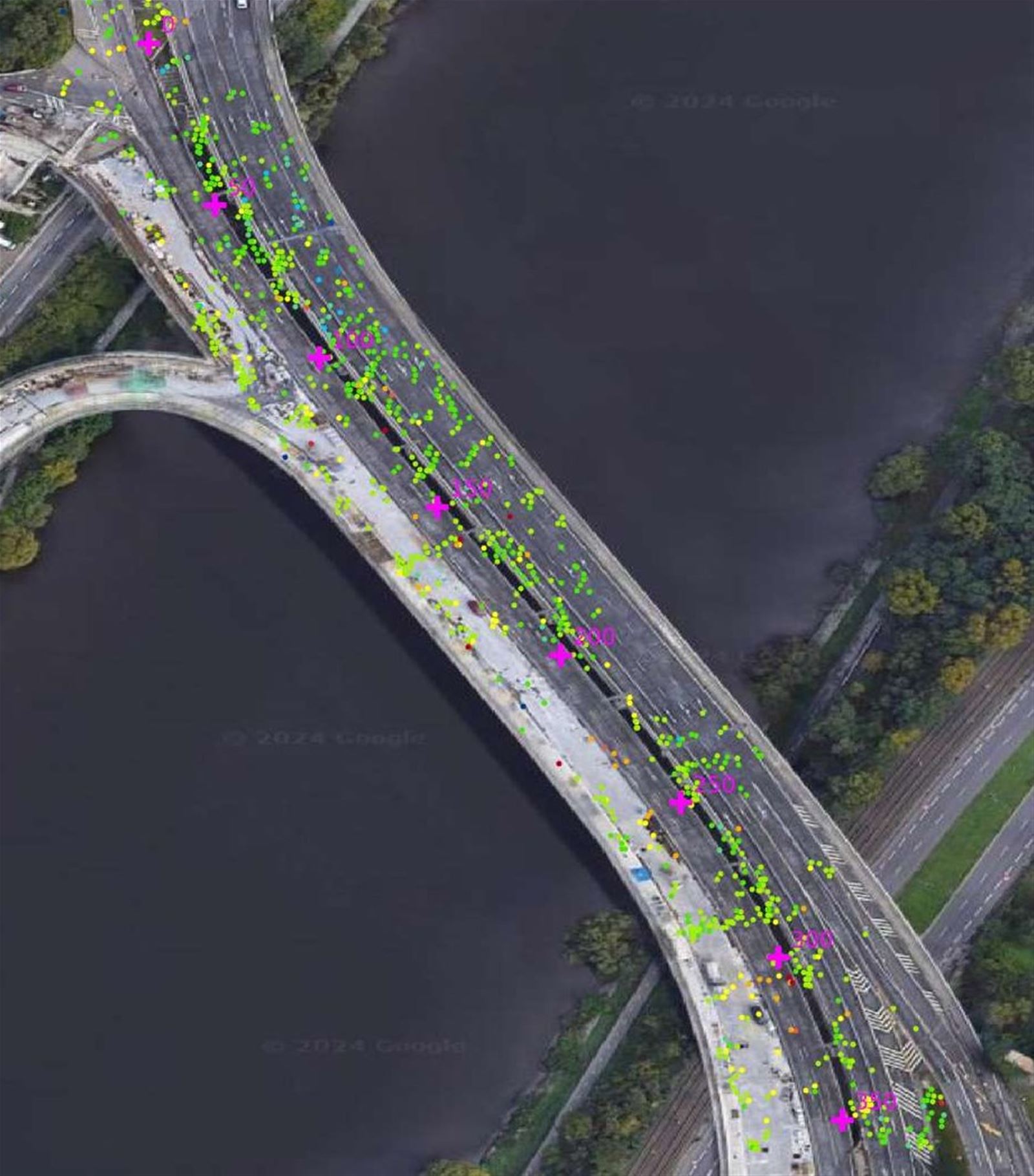
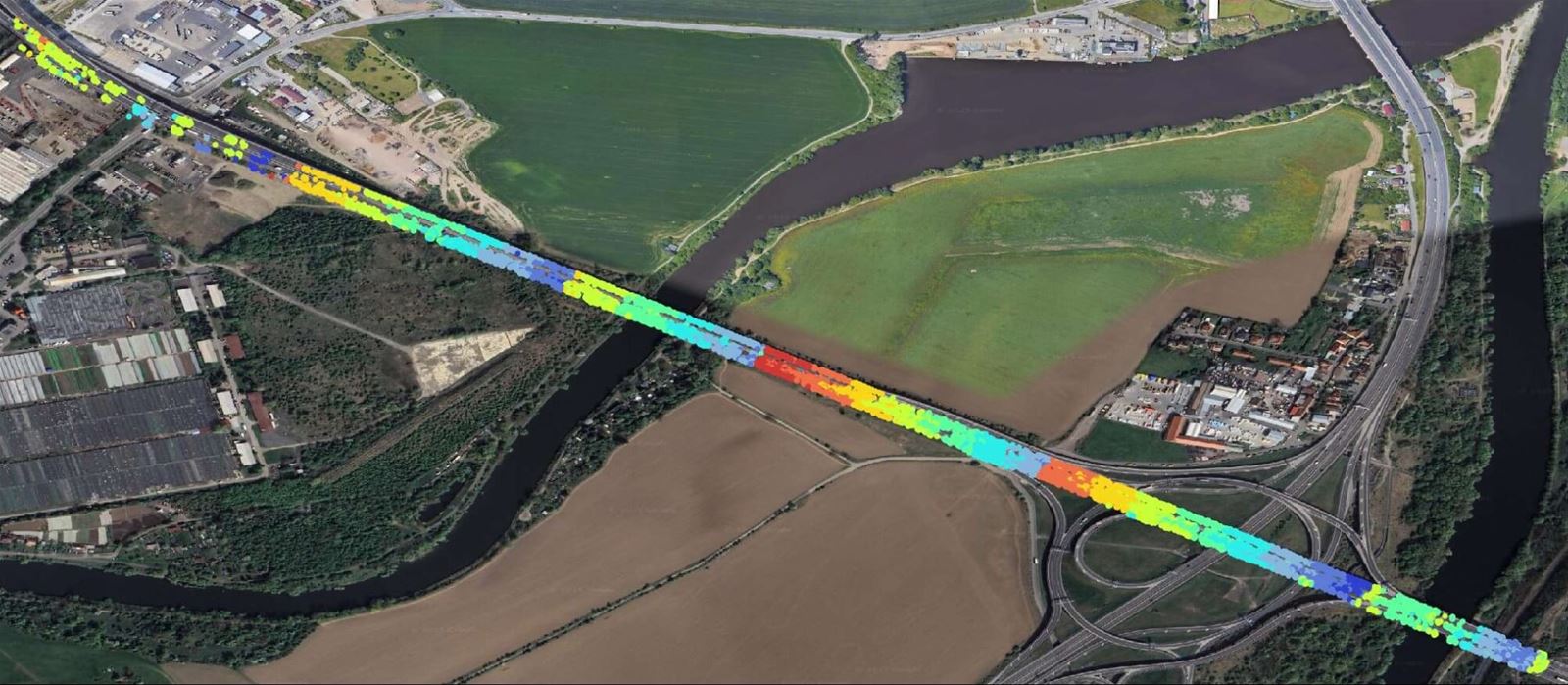
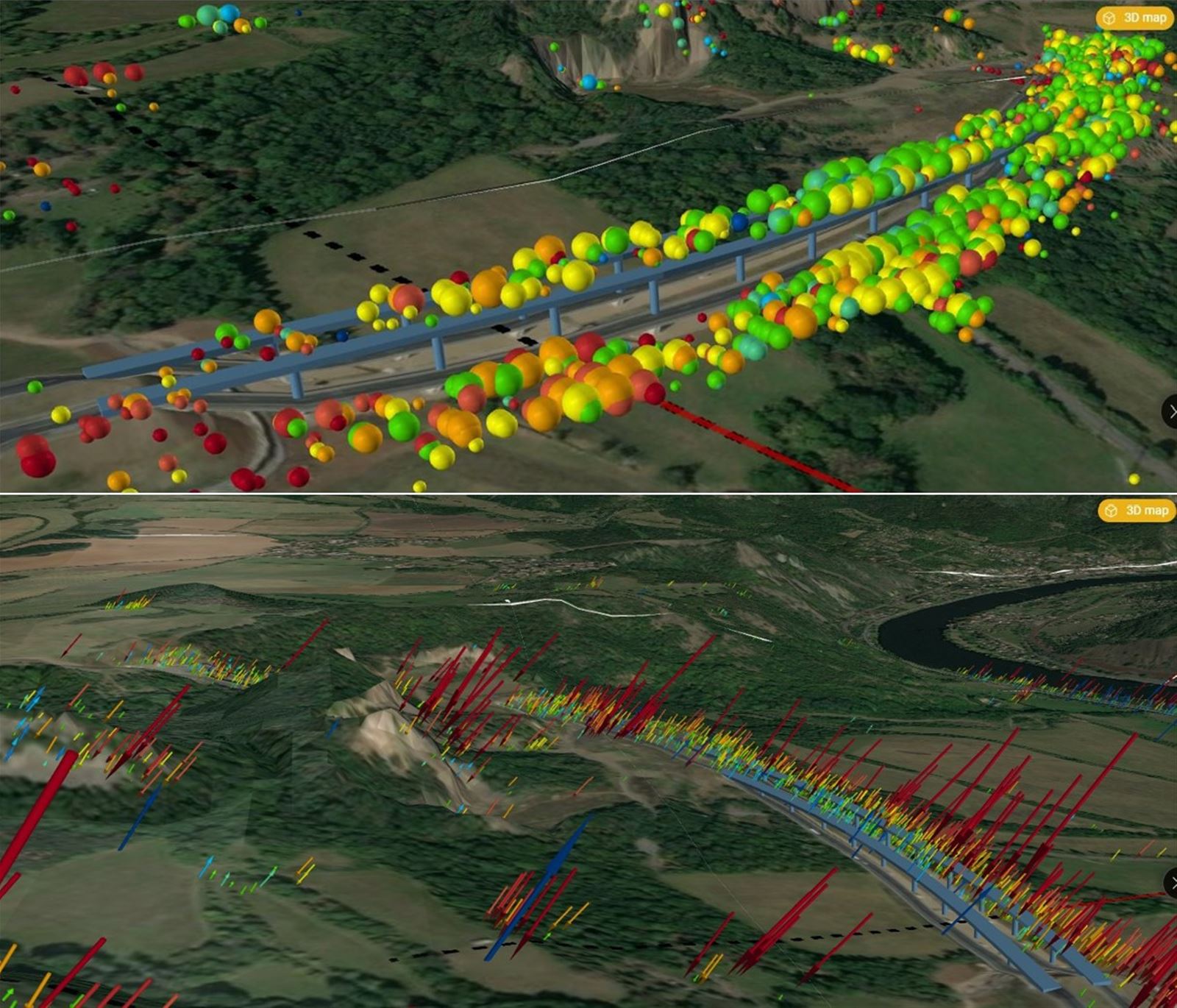
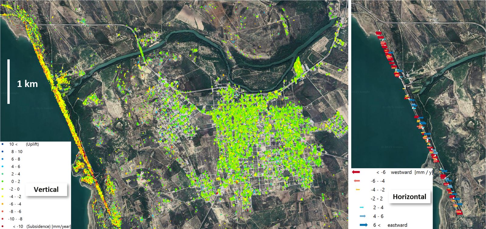
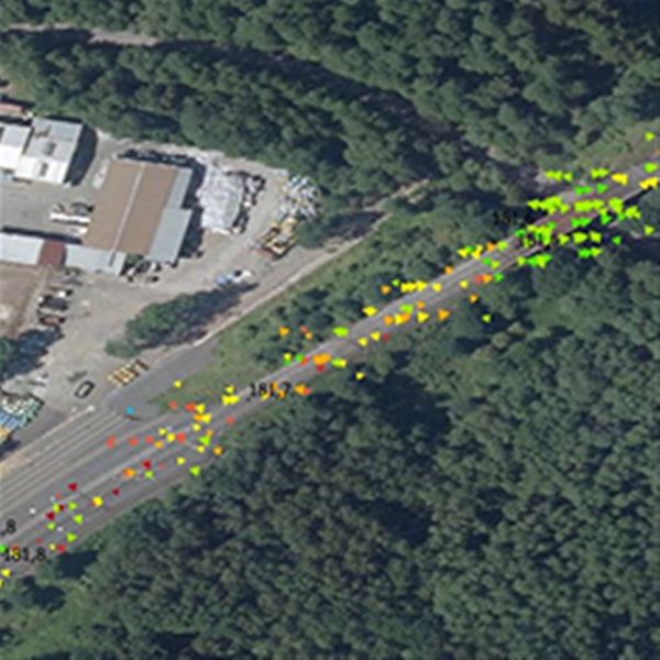
- Identify hotspots for road and rail embankment deformations using blanket observations of long stretches, or targeted monitoring of hard-to-reach points.
- Factor in existing deformations when setting maintenance and reconstruction priorities
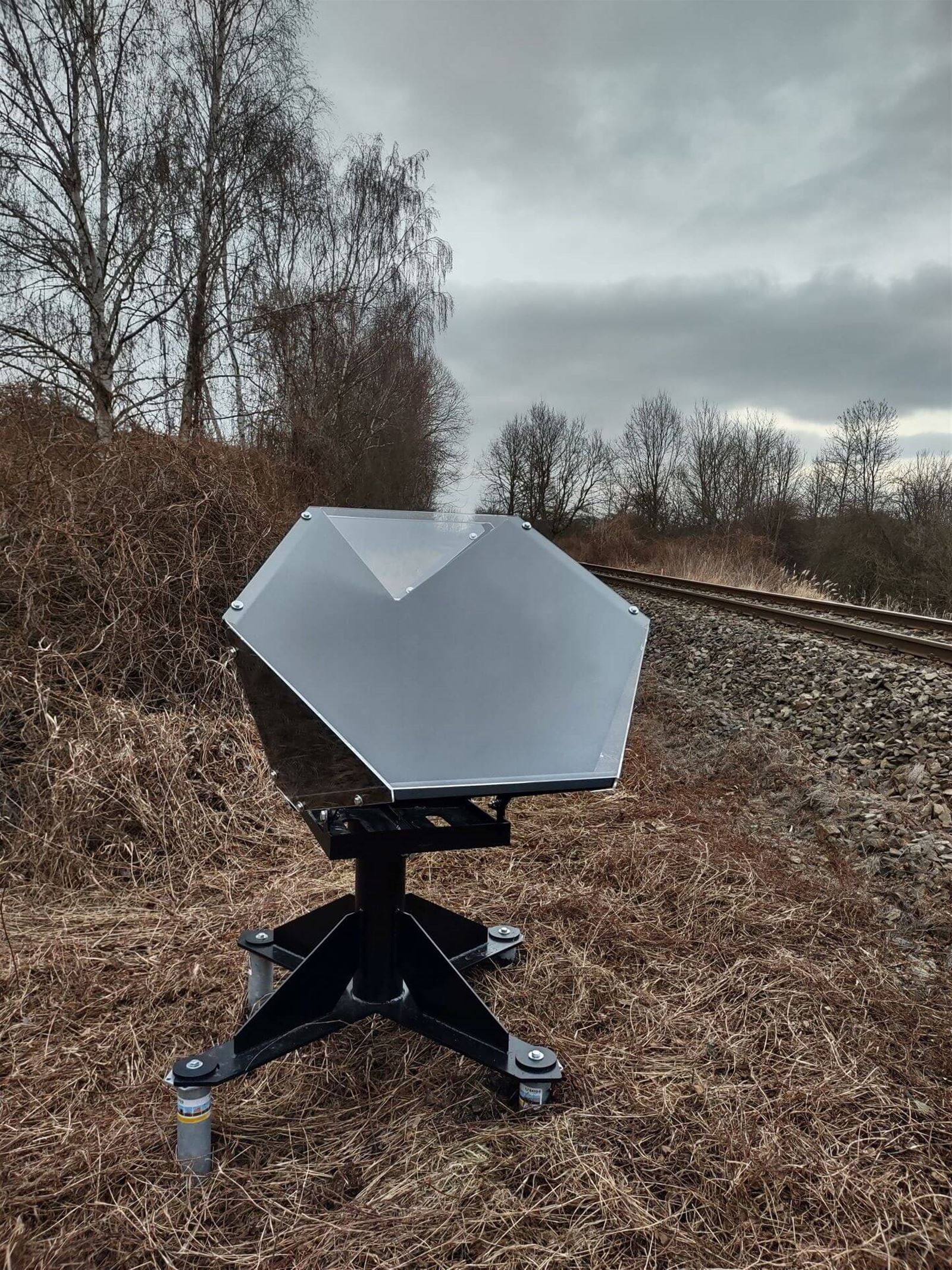
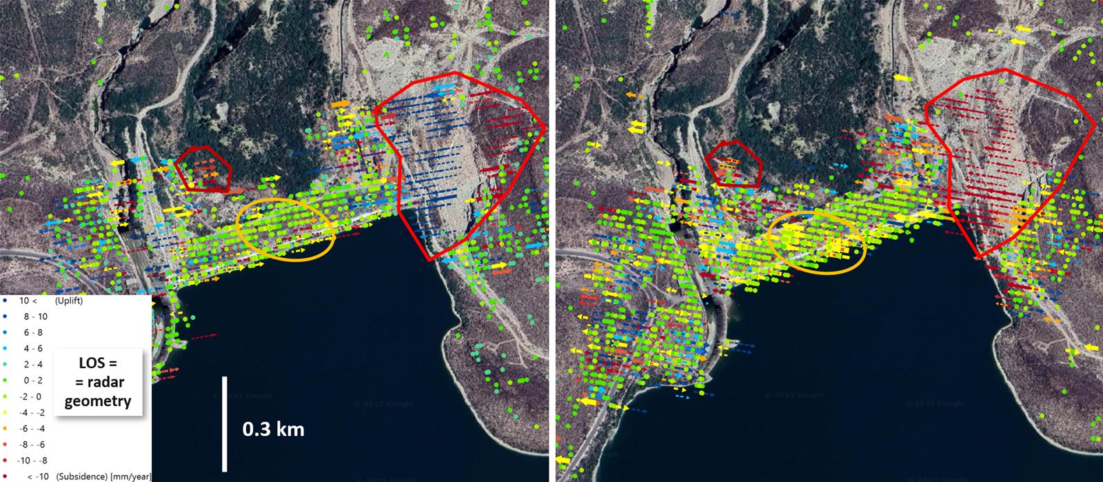
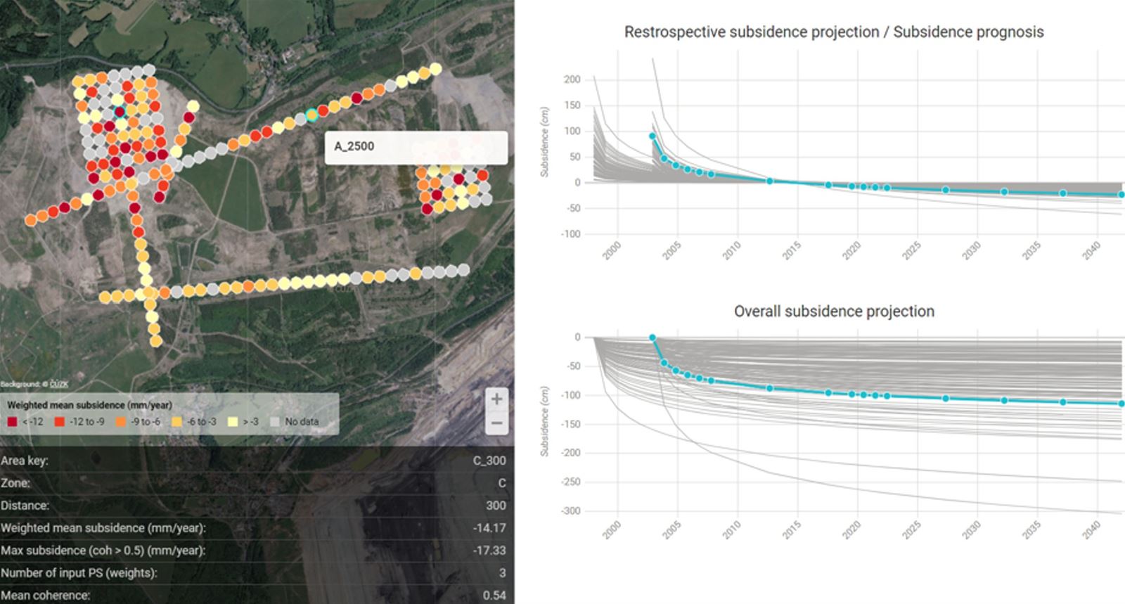
We use our own InSAR process workflow for retrospective analysis and proactive monitoring of deformations in infrastructure and its vicinity to build an early warning system. We calibrate warning reports with customers and our results complement standard geodetic measurements from manometers, inclinometers and meteorological data at all stages of geotechnical surveys. For pinpoint determination of displacement vectors, we monitor areas from multiple directions – satellite orbits. If necessary, we design a network of artificial corner reflectors to be installed on-site attached to buildings or placed in the surrounding area.